·

Enable Location

We need your location to show you interesting places around you

Discover nearby places

Find interesting locations and hidden gems around you

Precise directions

Get accurate directions and distances to places

Your location is never shared with other users. It's only used when you tap the location button.

Orange County

Log in to your account

Start exploring — it's free

Trusted by 62,678 travelers worldwide

Continue with Google
Continue with Apple
or

We will send you a code to connect

By continuing, you accept our Terms and Conditions and our Privacy Policy

Check your inbox

We've sent a pincode in your inbox. Please enter the code below.

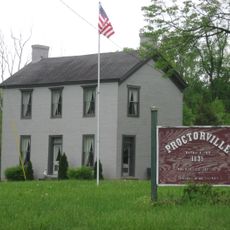
Orange County, Administrative county in Southern Indiana, United States

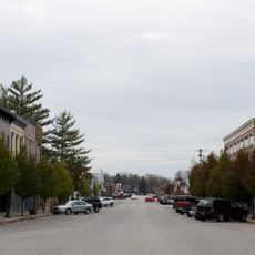
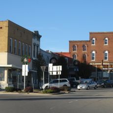
Orange County sits in southern Indiana and includes parts of the Hoosier National Forest, with Paoli serving as the administrative center for the region.

Indiana created this county in 1815 by combining sections of neighboring areas, and Quaker settlers arrived shortly after seeking religious freedom from their previous homes.

The Quaker communities who settled here left behind a strong religious heritage that you can still see in historic meetinghouses scattered across the area.

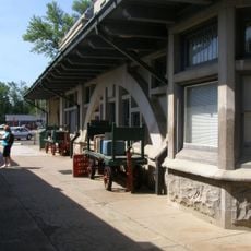
The main county offices are located in downtown Paoli and are easily accessible if you need information or directions while exploring the area.

A former settlement called Little Africa was home to Black residents who received land, though only the cemetery remains visible today from this past community.

The community of curious travelers

AroundUs brings together thousands of curated places, local tips, and hidden gems, enriched daily by 60,000 contributors worldwide.

Start exploring
Location
Inception
1816
Capital city
Paoli
Shares border with
Lawrence County, Washington County, Crawford County, Martin County, Dubois County
GPS coordinates
38.54000,-86.50000
Latest update
December 7, 2025 19:27
Around this place
Patoka Lake
United States of America

Patoka Lake

21.5 km
Spring Mill State Park
United States of America

Spring Mill State Park

22.6 km
Marengo Cave
United States of America

Marengo Cave

23 km
Bluespring Caverns
United States of America

Bluespring Caverns

28.8 km
Indiana Railway Museum
United States of America

Indiana Railway Museum

10.3 km
Beck's Mill
United States of America

Beck's Mill

30 km
United States of America

Second principal meridian

8.7 km
Pioneer Mothers Memorial Forest
United States of America

Pioneer Mothers Memorial Forest

4 km
United States of America

Twin caves

22 km
First Baptist Church
United States of America

First Baptist Church

10.2 km
Orange County Courthouse
United States of America

Orange County Courthouse

3.3 km
Mitchell Opera House
United States of America

Mitchell Opera House

21.8 km
Evangelische Lutherische Emanuels Kirche
United States of America

Evangelische Lutherische Emanuels Kirche

29.3 km
West Baden National Bank
United States of America

West Baden National Bank

10.4 km
Mitchell Downtown Historic District
United States of America

Mitchell Downtown Historic District

21.6 km
Martin County Courthouse
United States of America

Martin County Courthouse

29.6 km
Thomas Newby Braxtan House
United States of America

Thomas Newby Braxtan House

3.4 km
Dixie Garage
United States of America

Dixie Garage

10.3 km
Jenkins Place
United States of America

Jenkins Place

13.8 km
Paoli Historic District
United States of America

Paoli Historic District

3.2 km
Orleans Historic District
United States of America

Orleans Historic District

14.2 km
Newberry Friends Meeting House
United States of America

Newberry Friends Meeting House

2.8 km
William Proctor House
United States of America

William Proctor House

24.4 km
French Lick West Baden Museum
United States of America

French Lick West Baden Museum

10.6 km
Patoka Lake Nature Center
United States of America

Patoka Lake Nature Center

21.4 km
Lindley House
United States of America

Lindley House

2.2 km
Beck's Mill Bridge
United States of America

Beck's Mill Bridge

30.1 km
Gospel Street Bridge
United States of America

Gospel Street Bridge

3.2 km
Show the full map
Administrative divisions
« Orange County - Administrative county in Southern Indiana, United States » is provided by Around Us (aroundus.com). Images and texts are derived from Wikimedia project under a Creative Commons license. You are allowed to copy, distribute, and modify copies of this page, under the conditions set by the license, as long as this note is clearly visible.

Discover hidden gems everywhere you go!

From secret cafés to breathtaking viewpoints, skip the crowded tourist spots and find places that match your style. Our app makes it easy with voice search, smart filtering, route optimization, and insider tips from travelers worldwide. Download now for the complete mobile experience.

Around Us App Screenshot

A unique approach to discovering new places

Le Figaro

All the places worth exploring

France Info

A tailor-made excursion in just a few clicks

20 Minutes

Around Us
Travel Guide & Maps
Download

Send to your phone

QR Code
1

Open the camera app on your mobile.

2

Point at the QR code with your camera. A notification will appear.

3

Tap the notification to open the link.