Chest opened
+${chestReward.xp} XP
Explorer
NOUVEAU ×${chestReward.collectible.quantity}
tapez pour fermer
Chest locked

Open chests in the app

Around Us is built for your phone — chests unlock when you walk, explore and capture nearby places.

Enable Location

We need your location to show you interesting places around you

Discover nearby places

Find interesting locations and hidden gems around you

Precise directions

Get accurate directions and distances to places

Your location is never shared with other users. It's only used when you tap the location button.

Iowa River

Log in to your account

Start exploring — it's free

Trusted by 72,913 travelers worldwide

Continue with Google
Continue with Apple
or

We will send you a code to connect

By continuing, you accept our Terms and Conditions and our Privacy Policy

Check your inbox

We've sent a pincode in your inbox. Please enter the code below.

Iowa River
Discussion Reviews 1 Photos
13.3k Popularity

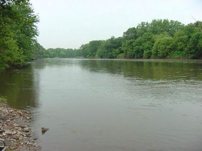
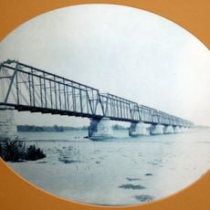
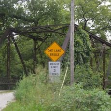
Iowa River, River system in central Iowa, United States.

The Iowa River is a waterway running through central Iowa, extending across the state and connecting various towns and cities along its path. It flows southeast toward the Mississippi River near the state's border.

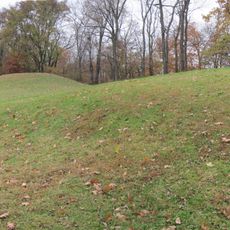
Native people established settlements along the river's banks and depended on it for travel and food long before European settlers arrived in the 1800s. The river became an important transportation route during early American expansion.

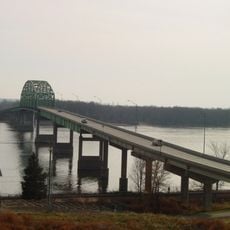
The river runs through the University of Iowa campus in Iowa City, where the waterway becomes part of how students spend their days both in classes and outside of them.

The water can be accessed at various points along its length for fishing, with good opportunities to catch largemouth bass, walleye, pike, and different types of catfish. Conditions and the best times to fish change throughout the year.

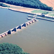
The Coralville Dam creates a lake behind it where commercial fishing operations focus on carp and buffalo fish, species that many visitors don't realize support a local fishing industry. These fish were once more common in wild populations but are now managed through the reservoir.

The community of curious travelers

AroundUs brings together thousands of curated places, local tips, and hidden gems, enriched daily by 60,000 contributors worldwide.

Start exploring
Location
GPS coordinates
41.16059,-91.02376
Latest update
December 7, 2025 20:40
Around this place
Toolesboro Mound Group
United States of America

Toolesboro Mound Group

2.5 km
Norbert F. Beckey Bridge
United States of America

Norbert F. Beckey Bridge

29.2 km
Lock and Dam No. 17
United States of America

Lock and Dam No. 17

4.5 km
Keithsburg Rail Bridge
United States of America

Keithsburg Rail Bridge

8.6 km
Mercer County Jail
United States of America

Mercer County Jail

23.4 km
Alexander Clark House
United States of America

Alexander Clark House

29.1 km
Mercer County Courthouse
United States of America

Mercer County Courthouse

23.5 km
Trinity Episcopal Church
United States of America

Trinity Episcopal Church

29.3 km
Pliny and Adelia Fay House
United States of America

Pliny and Adelia Fay House

28.7 km
Louisa County Courthouse
United States of America

Louisa County Courthouse

13.7 km
Alexis Phelps House
United States of America

Alexis Phelps House

25.3 km
Clark-Blackwell House
United States of America

Clark-Blackwell House

28.6 km
Hawkeye Creek Bridge
United States of America

Hawkeye Creek Bridge

13.4 km
First Presbyterian Church
United States of America

First Presbyterian Church

29.3 km
Hotel Wapello
United States of America

Hotel Wapello

13.9 km
Levi Willits House
United States of America

Levi Willits House

2.2 km
Bethel Church
United States of America

Bethel Church

14.8 km
West Hill Historic District
United States of America

West Hill Historic District

28.9 km
Downtown Commercial Historic District
United States of America

Downtown Commercial Historic District

29.3 km
Greenwood Cemetery Chapel
United States of America

Greenwood Cemetery Chapel

29.1 km
Baptist Church
United States of America

Baptist Church

26.9 km
Welch Apartments
United States of America

Welch Apartments

29.1 km
Henderson County Courthouse
United States of America

Henderson County Courthouse

25.8 km
James S. Thompson House
United States of America

James S. Thompson House

2.8 km
J. C. B. Warde House
United States of America

J. C. B. Warde House

28.7 km
Florence-Council On The Iowa Site
United States of America

Florence-Council On The Iowa Site

9.7 km
S. M. McKibben House
United States of America

S. M. McKibben House

29.2 km
Commercial House
United States of America

Commercial House

9.6 km
Show the full map
Reviews
Share your experience

No review yet

Discussions
Start a discussion...

No discussion yet

« Iowa River - River system in central Iowa, United States » is provided by Around Us (aroundus.com). Images and texts are derived from Wikimedia project under a Creative Commons license. You are allowed to copy, distribute, and modify copies of this page, under the conditions set by the license, as long as this note is clearly visible.

Discover hidden gems everywhere you go!

From secret cafés to breathtaking viewpoints, skip the crowded tourist spots and find places that match your style. Our app makes it easy with voice search, smart filtering, route optimization, and insider tips from travelers worldwide. Download now for the complete mobile experience.

Around Us App Screenshot

A unique approach to discovering new places

Le Figaro

All the places worth exploring

France Info

A tailor-made excursion in just a few clicks

20 Minutes

Around Us
Travel Guide & Maps
Download

Send to your phone

QR Code
1

Open the camera app on your mobile.

2

Point at the QR code with your camera. A notification will appear.

3

Tap the notification to open the link.