Enable Location

We need your location to show you interesting places around you

Discover nearby places

Find interesting locations and hidden gems around you

Precise directions

Get accurate directions and distances to places

Your location is never shared with other users. It's only used when you tap the location button.

Abrams Falls Trail

Log in to your account

Start exploring — it's free

Trusted by 61,990 travelers worldwide

Continue with Google
Continue with Apple
or

We will send you a code to connect

By continuing, you accept our Terms and Conditions and our Privacy Policy

Check your inbox

We've sent a pincode in your inbox. Please enter the code below.

Abrams Falls Trail

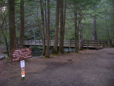
Abrams Falls Trail, Hiking trail in Great Smoky Mountains National Park, Tennessee, US

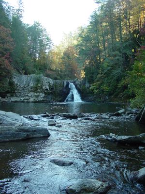
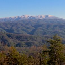
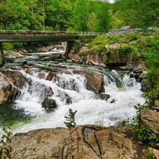
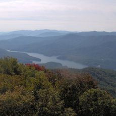
Abrams Falls Trail is a hiking path in Great Smoky Mountains National Park that winds through dense forest alongside a creek. The route crosses rocky ground and passes through layers of trees and boulders before arriving at a cascade with a large pool below.

The trail takes its name from a Cherokee leader known as Oskuah, who took the name Abram and built his settlement downstream from the waterfall. This naming reflects the enduring Cherokee presence in these mountains.

The name Abrams comes from a Cherokee leader whose legacy remains woven into the mountain landscape. Visitors can sense these cultural connections as they walk along the creek through the valley.

Sturdy footwear is essential as the trail includes rocky sections that can become slippery, especially after rain. Bring plenty of water since there are few rest areas or facilities once you start the hike.

Though the waterfall stands only about 20 feet high, it carries more water than any other cascade in the park. This concentrated flow creates an impressive display and a deep pool perfect for swimming.

The community of curious travelers

AroundUs brings together thousands of curated places, local tips, and hidden gems, enriched daily by 60,000 contributors worldwide.

Start exploring
GPS coordinates
35.59000,-83.85000
Latest update
December 8, 2025 20:01
Around this place
Show the full map
« Abrams Falls Trail - Hiking trail in Great Smoky Mountains National Park, Tennessee, US » is provided by Around Us (aroundus.com). Images and texts are derived from Wikimedia project under a Creative Commons license. You are allowed to copy, distribute, and modify copies of this page, under the conditions set by the license, as long as this note is clearly visible.

Discover hidden gems everywhere you go!

From secret cafés to breathtaking viewpoints, skip the crowded tourist spots and find places that match your style. Our app makes it easy with voice search, smart filtering, route optimization, and insider tips from travelers worldwide. Download now for the complete mobile experience.

Around Us App Screenshot

A unique approach to discovering new places

Le Figaro

All the places worth exploring

France Info

A tailor-made excursion in just a few clicks

20 Minutes

Around Us
Travel Guide & Maps
Download

Send to your phone

QR Code
1

Open the camera app on your mobile.

2

Point at the QR code with your camera. A notification will appear.

3

Tap the notification to open the link.