Enable Location

We need your location to show you interesting places around you

Discover nearby places

Find interesting locations and hidden gems around you

Precise directions

Get accurate directions and distances to places

Your location is never shared with other users. It's only used when you tap the location button.

Log in to your account

Start exploring — it's free

Trusted by 63,823 travelers worldwide

Continue with Google
Continue with Apple
or

We will send you a code to connect

By continuing, you accept our Terms and Conditions and our Privacy Policy

Check your inbox

We've sent a pincode in your inbox. Please enter the code below.

Fort Wayne Moraine
Discussion Reviews Photo
2.6k Popularity

Fort Wayne Moraine, Glacial formation in Ohio, US

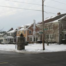
Fort Wayne Moraine is a glacial formation that extends along the northern bank of the St. Marys River with an undulating surface pattern. This ridge was created by rock and sediment deposits during ice age periods and shapes the land across multiple counties.

This formation developed during the final stages of glacial activity in the late Pleistocene period. The moraine emerged as part of a larger ice age system that reshaped the region's landscape.

The old Piqua Road in Allen County, Indiana follows the natural crest of this formation, marking a traditional transportation route that has guided travelers for centuries.

The area offers opportunities to observe the natural watershed between two river systems from the elevated ridge. The main crest rises noticeably above surrounding riverbeds, providing good views of the landform itself.

Near Lima, Ohio, three parallel moraines run alongside the main crest and form a series of distinct geological ridges. This multiple ridge pattern reveals the complex processes that occurred during glacial retreat and readvance.

The community of curious travelers

AroundUs brings together thousands of curated places, local tips, and hidden gems, enriched daily by 60,000 contributors worldwide.

Start exploring
Location
GPS coordinates
41.00000,-85.00000
Latest update
December 12, 2025 17:48
Around this place
Nickel Plate Road 765
United States of America

Nickel Plate Road 765

11.1 km
Embassy Theatre
United States of America

Embassy Theatre

14.5 km
Cathedral of the Immaculate Conception
United States of America

Cathedral of the Immaculate Conception

14.3 km
Richardville House
United States of America

Richardville House

14.2 km
Fort Wayne Old City Hall Building
United States of America

Fort Wayne Old City Hall Building

14.5 km
Foellinger-Freimann Botanical Conservatory
United States of America

Foellinger-Freimann Botanical Conservatory

14.4 km
Abraham Lincoln: The Hoosier Youth
United States of America

Abraham Lincoln: The Hoosier Youth

14.3 km
Fort Wayne Park and Boulevard System Historic District
United States of America

Fort Wayne Park and Boulevard System Historic District

10.4 km
Saint Mary's Catholic Church
United States of America

Saint Mary's Catholic Church

14.1 km
E. Ross Adair Federal Building and United States Courthouse
United States of America

E. Ross Adair Federal Building and United States Courthouse

14.4 km
Fairfield Manor
United States of America

Fairfield Manor

14.1 km
St. Louis, Besancon, Historic District
United States of America

St. Louis, Besancon, Historic District

7.6 km
St. Peter's Square
United States of America

St. Peter's Square

13.1 km
Christian G. Strunz House
United States of America

Christian G. Strunz House

14.5 km
Alexander Taylor Rankin House
United States of America

Alexander Taylor Rankin House

14.4 km
Williams-Woodland Park Historic District
United States of America

Williams-Woodland Park Historic District

13.7 km
McColloch-Weatherhogg Double House
United States of America

McColloch-Weatherhogg Double House

14.4 km
Southwood Park Historic District
United States of America

Southwood Park Historic District

13.4 km
Illsley Place-West Rudisill Historic District
United States of America

Illsley Place-West Rudisill Historic District

14.1 km
Lafayette Place Historic District
United States of America

Lafayette Place Historic District

12.2 km
Lakeside Historic District
United States of America

Lakeside Historic District

14.3 km
South Wayne Historic District
United States of America

South Wayne Historic District

14 km
Foster Park Neighborhood Historic District
United States of America

Foster Park Neighborhood Historic District

14.1 km
Blackstone Building
United States of America

Blackstone Building

13.8 km
Oakdale Historic District
United States of America

Oakdale Historic District

13.7 km
Harry A. Keplinger House
United States of America

Harry A. Keplinger House

13.8 km
William C. and Clara Hagerman House
United States of America

William C. and Clara Hagerman House

14.4 km
(Christ Holding a Chalice)
United States of America

(Christ Holding a Chalice)

14.3 km
Show the full map
Reviews
Share your experience

No review yet

Discussions
Start a discussion...

No discussion yet

« Fort Wayne Moraine - Glacial formation in Ohio, US » is provided by Around Us (aroundus.com). Images and texts are derived from Wikimedia project under a Creative Commons license. You are allowed to copy, distribute, and modify copies of this page, under the conditions set by the license, as long as this note is clearly visible.

Discover hidden gems everywhere you go!

From secret cafés to breathtaking viewpoints, skip the crowded tourist spots and find places that match your style. Our app makes it easy with voice search, smart filtering, route optimization, and insider tips from travelers worldwide. Download now for the complete mobile experience.

Around Us App Screenshot

A unique approach to discovering new places

Le Figaro

All the places worth exploring

France Info

A tailor-made excursion in just a few clicks

20 Minutes

Around Us
Travel Guide & Maps
Download

Send to your phone

QR Code
1

Open the camera app on your mobile.

2

Point at the QR code with your camera. A notification will appear.

3

Tap the notification to open the link.