St. Louis, Besancon, Historic District

Log in to your account

AroundUs is a community-driven map of interesting places, built by curious explorers like you. It grows with every review, story, and photo you share.
Connect to save your favorite spots, contribute locations, and create personalized routes.
Continue with Google
Continue with Apple
Continue with X
Continue with Facebook
Continue with email
By continuing, you accept our Terms and Conditions and our Privacy Policy
Create an account
Add to collection
Map
Suggest a change
Share

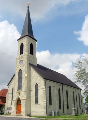
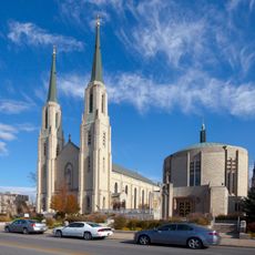
St. Louis, Besancon, Historic District, Historic district in Indiana, United States.

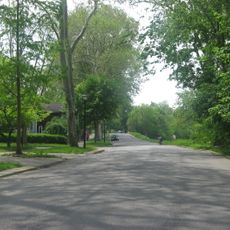
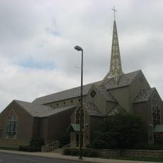
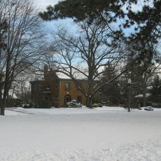
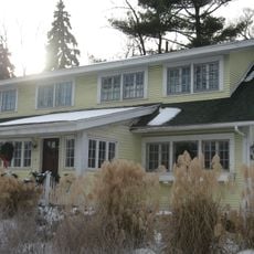
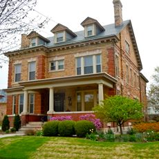
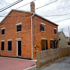
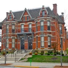
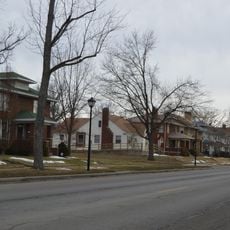
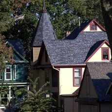
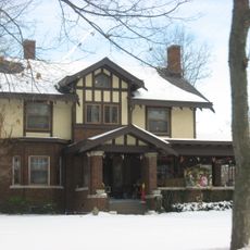
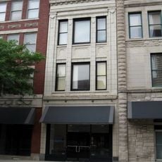
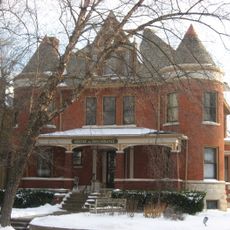
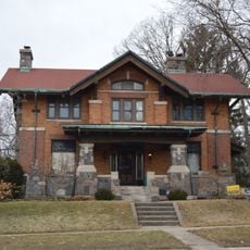
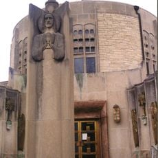
This historic district in Besancon consists of numerous buildings from the late 1800s, each displaying various architectural styles and construction methods from that era. The area spans several blocks and contains structures that range from residential homes to commercial buildings of different sizes and designs.

The district was established in 1871 during a period of growth for the city and its surroundings. Later, its structures earned national recognition because they document the area's development and changes over many decades.

The buildings show how residents lived and built their homes during different periods, with varying styles that reflect local preferences. Walking through, you notice which materials were favored and how tastes shifted from one generation to the next.

The area is easy to explore on foot, with buildings arranged along clear streets that visitors can walk through at their own pace. For information about specific buildings, you can check with local offices that provide background details about the structures and their features.

The district holds more than 100 registered structures, many going back to the earliest days of the settlement and including often-overlooked outbuildings and additions. These smaller constructions tell their own story about local craftsmanship and daily life that is rarely documented in the larger, more prominent buildings.

Location: Indiana

Inception: 1871

GPS coordinates: 41.05080,-84.93890

Latest update: December 14, 2025 18:09

Photos
Around this place
Nickel Plate Road 765
United States of America

Nickel Plate Road 765

4.1 km
Johnny Appleseed Park
United States of America

Johnny Appleseed Park

16.9 km
Lincoln Bank Tower
United States of America

Lincoln Bank Tower

17.1 km
Cathedral of the Immaculate Conception
United States of America

Cathedral of the Immaculate Conception

16.9 km
Fort Wayne Museum of Art
United States of America

Fort Wayne Museum of Art

16.9 km
Arts United Center
United States of America

Arts United Center

17 km
Fort Wayne Old City Hall Building
United States of America

Fort Wayne Old City Hall Building

16.9 km
Indiana Michigan Power Center
United States of America

Indiana Michigan Power Center

17.1 km
Foellinger-Freimann Botanical Conservatory
United States of America

Foellinger-Freimann Botanical Conservatory

17.1 km
United States of America

Fort Wayne Moraine

7.6 km
Abraham Lincoln: The Hoosier Youth
United States of America

Abraham Lincoln: The Hoosier Youth

17.1 km
Fort Wayne Park and Boulevard System Historic District
United States of America

Fort Wayne Park and Boulevard System Historic District

12.8 km
Saint Mary's Catholic Church
United States of America

Saint Mary's Catholic Church

16.6 km
Forest Park Boulevard Historic District
United States of America

Forest Park Boulevard Historic District

15.8 km
Ninde-Mead-Farnsworth House
United States of America

Ninde-Mead-Farnsworth House

16.8 km
Christian G. Strunz House
United States of America

Christian G. Strunz House

16.8 km
St. Peter's Square
United States of America

St. Peter's Square

16.1 km
Alexander Taylor Rankin House
United States of America

Alexander Taylor Rankin House

16.8 km
Williams-Woodland Park Historic District
United States of America

Williams-Woodland Park Historic District

17 km
McColloch-Weatherhogg Double House
United States of America

McColloch-Weatherhogg Double House

16.8 km
North Anthony Boulevard Historic District
United States of America

North Anthony Boulevard Historic District

15.8 km
Lafayette Place Historic District
United States of America

Lafayette Place Historic District

16.3 km
Lakeside Historic District
United States of America

Lakeside Historic District

16.2 km
John H. and Mary Abercrombie House
United States of America

John H. and Mary Abercrombie House

17 km
Blackstone Building
United States of America

Blackstone Building

16.5 km
Harry A. Keplinger House
United States of America

Harry A. Keplinger House

17 km
William C. and Clara Hagerman House
United States of America

William C. and Clara Hagerman House

15.7 km
(Christ Holding a Chalice)
United States of America

(Christ Holding a Chalice)

16.9 km
Show the full map
Reviews

Visited this place? Tap the stars to rate it and share your experience / photos with the community! Try now! You can cancel it anytime.

« St. Louis, Besancon, Historic District - Historic district in Indiana, United States » is provided by Around Us (aroundus.com). Images and texts are derived from Wikimedia project under a Creative Commons license. You are allowed to copy, distribute, and modify copies of this page, under the conditions set by the license, as long as this note is clearly visible.

Discover hidden gems everywhere you go!

From secret cafés to breathtaking viewpoints, skip the crowded tourist spots and find places that match your style. Our app makes it easy with voice search, smart filtering, route optimization, and insider tips from travelers worldwide. Download now for the complete mobile experience.

Around Us App Screenshot

A unique approach to discovering new places

Le Figaro

All the places worth exploring

France Info

A tailor-made excursion in just a few clicks

20 Minutes