Enable Location

We need your location to show you interesting places around you

Discover nearby places

Find interesting locations and hidden gems around you

Precise directions

Get accurate directions and distances to places

Your location is never shared with other users. It's only used when you tap the location button.

Fisherman's Island State Park

Log in to your account

Start exploring — it's free

Trusted by 61,516 travelers worldwide

Continue with Google
Continue with Apple
or

We will send you a code to connect

By continuing, you accept our Terms and Conditions and our Privacy Policy

Check your inbox

We've sent a pincode in your inbox. Please enter the code below.

Fisherman's Island State Park

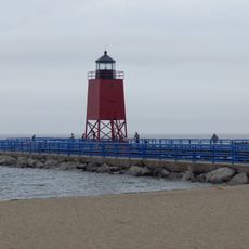
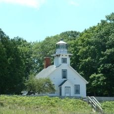
Fisherman's Island State Park, State park near Charlevoix, Michigan

Description

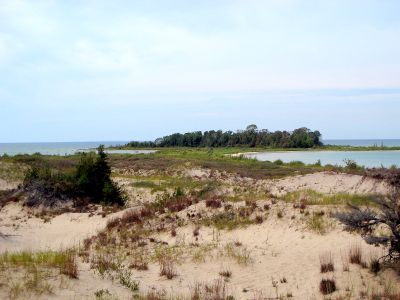
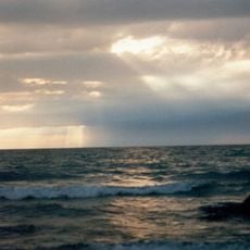
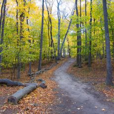
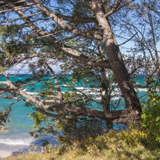
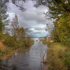
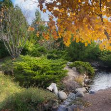
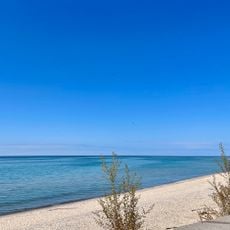
Fisherman's Island State Park is a coastal park along Lake Michigan featuring rolling sand dunes, maple and birch forests, and cedar wetlands across its 2,678 acres. The terrain varies from open dune areas to dense woodland, creating different environments for visitors to explore.

History

Indigenous peoples inhabited this shoreline before the state established a protected area to preserve the coastal landscape and its ecosystems. The park designation ensured that the natural features along the lake would remain protected for the future.

Culture

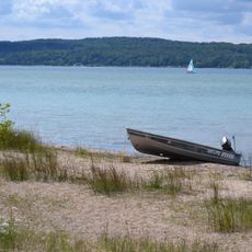
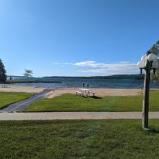
The park draws people seeking outdoor recreation and time in nature throughout the seasons. Local visitors and tourists come to hike, observe wildlife, and enjoy winter sports on marked trails.

Practical

A Recreation Passport is required for vehicle access, and the park provides marked hiking trails, rustic camping areas, and day-use facilities with basic services. The best times to visit are late spring through fall when trails are easier to navigate and weather is most favorable.

Did you know?

The park is named after an island that becomes a peninsula during periods of lower water levels in Lake Michigan. This natural transformation is a quirk of the lake's changing water levels that few visitors think to watch for.

Location
GPS coordinates
45.27000,-85.35690
Latest update
December 11, 2025 11:01

AroundUs brings together thousands of curated places, local tips, and hidden gems, enriched daily by 60,000 contributors worldwide. Discover all places nearby (Michigan).

Around this place
Ernest Hemingway Cottage
United States of America

Ernest Hemingway Cottage

28 km
Castle Farms
United States of America

Castle Farms

10 km
Young State Park
United States of America

Young State Park

24.6 km
Leelanau State Park
United States of America

Leelanau State Park

18.6 km
Charlevoix South Pier Light Station
United States of America

Charlevoix South Pier Light Station

9.1 km
Grand Traverse Light
United States of America

Grand Traverse Light

16.5 km
US 31–Island Lake Outlet Bridge
United States of America

US 31–Island Lake Outlet Bridge

9.4 km
Greensky Hill church
United States of America

Greensky Hill church

15 km
Grove Hill New Mission Church
United States of America

Grove Hill New Mission Church

29.7 km
Red Fox Inn
United States of America

Red Fox Inn

21.8 km
Mt. McSauba Site
United States of America

Mt. McSauba Site

11.1 km
John J. and Eva Reynier Porter Estate
United States of America

John J. and Eva Reynier Porter Estate

18.3 km
St. Francis Solanus Mission
United States of America

St. Francis Solanus Mission

32.7 km
John Kabler House
United States of America

John Kabler House

32.5 km
Pine River Site
United States of America

Pine River Site

9.3 km
Omena Historic District
United States of America

Omena Historic District

29.9 km
Jacob Miller House
United States of America

Jacob Miller House

32.7 km
Grace Methodist Episcopal Church
United States of America

Grace Methodist Episcopal Church

32.4 km
Lake Michigan Beach
United States of America

Lake Michigan Beach

8.9 km
Boyne City Central Historic District
United States of America

Boyne City Central Historic District

27.7 km
Sarah Pennington House
United States of America

Sarah Pennington House

32.3 km
Boyne City Water Works Building
United States of America

Boyne City Water Works Building

27.9 km
O'Neill Site
United States of America

O'Neill Site

2 km
Horton Bay School
United States of America

Horton Bay School

22 km
Charlevoix City Park Site
United States of America

Charlevoix City Park Site

9.3 km
Peninsula Beach
United States of America

Peninsula Beach

27.3 km
Christmas Cove Beach
United States of America

Christmas Cove Beach

24.4 km
Mission Point Light
United States of America

Mission Point Light

32.5 km
Show the full map
« Fisherman's Island State Park - State park near Charlevoix, Michigan » is provided by Around Us (aroundus.com). Images and texts are derived from Wikimedia project under a Creative Commons license. You are allowed to copy, distribute, and modify copies of this page, under the conditions set by the license, as long as this note is clearly visible.

Discover hidden gems everywhere you go!

From secret cafés to breathtaking viewpoints, skip the crowded tourist spots and find places that match your style. Our app makes it easy with voice search, smart filtering, route optimization, and insider tips from travelers worldwide. Download now for the complete mobile experience.

Around Us App Screenshot

A unique approach to discovering new places

Le Figaro

All the places worth exploring

France Info

A tailor-made excursion in just a few clicks

20 Minutes

Around Us
Travel Guide & Maps
Download

Send to your phone

QR Code
1

Open the camera app on your mobile.

2

Point at the QR code with your camera. A notification will appear.

3

Tap the notification to open the link.