Enable Location

We need your location to show you interesting places around you

Discover nearby places

Find interesting locations and hidden gems around you

Precise directions

Get accurate directions and distances to places

Your location is never shared with other users. It's only used when you tap the location button.

Fort Christanna

Log in to your account

Start exploring — it's free

Trusted by 66,121 travelers worldwide

Continue with Google
Continue with Apple
or

We will send you a code to connect

By continuing, you accept our Terms and Conditions and our Privacy Policy

Check your inbox

We've sent a pincode in your inbox. Please enter the code below.

Discussion Reviews 1 Photos
5.6k Popularity

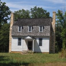
Fort Christanna, Colonial fort with Native American school in Brunswick County, Virginia.

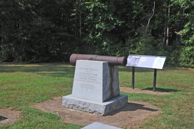
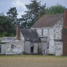
Fort Christanna is an archaeological site in Brunswick County, Virginia, preserving the remains of a colonial military outpost built in a five-sided shape with blockhouses at each corner. The site also contained a trading post and a school for Native American children, making it more than a simple military structure.

Governor Alexander Spotswood had the fort built in 1714 as a response to tensions along the Virginia frontier and as a base for diplomacy with nearby tribes. It operated for only a few years before the Virginia Indian Company lost its license and the fort was abandoned in the early 1720s.

The name Christanna is thought to combine the words Christ and Anna, the latter being the name of the reigning British queen at the time of construction. This detail is still discussed by locals and researchers who visit the site today.

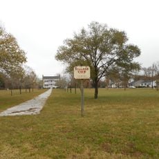
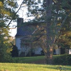
The site is in a rural part of Brunswick County, so reaching it by car is the most practical option, and signage in the area can be limited. It is worth contacting the local tourism office before visiting to confirm access, since parts of the site may require a guided tour.

The Saponi people who settled near the fort did so partly for protection from rival tribes, not only because of colonial pressure, making the relationship between the fort and its neighbors more layered than it might seem. Archaeological digs have turned up writing tools and book fragments that confirm children were genuinely taught to read and write on this spot.

The community of curious travelers

AroundUs brings together thousands of curated places, local tips, and hidden gems, enriched daily by 60,000 contributors worldwide.

Start exploring
Location
Inception
1714
GPS coordinates
36.71580,-77.86860
Latest update
March 3, 2026 08:16
Around this place
Lake Gaston
United States of America

Lake Gaston

23 km
Cumberland State Forest
United States of America

Cumberland State Forest

33.7 km
Colonial Center
United States of America

Colonial Center

23.4 km
Rose Bower
United States of America

Rose Bower

38.1 km
Roanoke Rapids Historic District
United States of America

Roanoke Rapids Historic District

34.2 km
Village View
United States of America

Village View

29.3 km
Washington Avenue Historic District
United States of America

Washington Avenue Historic District

29.5 km
Gholson Bridge
United States of America

Gholson Bridge

3.3 km
Hobson's Choice
United States of America

Hobson's Choice

18 km
Greensville County Training School
United States of America

Greensville County Training School

29.8 km
Eureka
United States of America

Eureka

34 km
Montrose
United States of America

Montrose

33.5 km
Hicksford-Emporia Historic District
United States of America

Hicksford-Emporia Historic District

29.3 km
Hebron Methodist Church
United States of America

Hebron Methodist Church

30 km
Zehmer Farm
United States of America

Zehmer Farm

32.4 km
St. Alban's Episcopal Church
United States of America

St. Alban's Episcopal Church

32.1 km
Old Merchants and Farmers Bank Building
United States of America

Old Merchants and Farmers Bank Building

29.3 km
Brunswick County Courthouse Square
United States of America

Brunswick County Courthouse Square

5.1 km
O.H.P. Tanner House
United States of America

O.H.P. Tanner House

20.1 km
Rocky Run Methodist Church
United States of America

Rocky Run Methodist Church

24.9 km
Greensville County Courthouse Complex
United States of America

Greensville County Courthouse Complex

29.3 km
Belfield-Emporia Historic District
United States of America

Belfield-Emporia Historic District

29.5 km
Lawrenceville Historic District
United States of America

Lawrenceville Historic District

5.1 km
Alexander Watson Batte House
United States of America

Alexander Watson Batte House

32.1 km
Elm Hill Archaeological Site
United States of America

Elm Hill Archaeological Site

37.6 km
St. Paul's School
United States of America

St. Paul's School

14.6 km
Weaver House
United States of America

Weaver House

32.1 km
Franklin Historic District
United States of America

Franklin Historic District

29.5 km
Show the full map
Reviews
Share your experience

No review yet

Discussions
Start a discussion...

No discussion yet

« Fort Christanna - Colonial fort with Native American school in Brunswick County, Virginia » is provided by Around Us (aroundus.com). Images and texts are derived from Wikimedia project under a Creative Commons license. You are allowed to copy, distribute, and modify copies of this page, under the conditions set by the license, as long as this note is clearly visible.

Discover hidden gems everywhere you go!

From secret cafés to breathtaking viewpoints, skip the crowded tourist spots and find places that match your style. Our app makes it easy with voice search, smart filtering, route optimization, and insider tips from travelers worldwide. Download now for the complete mobile experience.

Around Us App Screenshot

A unique approach to discovering new places

Le Figaro

All the places worth exploring

France Info

A tailor-made excursion in just a few clicks

20 Minutes

Around Us
Travel Guide & Maps
Download

Send to your phone

QR Code
1

Open the camera app on your mobile.

2

Point at the QR code with your camera. A notification will appear.

3

Tap the notification to open the link.