Enable Location

We need your location to show you interesting places around you

Discover nearby places

Find interesting locations and hidden gems around you

Precise directions

Get accurate directions and distances to places

Your location is never shared with other users. It's only used when you tap the location button.

Grassy Ridge Bald

Log in to your account

Start exploring — it's free

Trusted by 61,861 travelers worldwide

Continue with Google
Continue with Apple
or

We will send you a code to connect

By continuing, you accept our Terms and Conditions and our Privacy Policy

Check your inbox

We've sent a pincode in your inbox. Please enter the code below.

Grassy Ridge Bald

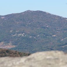
Grassy Ridge Bald, Mountain summit in the Roan Highlands, North Carolina.

Description

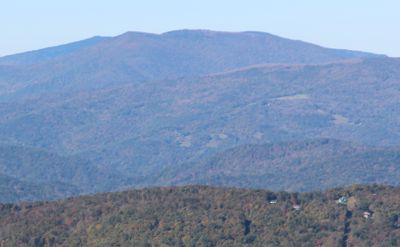
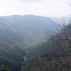
Grassy Ridge Bald is a mountain summit in the Roan Highlands with an elevation of 6,189 feet and open meadows that offer sweeping views across the Appalachian range. The ridge connects several nearby peaks and provides a continuous walking path without tree cover overhead.

History

In the 19th and early 20th centuries, local farmers kept the treeless summits open through cattle grazing practices. These traditional grazing methods preserved the characteristic meadows that remain today.

Culture

The summit is part of the Appalachian Trail system, a celebrated hiking route that draws visitors from across the country. The open grasslands reflect how mountain communities shaped this landscape over generations.

Practical

The main trail starts from Carvers Gap and covers about 5 miles round trip, passing through two other nearby summits along the way. The exposed terrain means weather can change quickly, so bring layers and be prepared for wind at higher elevations.

Did you know?

Dense patches of rhododendron and flame azalea shrubs cover parts of the summit and form natural tunnels along the path. These plants burst into vivid bloom in June with bright pink and orange flowers, transforming the landscape for about a couple of weeks.

Location
GPS coordinates
36.09984,-82.08040
Latest update
December 12, 2025 17:41

AroundUs brings together thousands of curated places, local tips, and hidden gems, enriched daily by 60,000 contributors worldwide. Discover all places nearby (North Carolina).

Around this place
Grandfather Mountain
United States of America

Grandfather Mountain

24.2 km
Linville Falls
United States of America

Linville Falls

21.7 km
Watauga Lake
United States of America

Watauga Lake

26.9 km
Linville Gorge Wilderness
United States of America

Linville Gorge Wilderness

26.2 km
Linn Cove Viaduct
United States of America

Linn Cove Viaduct

24 km
Roan Mountain State Park
United States of America

Roan Mountain State Park

7.9 km
Sugar Mountain
United States of America

Sugar Mountain

18.6 km
Beech Mountain
United States of America

Beech Mountain

20.2 km
Church of the Resurrection
United States of America

Church of the Resurrection

27.7 km
Big Yellow Mountain
United States of America

Big Yellow Mountain

4.9 km
Valle Crucis Episcopal Mission
United States of America

Valle Crucis Episcopal Mission

27.7 km
Bee Mountain
United States of America

Bee Mountain

24.4 km
Simerly-Butler House
United States of America

Simerly-Butler House

22.1 km
Gillespie Gap
United States of America

Gillespie Gap

27.6 km
John T. Wilder House
United States of America

John T. Wilder House

10.7 km
Yancey Collegiate Institute Historic District
United States of America

Yancey Collegiate Institute Historic District

27.6 km
Downtown Spruce Pine Historic District
United States of America

Downtown Spruce Pine Historic District

20.5 km
Elk Park School
United States of America

Elk Park School

11.3 km
Ward Family House
United States of America

Ward Family House

28.4 km
Yancey County Courthouse
United States of America

Yancey County Courthouse

28.4 km
Mitchell County Courthouse
United States of America

Mitchell County Courthouse

11.7 km
Ray Wiseman House
United States of America

Ray Wiseman House

17.2 km
Milligan Shuford Wise and Theron Colbert Dellinger Houses
United States of America

Milligan Shuford Wise and Theron Colbert Dellinger Houses

16.2 km
Dellinger Mill
United States of America

Dellinger Mill

9.4 km
Franklin-Penland House
United States of America

Franklin-Penland House

20.8 km
Museum of North Carolina Minerals
United States of America

Museum of North Carolina Minerals

27.1 km
Linville Falls Visitor Center
United States of America

Linville Falls Visitor Center

21.2 km
Linn Cove Visitor Center
United States of America

Linn Cove Visitor Center

24 km
Show the full map
« Grassy Ridge Bald - Mountain summit in the Roan Highlands, North Carolina » is provided by Around Us (aroundus.com). Images and texts are derived from Wikimedia project under a Creative Commons license. You are allowed to copy, distribute, and modify copies of this page, under the conditions set by the license, as long as this note is clearly visible.

Discover hidden gems everywhere you go!

From secret cafés to breathtaking viewpoints, skip the crowded tourist spots and find places that match your style. Our app makes it easy with voice search, smart filtering, route optimization, and insider tips from travelers worldwide. Download now for the complete mobile experience.

Around Us App Screenshot

A unique approach to discovering new places

Le Figaro

All the places worth exploring

France Info

A tailor-made excursion in just a few clicks

20 Minutes

Around Us
Travel Guide & Maps
Download

Send to your phone

QR Code
1

Open the camera app on your mobile.

2

Point at the QR code with your camera. A notification will appear.

3

Tap the notification to open the link.