Chest opened
+${chestReward.xp} XP
Explorer
NOUVEAU ×${chestReward.collectible.quantity}
tapez pour fermer
Chest locked

Open chests in the app

Around Us is built for your phone — chests unlock when you walk, explore and capture nearby places.

Enable Location

We need your location to show you interesting places around you

Discover nearby places

Find interesting locations and hidden gems around you

Precise directions

Get accurate directions and distances to places

Your location is never shared with other users. It's only used when you tap the location button.

Griffithsville

Log in to your account

Start exploring — it's free

Trusted by 72,886 travelers worldwide

Continue with Google
Continue with Apple
or

We will send you a code to connect

By continuing, you accept our Terms and Conditions and our Privacy Policy

Check your inbox

We've sent a pincode in your inbox. Please enter the code below.

Discussion Reviews 1 Photos
1.7k Popularity

Griffithsville, unincorporated community in Lincoln County, West Virginia

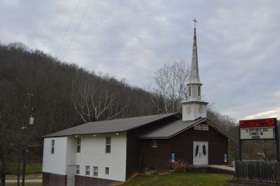
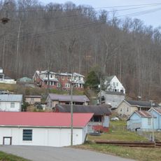
Griffithsville is a small unincorporated community in Lincoln County, West Virginia, situated along Route 3. The settlement features scattered homes nestled among gentle hills and woodlands, where residents live in a quiet rural setting without formal town government.

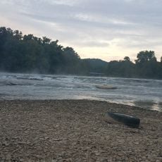
The community was established around 1854 and named after Alexander Griffith as people began using the river for commerce and transport. In the late 1800s, the local economy grew through timber logging and river trade, with coal and gas development following in the early 1900s.

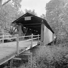
Griffithsville is named after Alexander Griffith, an early settler whose family shaped the community. The place held significance as a river trading point, a role that remains woven into local memory through stories of boats and steamboats that once connected the area to larger towns.

The location sits off main highways but is easily reached via Route 3, which passes through the community. Visitors should note that Griffithsville has no formal town services, with all amenities provided through Lincoln County resources.

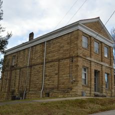
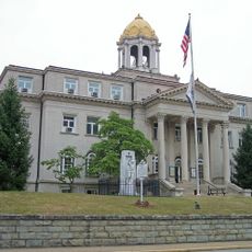
A notable event was the 1909 courthouse fire, believed to have been deliberately set to destroy land records. This incident reveals the complex and often difficult history of property disputes in the region.

The community of curious travelers

AroundUs brings together thousands of curated places, local tips, and hidden gems, enriched daily by 60,000 contributors worldwide.

Start exploring
Location
Elevation above the sea
201 m
GPS coordinates
38.23860,-81.98920
Latest update
December 18, 2025 08:24
Around this place
Mud River Covered Bridge
United States of America

Mud River Covered Bridge

25.1 km
Canty House
United States of America

Canty House

25.4 km
Lincoln National Bank
United States of America

Lincoln National Bank

11.1 km
Chilton House
United States of America

Chilton House

21 km
William E. Mohler House
United States of America

William E. Mohler House

21.1 km
Dutch Hollow Wine Cellars
United States of America

Dutch Hollow Wine Cellars

26.4 km
St. Albans Post Office
United States of America

St. Albans Post Office

21.2 km
Madison National Bank
United States of America

Madison National Bank

24.3 km
Holley Hills Estate
United States of America

Holley Hills Estate

16.1 km
The Beeches
United States of America

The Beeches

21.1 km
East Hall
United States of America

East Hall

24.8 km
Boone County Courthouse
United States of America

Boone County Courthouse

24.3 km
St. Albans Main Street Historic District
United States of America

St. Albans Main Street Historic District

21.1 km
Asbury House
United States of America

Asbury House

21.9 km
Bank of St. Albans Building
United States of America

Bank of St. Albans Building

21 km
Hurricane Splash Park
United States of America

Hurricane Splash Park

22.6 km
James Weimer House
United States of America

James Weimer House

21.1 km
United States of America

Nitro WWI Memorial Bridge

26.3 km
United States of America

Donald M. Legg Memorial Bridge

26.3 km
Upper Falls Beach
United States of America

Upper Falls Beach

17.3 km
United States of America

Crawford Field

21.7 km
Nellis Historic District
United States of America

Nellis Historic District

23.6 km
United States of America

Morris Memorial Hospital for Crippled Children

22.8 km
United States of America

Sleepy Hollow Golf Club

23.9 km
United States of America

Big Bend Golf Course

17.9 km
United States of America

Dunbar Middle School Theater

24.8 km

Outdoor Education/Performance Theatre

17.4 km
United States of America

Waterfall

24.9 km
Show the full map
Reviews
Share your experience

No review yet

Discussions
Start a discussion...

No discussion yet

« Griffithsville - unincorporated community in Lincoln County, West Virginia » is provided by Around Us (aroundus.com). Images and texts are derived from Wikimedia project under a Creative Commons license. You are allowed to copy, distribute, and modify copies of this page, under the conditions set by the license, as long as this note is clearly visible.

Discover hidden gems everywhere you go!

From secret cafés to breathtaking viewpoints, skip the crowded tourist spots and find places that match your style. Our app makes it easy with voice search, smart filtering, route optimization, and insider tips from travelers worldwide. Download now for the complete mobile experience.

Around Us App Screenshot

A unique approach to discovering new places

Le Figaro

All the places worth exploring

France Info

A tailor-made excursion in just a few clicks

20 Minutes

Around Us
Travel Guide & Maps
Download

Send to your phone

QR Code
1

Open the camera app on your mobile.

2

Point at the QR code with your camera. A notification will appear.

3

Tap the notification to open the link.