Enable Location

We need your location to show you interesting places around you

Discover nearby places

Find interesting locations and hidden gems around you

Precise directions

Get accurate directions and distances to places

Your location is never shared with other users. It's only used when you tap the location button.

Hanover Center Historic District

Log in to your account

Start exploring — it's free

Trusted by 62,960 travelers worldwide

Continue with Google
Continue with Apple
or

We will send you a code to connect

By continuing, you accept our Terms and Conditions and our Privacy Policy

Check your inbox

We've sent a pincode in your inbox. Please enter the code below.

Discussion Reviews 1 Photos
1.2k Popularity

Hanover Center Historic District, Historic district in Hanover, Massachusetts.

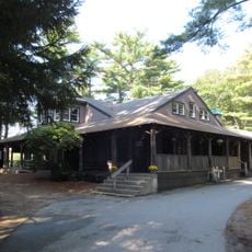
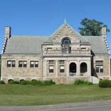
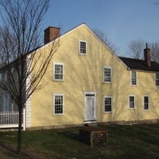
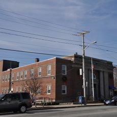
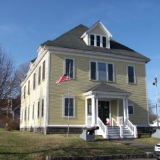
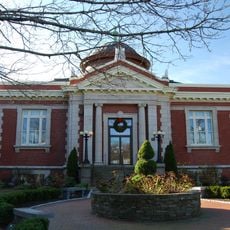
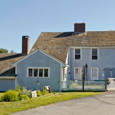
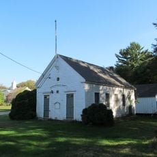
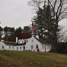
Hanover Center Historic District is a collection of seven historic properties located around the intersection of Hanover Street with Main and Silver Streets near the town center. The grouping includes the Curtis Free Library, town hall, and the Stetson House, which houses local historical objects and documents.

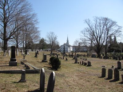
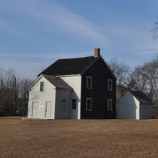
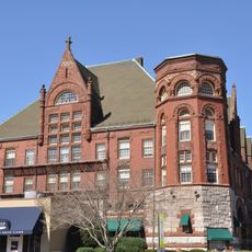
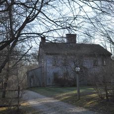
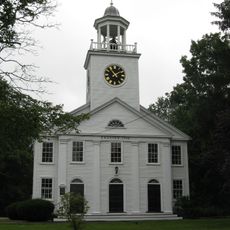
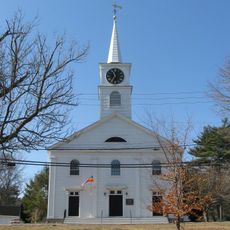
The roots of the district reach back to 1700 with the construction of the Stetson House, followed by additional buildings added throughout the 1800s. The First Congregational Church was completed in 1863 and represents a significant growth phase in the town's development.

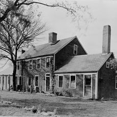
The district shows layers of New England architectural styles from different times, with colonial homes next to later revival buildings that reflect how the town grew and changed. Walking through, you can see how each era left its mark on the streetscape and building forms.

The district is walkable and offers several spots to visit, including the library, town hall, and museum. The best time to explore is on pleasant days when the streets are active and all buildings are fully accessible.

The First Congregational Church sits on an island formation created by the intersection of three roads, giving the location an unusual geographic structure. This triangular arrangement is clearly visible while walking and shapes the entire center.

The community of curious travelers

AroundUs brings together thousands of curated places, local tips, and hidden gems, enriched daily by 60,000 contributors worldwide.

Start exploring
Location
GPS coordinates
42.11833,-70.84444
Latest update
December 14, 2025 18:05
Around this place
Wompatuck State Park
United States of America

Wompatuck State Park

9.8 km
Daniel Webster Wildlife Sanctuary
United States of America

Daniel Webster Wildlife Sanctuary

9.3 km
North River Wildlife Sanctuary
United States of America

North River Wildlife Sanctuary

9.3 km
Cardinal Cushing Centers
United States of America

Cardinal Cushing Centers

2 km
Whitman Park
United States of America

Whitman Park

8.4 km
Camp Kiwanee Historic District
United States of America

Camp Kiwanee Historic District

6.6 km
Pembroke Friends Meetinghouse
United States of America

Pembroke Friends Meetinghouse

3.6 km
Hatch Homestead and Mill Historic District
United States of America

Hatch Homestead and Mill Historic District

6.2 km
Woodworth House
United States of America

Woodworth House

9.8 km
Fogg Library
United States of America

Fogg Library

10.8 km
Stetson House
United States of America

Stetson House

248 m
Rockland Trust Company
United States of America

Rockland Trust Company

6.3 km
Island Grove Park National Register District
United States of America

Island Grove Park National Register District

1.5 km
Rockland Almshouse
United States of America

Rockland Almshouse

5.6 km
Grand Army of the Republic Hall
United States of America

Grand Army of the Republic Hall

5.8 km
Rockland Memorial Library
United States of America

Rockland Memorial Library

6.5 km
Capt. Benjamin James House
United States of America

Capt. Benjamin James House

10.6 km
Lower Union Street Historic District
United States of America

Lower Union Street Historic District

6 km
The Tack Factory
United States of America

The Tack Factory

3 km
Fogg Building
United States of America

Fogg Building

10.9 km
Bryant-Cushing House
United States of America

Bryant-Cushing House

6.6 km
Stetson-Ford House
United States of America

Stetson-Ford House

4.9 km
District 7 School
United States of America

District 7 School

8.8 km
Thomas Chubbuck, Jr. House
United States of America

Thomas Chubbuck, Jr. House

7.4 km
South Hingham Historic District
United States of America

South Hingham Historic District

10.9 km
South Shore Natural Science Center
United States of America

South Shore Natural Science Center

4.9 km
Norwell Village Area Historic District
United States of America

Norwell Village Area Historic District

6.5 km
Marshfield Hills Historic District
United States of America

Marshfield Hills Historic District

9.2 km
Show the full map
Reviews
Share your experience

No review yet

Discussions
Start a discussion...

No discussion yet

« Hanover Center Historic District - Historic district in Hanover, Massachusetts » is provided by Around Us (aroundus.com). Images and texts are derived from Wikimedia project under a Creative Commons license. You are allowed to copy, distribute, and modify copies of this page, under the conditions set by the license, as long as this note is clearly visible.

Discover hidden gems everywhere you go!

From secret cafés to breathtaking viewpoints, skip the crowded tourist spots and find places that match your style. Our app makes it easy with voice search, smart filtering, route optimization, and insider tips from travelers worldwide. Download now for the complete mobile experience.

Around Us App Screenshot

A unique approach to discovering new places

Le Figaro

All the places worth exploring

France Info

A tailor-made excursion in just a few clicks

20 Minutes

Around Us
Travel Guide & Maps
Download

Send to your phone

QR Code
1

Open the camera app on your mobile.

2

Point at the QR code with your camera. A notification will appear.

3

Tap the notification to open the link.