Wompatuck State Park

Log in to your account

AroundUs is a community-driven map of interesting places, built by curious explorers like you. It grows with every review, story, and photo you share.
Connect to save your favorite spots, contribute locations, and create personalized routes.
By continuing, you accept our Terms and Conditions and our Privacy Policy
Add to collection
Map
Suggest a change
Share

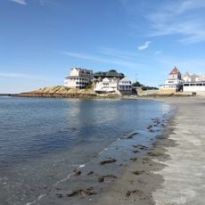
Wompatuck State Park, Natural reserve and state park in Hingham, United States.

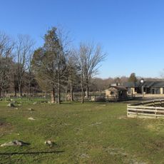
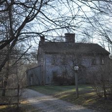
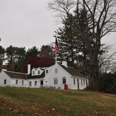
Wompatuck State Park is a nature reserve spanning roughly 3,500 acres across four Massachusetts towns, connecting forests, streams, and ponds through its landscape. The park features a dense network of hiking trails in varying lengths and accessible camping facilities for overnight visitors.

The land was originally inhabited by Chief Josiah Wompatuck and the Massachusett people until mid-1600s, when it passed to European settlers. During World War II, the area served as a naval ammunition storage facility, maintaining this role for several decades.

The name honors Chief Josiah Wompatuck of the Massachusett people, whose legacy remains tied to this landscape. Walking through the park means moving through a place shaped by both Indigenous and colonial history.

The area is easily accessible and offers amenities for various activities such as hiking and overnight stays. Visitors should know that the park experiences different conditions depending on season and should check local conditions before arriving.

The park holds over one hundred abandoned bunkers remaining from its time as a naval depot, hidden beneath the forest canopy. These underground structures quietly remind visitors of a lesser-known wartime chapter in the area's past.

Location: Massachusetts

Inception: 1969

Operator: DCR - Division Of State Parks And Recreation

Website: https://mass.gov/locations/wompatuck-state-park

GPS coordinates: 42.20640,-70.84610

Latest update: December 8, 2025 19:57

Photos
Around this place
Paragon Park
United States of America

Paragon Park

6.9 km
Weir River Farm
United States of America

Weir River Farm

3.8 km
Josephine M. Hagerty House
United States of America

Josephine M. Hagerty House

6.8 km
Hingham Naval Ammunition Depot
United States of America

Hingham Naval Ammunition Depot

6.6 km
Paragon Park Carousel
United States of America

Paragon Park Carousel

7.1 km
General Benjamin Lincoln House
United States of America

General Benjamin Lincoln House

5.6 km
Cushing Homestead
United States of America

Cushing Homestead

4 km
WPA Field House and Pump Station
United States of America

WPA Field House and Pump Station

5 km
First Trinitarian Congregational Church
United States of America

First Trinitarian Congregational Church

7.1 km
Capt. John Wilson House and Bates Ship Chandlery
United States of America

Capt. John Wilson House and Bates Ship Chandlery

5.3 km
Pratt Historic Building
United States of America

Pratt Historic Building

5.3 km
First Baptist Church of Scituate
United States of America

First Baptist Church of Scituate

5.8 km
Lincoln Historic District
United States of America

Lincoln Historic District

5.2 km
Cohasset Common Historic District
United States of America

Cohasset Common Historic District

5.4 km
Bryant-Cushing House
United States of America

Bryant-Cushing House

7.1 km
Caleb Lothrop House
United States of America

Caleb Lothrop House

5.3 km
Government Island Historic District
United States of America

Government Island Historic District

5.9 km
Thomas Chubbuck, Jr. House
United States of America

Thomas Chubbuck, Jr. House

4.6 km
Cohasset Central Cemetery
United States of America

Cohasset Central Cemetery

5.5 km
South Hingham Historic District
United States of America

South Hingham Historic District

3.3 km
Crescent Beach
United States of America

Crescent Beach

6.8 km
South Shore Natural Science Center
United States of America

South Shore Natural Science Center

4.9 km
Gun Rock Beach
United States of America

Gun Rock Beach

6.9 km
Norwell Village Area Historic District
United States of America

Norwell Village Area Historic District

6.8 km
Bassing Beach
United States of America

Bassing Beach

6.4 km
Pleasant Beach
United States of America

Pleasant Beach

6.7 km
Black Rock Beach
United States of America

Black Rock Beach

6.6 km
Sandy Beach
United States of America

Sandy Beach

6.8 km
Show the full map
Reviews

Visited this place? Tap the stars to rate it and share your experience / photos with the community! Try now! You can cancel it anytime.

« Wompatuck State Park - Natural reserve and state park in Hingham, United States » is provided by Around Us (aroundus.com). Images and texts are derived from Wikimedia project under a Creative Commons license. You are allowed to copy, distribute, and modify copies of this page, under the conditions set by the license, as long as this note is clearly visible.

Discover hidden gems everywhere you go!

From secret cafés to breathtaking viewpoints, skip the crowded tourist spots and find places that match your style. Our app makes it easy with voice search, smart filtering, route optimization, and insider tips from travelers worldwide. Download now for the complete mobile experience.

Around Us App Screenshot

A unique approach to discovering new places

Le Figaro

All the places worth exploring

France Info

A tailor-made excursion in just a few clicks

20 Minutes