Enable Location

We need your location to show you interesting places around you

Discover nearby places

Find interesting locations and hidden gems around you

Precise directions

Get accurate directions and distances to places

Your location is never shared with other users. It's only used when you tap the location button.

WPA Field House and Pump Station

Log in to your account

Start exploring — it's free

Trusted by 62,943 travelers worldwide

Continue with Google
Continue with Apple
or

We will send you a code to connect

By continuing, you accept our Terms and Conditions and our Privacy Policy

Check your inbox

We've sent a pincode in your inbox. Please enter the code below.

WPA Field House and Pump Station
Discussion Reviews 1 Photos
1.4k Popularity

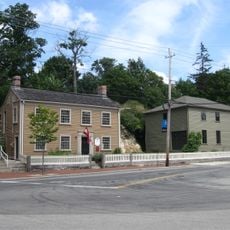
WPA Field House and Pump Station, New Deal era public facility in Scituate, Massachusetts.

The WPA Field House and Pump Station is a public facility from the New Deal era built with solid stone walls and a slate-covered gable roof. The 1.5-story structure spans about 41 feet (12.5 m) in width and contained basement storage space along with a community gathering area on the upper level.

Built between 1938 and 1939 as part of Depression-era recovery efforts, this structure served both recreational and water supply purposes for the community. The dual function reflected how public works projects addressed local needs during economic hardship.

The building once served as a gathering place where locals came together for sports events and community meetings throughout the 20th century. Different neighborhood groups used its spaces for their regular activities and celebrations.

The building is located on Henry Bailey Turner Road and is recognizable from the street. You can view the structure and its stonework details from outside without needing advance arrangements.

The building blends design elements from three different architectural traditions, featuring distinctive stone piers that support the front porch. This mixture of craftsmanship and classical details makes it a notable example of local architecture from that era.

The community of curious travelers

AroundUs brings together thousands of curated places, local tips, and hidden gems, enriched daily by 60,000 contributors worldwide.

Start exploring
GPS coordinates
42.21830,-70.78720
Latest update
December 14, 2025 17:04
Around this place
Wompatuck State Park
United States of America

Wompatuck State Park

5 km
Old Scituate Light
United States of America

Old Scituate Light

6.1 km
Weir River Farm
United States of America

Weir River Farm

6 km
Josephine M. Hagerty House
United States of America

Josephine M. Hagerty House

4.7 km
Cushing Homestead
United States of America

Cushing Homestead

6.7 km
Woodworth House
United States of America

Woodworth House

5.2 km
First Trinitarian Congregational Church
United States of America

First Trinitarian Congregational Church

3 km
Men of Kent Cemetery
United States of America

Men of Kent Cemetery

6 km
Capt. John Wilson House and Bates Ship Chandlery
United States of America

Capt. John Wilson House and Bates Ship Chandlery

2.8 km
Pratt Historic Building
United States of America

Pratt Historic Building

2.5 km
First Baptist Church of Scituate
United States of America

First Baptist Church of Scituate

890 m
Capt. Benjamin James House
United States of America

Capt. Benjamin James House

5.9 km
Cohasset Common Historic District
United States of America

Cohasset Common Historic District

3 km
Peggotty Beach
United States of America

Peggotty Beach

6.7 km
Bryant-Cushing House
United States of America

Bryant-Cushing House

6.5 km
Caleb Lothrop House
United States of America

Caleb Lothrop House

2.2 km
Government Island Historic District
United States of America

Government Island Historic District

2.2 km
Cohasset Central Cemetery
United States of America

Cohasset Central Cemetery

3.5 km
North Scituate Beach
United States of America

North Scituate Beach

3 km
Crescent Beach
United States of America

Crescent Beach

6.7 km
Minot's Ledge Light
United States of America

Minot's Ledge Light

6.2 km
Gun Rock Beach
United States of America

Gun Rock Beach

7.1 km
Lawson Tower
United States of America

Lawson Tower

3.3 km
Norwell Village Area Historic District
United States of America

Norwell Village Area Historic District

6.3 km
Minot Beach
United States of America

Minot Beach

3.4 km
Bassing Beach
United States of America

Bassing Beach

2.7 km
Pleasant Beach
United States of America

Pleasant Beach

5.1 km
Black Rock Beach
United States of America

Black Rock Beach

5.9 km
Show the full map
Reviews
Share your experience

No review yet

Discussions
Start a discussion...

No discussion yet

« WPA Field House and Pump Station - New Deal era public facility in Scituate, Massachusetts » is provided by Around Us (aroundus.com). Images and texts are derived from Wikimedia project under a Creative Commons license. You are allowed to copy, distribute, and modify copies of this page, under the conditions set by the license, as long as this note is clearly visible.

Discover hidden gems everywhere you go!

From secret cafés to breathtaking viewpoints, skip the crowded tourist spots and find places that match your style. Our app makes it easy with voice search, smart filtering, route optimization, and insider tips from travelers worldwide. Download now for the complete mobile experience.

Around Us App Screenshot

A unique approach to discovering new places

Le Figaro

All the places worth exploring

France Info

A tailor-made excursion in just a few clicks

20 Minutes

Around Us
Travel Guide & Maps
Download

Send to your phone

QR Code
1

Open the camera app on your mobile.

2

Point at the QR code with your camera. A notification will appear.

3

Tap the notification to open the link.