Enable Location

We need your location to show you interesting places around you

Discover nearby places

Find interesting locations and hidden gems around you

Precise directions

Get accurate directions and distances to places

Your location is never shared with other users. It's only used when you tap the location button.

Howland Mill Village Historic District

Log in to your account

Start exploring — it's free

Trusted by 62,558 travelers worldwide

Continue with Google
Continue with Apple
or

We will send you a code to connect

By continuing, you accept our Terms and Conditions and our Privacy Policy

Check your inbox

We've sent a pincode in your inbox. Please enter the code below.

Howland Mill Village Historic District, New Bedford, MA, listed on the NRHP in Massachusetts

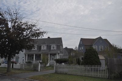
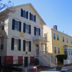
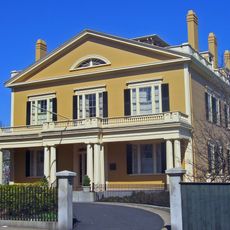
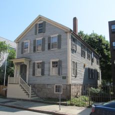
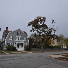
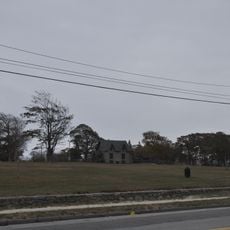
The Howland Mill Village Historic District is a residential neighborhood in New Bedford with small houses built in the 1880s and 1890s for mill workers. Most homes follow just two basic architectural styles and are arranged closely together along streets including Bolton, Winsper, Hemlock, and Rockdale Avenue.

The area was developed in the late 1880s as the Howland Mill Company began operations and built housing for its workers. The mill remained active until 1954, and in 1996 the district was added to the National Register of Historic Places.

The street names like Bolton and Winsper reflect the planned layout for mill workers and their families. You can see how closely the houses sit together, showing how people organized their daily lives around the mill and its rhythms.

The district is best explored on foot, as the streets are narrow and quiet, inviting a slow walk through the neighborhood. The warmest months are ideal for visiting, when trees are green and the area feels more open.

In the 1920s, larger two-story houses were added to the district, showing how the community evolved as original worker families became more prosperous. These later homes differ noticeably from the earlier simple structures and record the economic shifts of the period.

The community of curious travelers

AroundUs brings together thousands of curated places, local tips, and hidden gems, enriched daily by 60,000 contributors worldwide.

Start exploring
Location
GPS coordinates
41.61611,-70.93333
Latest update
February 9, 2026 07:40
Around this place
New Bedford Whaling Museum
United States of America

New Bedford Whaling Museum

2.3 km
Effie M. Morrissey
United States of America

Effie M. Morrissey

2.3 km
New Bedford Whaling National Historical Park
United States of America

New Bedford Whaling National Historical Park

2.3 km
Seamen's Bethel
United States of America

Seamen's Bethel

2.3 km
Buttonwood Park Zoo
United States of America

Buttonwood Park Zoo

2.2 km
Nathan and Mary Johnson properties
United States of America

Nathan and Mary Johnson properties

1.9 km
New Bedford Historic District
United States of America

New Bedford Historic District

2.3 km
Rotch-Jones-Duff House and Garden Museum
United States of America

Rotch-Jones-Duff House and Garden Museum

1.6 km
Sgt. William H. Carney House
United States of America

Sgt. William H. Carney House

2.4 km
Palmer Island Light
United States of America

Palmer Island Light

2.3 km
Buttonwood Park Historic District
United States of America

Buttonwood Park Historic District

2.3 km
William J. Rotch Gothic Cottage
United States of America

William J. Rotch Gothic Cottage

1.6 km
Moreland Terrace Historic District
United States of America

Moreland Terrace Historic District

1.3 km
Central New Bedford Historic District
United States of America

Central New Bedford Historic District

2.2 km
United States Customhouse
United States of America

United States Customhouse

2.3 km
Hazelwood Park
United States of America

Hazelwood Park

1.9 km
Union Baptist Church
United States of America

Union Baptist Church

2 km
County Street Historic District
United States of America

County Street Historic District

1.8 km
New Bedford Gas and Edison Light Complex
United States of America

New Bedford Gas and Edison Light Complex

1.9 km
First Baptist Church
United States of America

First Baptist Church

2.2 km
Merrill's Wharf Historic District
United States of America

Merrill's Wharf Historic District

2.2 km
Times and Olympia Buildings
United States of America

Times and Olympia Buildings

2.3 km
Old Third District Courthouse
United States of America

Old Third District Courthouse

2.3 km
New Bedford Marine Commerce Terminal
United States of America

New Bedford Marine Commerce Terminal

1.6 km
Robert C. Ingraham School
United States of America

Robert C. Ingraham School

1 km
Thomas Donaghy School
United States of America

Thomas Donaghy School

1.4 km
Thompson Street School
United States of America

Thompson Street School

796 m
Zeiterion Theatre
United States of America

Zeiterion Theatre

2 km
Show the full map
« Howland Mill Village Historic District - New Bedford, MA, listed on the NRHP in Massachusetts » is provided by Around Us (aroundus.com). Images and texts are derived from Wikimedia project under a Creative Commons license. You are allowed to copy, distribute, and modify copies of this page, under the conditions set by the license, as long as this note is clearly visible.

Discover hidden gems everywhere you go!

From secret cafés to breathtaking viewpoints, skip the crowded tourist spots and find places that match your style. Our app makes it easy with voice search, smart filtering, route optimization, and insider tips from travelers worldwide. Download now for the complete mobile experience.

Around Us App Screenshot

A unique approach to discovering new places

Le Figaro

All the places worth exploring

France Info

A tailor-made excursion in just a few clicks

20 Minutes

Around Us
Travel Guide & Maps
Download

Send to your phone

QR Code
1

Open the camera app on your mobile.

2

Point at the QR code with your camera. A notification will appear.

3

Tap the notification to open the link.