Independence Dam State Park

Log in to your account

AroundUs is a community-driven map of interesting places, built by curious explorers like you. It grows with every review, story, and photo you share.
Connect to save your favorite spots, contribute locations, and create personalized routes.
Continue with Google
Continue with Apple
Continue with X
Continue with Facebook
Continue with email
By continuing, you accept our Terms and Conditions and our Privacy Policy
Create an account

Independence Dam State Park

Add to collection
Map
Suggest a change
Share

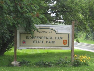
Independence Dam State Park, State park on Maumee River in Defiance County, United States.

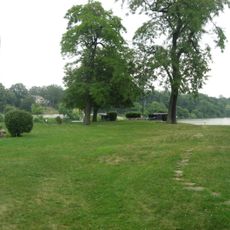
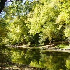
Independence Dam State Park spreads across woodland along the Maumee River where two waterways meet. The grounds feature remains of a former canal system and sections designed for fishing and riverside activities.

The site took its modern form when a concrete structure replaced an older wooden version in the 1920s. That replacement was part of changes to a canal system that once moved goods through the region.

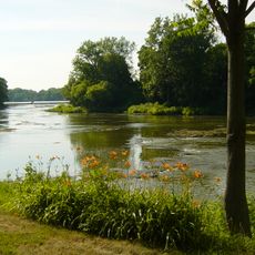
The meeting point of two rivers here held deep significance for Native American communities in the past. This location shaped how people moved through and settled the region.

Access to the water is straightforward with boat ramps and shallow launch spots available for visitors. Walking trails follow the old canal path and are easy to navigate on foot throughout the grounds.

The river flowing through here carries an enormous volume and ranks as one of the largest streams feeding Lake Erie. Witnessing this powerful waterway shows why the location mattered so much historically.

Location: Ohio

Inception: 1949

Website: https://ohiodnr.gov/wps/portal/gov/odnr/go-and-do/plan-a-visit/find-a-property/independence-dam-state-park

GPS coordinates: 41.29390,-84.28250

Latest update: December 12, 2025 14:40

Photos
Around this place
Fort Defiance
United States of America

Fort Defiance

6.3 km
Mary Jane Thurston State Park
United States of America

Mary Jane Thurston State Park

36.2 km
Goll Woods State Nature Preserve
United States of America

Goll Woods State Nature Preserve

29.5 km
Harrison Lake State Park
United States of America

Harrison Lake State Park

39.3 km
Henry County Sheriff's Residence and Jail
United States of America

Henry County Sheriff's Residence and Jail

17.2 km
Henry County Courthouse
United States of America

Henry County Courthouse

17.1 km
Putnam County Courthouse
United States of America

Putnam County Courthouse

36.4 km
John Edwards House
United States of America

John Edwards House

32.5 km
Defiance County Courthouse
United States of America

Defiance County Courthouse

6.6 km
Paulding County Courthouse
United States of America

Paulding County Courthouse

30.4 km
Paulding County Carnegie Library
United States of America

Paulding County Carnegie Library

30.4 km
Fulton County Courthouse
United States of America

Fulton County Courthouse

30.8 km
Leipsic Village Hall
United States of America

Leipsic Village Hall

33.1 km
Defiance Public Library
United States of America

Defiance Public Library

6.4 km
Goll Homestead
United States of America

Goll Homestead

30 km
Williams County Courthouse
United States of America

Williams County Courthouse

30.8 km
Dey Road Bridge
United States of America

Dey Road Bridge

8.6 km
St. Paul's Episcopal Church
United States of America

St. Paul's Episcopal Church

40.2 km
Round Barn
United States of America

Round Barn

24.7 km
Ottawa Waterworks Building
United States of America

Ottawa Waterworks Building

36.7 km
Brooke Site
United States of America

Brooke Site

11.3 km
Kunkle Log House
United States of America

Kunkle Log House

41.6 km
George S. Clement House
United States of America

George S. Clement House

30.7 km
United States of America

Round Barn

39 km
Jones-Read-Touvelle House
United States of America

Jones-Read-Touvelle House

30.2 km
St. John the Baptist Catholic Church
United States of America

St. John the Baptist Catholic Church

33.9 km
Riverside Chapel
United States of America

Riverside Chapel

8.3 km
Lockport Covered Bridge
United States of America

Lockport Covered Bridge

29.5 km
Show the full map
Reviews

Visited this place? Tap the stars to rate it and share your experience / photos with the community! Try now! You can cancel it anytime.

« Independence Dam State Park - State park on Maumee River in Defiance County, United States » is provided by Around Us (aroundus.com). Images and texts are derived from Wikimedia project under a Creative Commons license. You are allowed to copy, distribute, and modify copies of this page, under the conditions set by the license, as long as this note is clearly visible.

Discover hidden gems everywhere you go!

From secret cafés to breathtaking viewpoints, skip the crowded tourist spots and find places that match your style. Our app makes it easy with voice search, smart filtering, route optimization, and insider tips from travelers worldwide. Download now for the complete mobile experience.

Around Us App Screenshot

A unique approach to discovering new places

Le Figaro

All the places worth exploring

France Info

A tailor-made excursion in just a few clicks

20 Minutes