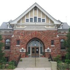
Paulding County Carnegie Library
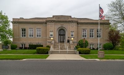
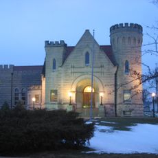
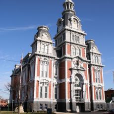
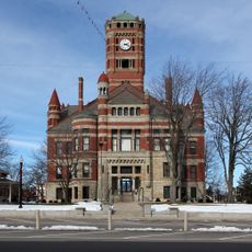
Paulding County Carnegie Library is a Beaux-Arts style building located in Paulding, Ohio, that opened in 1916. The structure features brick and limestone exterior elements with six interior rooms decorated with oak panels, marble floors, and classical columns that create a formal and orderly design.
The building was constructed from 1912 to 1916 and became the first Carnegie library to serve an entire county. Its creation followed local efforts to raise funds and request support from Andrew Carnegie, which led to successful construction of this community facility.
The library carries the name of a wealthy businessman who believed in supporting communities through learning spaces. Today, visitors can see how the building serves as a gathering place and resource center for the people of Paulding County.
The building is open most weekdays until early evening, with shorter hours on Saturdays and closed on Sundays. Visitors should note that the main entrance is reached by a stone staircase and the building has multiple rooms across different levels.
The building was the first Carnegie project to serve an entire county rather than just a single city, highlighting its importance in bringing educational access to rural areas. This exception demonstrated how a small community successfully advocated for support and created a model for other regions.
The community of curious travelers
AroundUs brings together thousands of curated places, local tips, and hidden gems, enriched daily by 60,000 contributors worldwide.