Chest opened
+${chestReward.xp} XP
Explorer
NOUVEAU ×${chestReward.collectible.quantity}
tapez pour fermer
Chest locked

Open chests in the app

Around Us is built for your phone — chests unlock when you walk, explore and capture nearby places.

Enable Location

We need your location to show you interesting places around you

Discover nearby places

Find interesting locations and hidden gems around you

Precise directions

Get accurate directions and distances to places

Your location is never shared with other users. It's only used when you tap the location button.

Log in to your account

Start exploring — it's free

Trusted by 72,888 travelers worldwide

Continue with Google
Continue with Apple
or

We will send you a code to connect

By continuing, you accept our Terms and Conditions and our Privacy Policy

Check your inbox

We've sent a pincode in your inbox. Please enter the code below.

Irish Wilderness
Discussion Reviews Photo
5.8k Popularity

Irish Wilderness, Wilderness area in Oregon County, Missouri, United States.

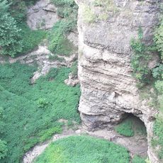
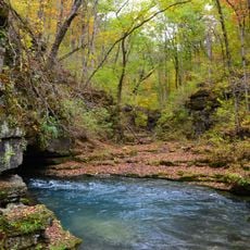
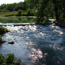
Irish Wilderness is a large forest preserve in Mark Twain National Forest spanning over 16,000 acres of dense hardwood forests, natural springs, and limestone formations. The main White's Creek Trail runs nearly 19 miles through the area, providing the primary access for visitors exploring the protected landscape.

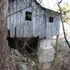
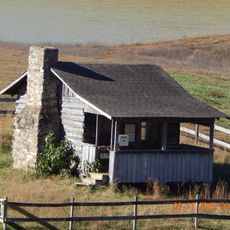
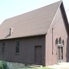
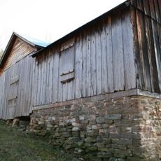
An Irish priest established a settlement here in 1858 for Irish immigrants seeking a new home in the forest. The Civil War forced residents to abandon the community by 1863, leaving the land to return to its wild state.

The place holds memories of Irish immigrants who settled here in the 1800s and built their own community in the forest. Walking through the land today, visitors can sense this heritage woven into the natural surroundings.

The area is best explored on foot and works well for multi-day backpacking trips or day hikes through the forest. Visitors should come prepared for remote conditions with sturdy gear and supplies, as facilities within the wilderness are very limited.

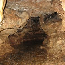
White's Creek Cave displays impressive limestone formations and is home to a significant population of endangered bats. Protective gates allow visitors to observe the natural beauty of the cavern while keeping the sensitive creatures undisturbed.

The community of curious travelers

AroundUs brings together thousands of curated places, local tips, and hidden gems, enriched daily by 60,000 contributors worldwide.

Start exploring
Location
GPS coordinates
36.73080,-91.17500
Latest update
December 9, 2025 18:47
Around this place
Mammoth Spring
United States of America

Mammoth Spring

41.4 km
Grand Gulf State Park
United States of America

Grand Gulf State Park

46.8 km
Greer Spring
United States of America

Greer Spring

16.6 km
Mammoth Spring State Park
United States of America

Mammoth Spring State Park

41.5 km
Mammoth Spring State Park
United States of America

Mammoth Spring State Park

41.5 km
Eleven Point State Park
United States of America

Eleven Point State Park

12.7 km
Current River Cavern
United States of America

Current River Cavern

30.2 km
Alley Spring Roller Mill
United States of America

Alley Spring Roller Mill

52.8 km
AR 289 Bridge Over English Creek
United States of America

AR 289 Bridge Over English Creek

47.2 km
Walter Klepzig Mill and Farm
United States of America

Walter Klepzig Mill and Farm

43.9 km
Hillyard Cabin
United States of America

Hillyard Cabin

30.2 km
Spring River Bridge
United States of America

Spring River Bridge

42.1 km
Cedar Grove School No. 81
United States of America

Cedar Grove School No. 81

48.6 km
Ripley County Jail, Sheriff's Office and Sheriff's Residence
United States of America

Ripley County Jail, Sheriff's Office and Sheriff's Residence

33.5 km
Big Spring Historic District
United States of America

Big Spring Historic District

29.2 km
Randolph Columbus Barrett House
United States of America

Randolph Columbus Barrett House

33.7 km
Holly Grove Presbyterian Church
United States of America

Holly Grove Presbyterian Church

45.3 km
Rice-Upshaw House
United States of America

Rice-Upshaw House

35.3 km
Ripley County Courthouse
United States of America

Ripley County Courthouse

33.5 km
Old Union School
United States of America

Old Union School

52.7 km
Saint Andrew's Episcopal Church
United States of America

Saint Andrew's Episcopal Church

41.4 km
Reed Log House
United States of America

Reed Log House

47 km
Ravenden Springs School
United States of America

Ravenden Springs School

46.6 km
Baynham House
United States of America

Baynham House

50.9 km
United States of America

Yadkin Church

39.7 km
Looney-French House
United States of America

Looney-French House

37.4 km
T.H. Morris House
United States of America

T.H. Morris House

42.1 km
Carter County Courthouse
United States of America

Carter County Courthouse

32.7 km
Show the full map
Reviews
Share your experience

No review yet

Discussions
Start a discussion...

No discussion yet

« Irish Wilderness - Wilderness area in Oregon County, Missouri, United States » is provided by Around Us (aroundus.com). Images and texts are derived from Wikimedia project under a Creative Commons license. You are allowed to copy, distribute, and modify copies of this page, under the conditions set by the license, as long as this note is clearly visible.

Discover hidden gems everywhere you go!

From secret cafés to breathtaking viewpoints, skip the crowded tourist spots and find places that match your style. Our app makes it easy with voice search, smart filtering, route optimization, and insider tips from travelers worldwide. Download now for the complete mobile experience.

Around Us App Screenshot

A unique approach to discovering new places

Le Figaro

All the places worth exploring

France Info

A tailor-made excursion in just a few clicks

20 Minutes

Around Us
Travel Guide & Maps
Download

Send to your phone

QR Code
1

Open the camera app on your mobile.

2

Point at the QR code with your camera. A notification will appear.

3

Tap the notification to open the link.