Enable Location

We need your location to show you interesting places around you

Discover nearby places

Find interesting locations and hidden gems around you

Precise directions

Get accurate directions and distances to places

Your location is never shared with other users. It's only used when you tap the location button.

Leesylvania State Park

Log in to your account

Start exploring — it's free

Trusted by 63,118 travelers worldwide

Continue with Google
Continue with Apple
or

We will send you a code to connect

By continuing, you accept our Terms and Conditions and our Privacy Policy

Check your inbox

We've sent a pincode in your inbox. Please enter the code below.

Leesylvania State Park
Discussion Reviews 1 Photos
8.8k Popularity

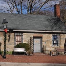
Leesylvania State Park, Historic plantation and state park in Prince William County, United States.

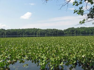
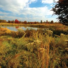
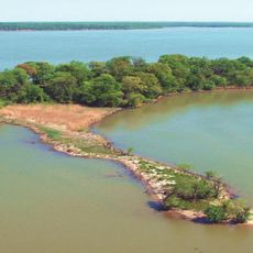
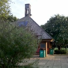
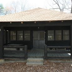
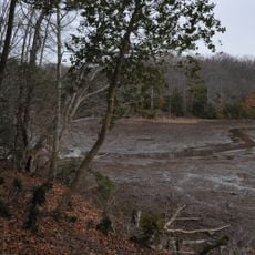
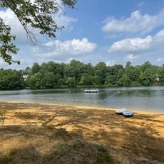
Leesylvania State Park is a 542-acre park along the Potomac River with natural sand beaches, five hiking trails, and elevated overlooks for water views. The grounds feature a boat ramp, fishing pier, picnic shelters, and seasonal rentals of kayaks and other paddle craft.

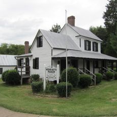
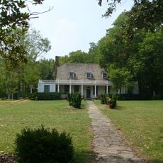
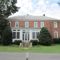
Henry Lee II established the plantation in 1747 and raised eight children here, including Henry Lee III, a major figure in the Revolutionary War. The family's presence shaped the development of this area for decades.

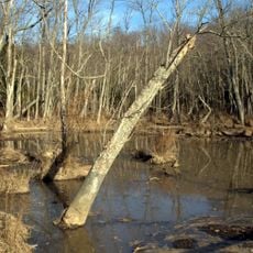
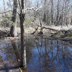
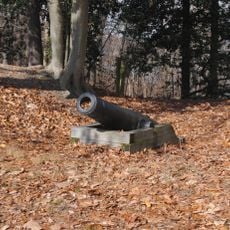
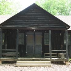
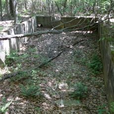
The archaeological site shows remains of an Algonquian village and early English settlements that visitors can discover while walking the trails. These traces tell the story of the different communities that lived on this shoreline over many generations.

The park is best explored on foot using well-marked trails of varying difficulty with river views along the way. Wear good shoes and be prepared for uneven terrain on some paths.

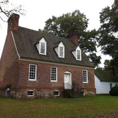
A restored chimney from the Fairfax House and a cemetery with graves of the Lee and Fairfax families are accessible by walking the park trails. These quiet spots offer a glimpse into the lives of the families who inhabited the estate centuries ago.

The community of curious travelers

AroundUs brings together thousands of curated places, local tips, and hidden gems, enriched daily by 60,000 contributors worldwide.

Start exploring
Inception
1985
GPS coordinates
38.59000,-77.25556
Latest update
December 8, 2025 19:56
Around this place
National Museum of the Marine Corps
United States of America

National Museum of the Marine Corps

9.2 km
Weems–Botts Museum
United States of America

Weems–Botts Museum

6.9 km
Quantico National Cemetery
United States of America

Quantico National Cemetery

10.8 km
Mason Neck State Park
United States of America

Mason Neck State Park

9.4 km
Bel Air
United States of America

Bel Air

10.9 km
Rippon Lodge
United States of America

Rippon Lodge

3.3 km
Occoquan Bay National Wildlife Refuge
United States of America

Occoquan Bay National Wildlife Refuge

6.3 km
Smallwood State Park
United States of America

Smallwood State Park

7.2 km
Chopawamsic
United States of America

Chopawamsic

9.8 km
Featherstone National Wildlife Refuge
United States of America

Featherstone National Wildlife Refuge

495 m
Waffle House
United States of America

Waffle House

6.2 km
Lexington
United States of America

Lexington

7.8 km
Occoquan Regional Park
United States of America

Occoquan Regional Park

10.4 km
Commanding General's Quarters, Quantico Marine Base
United States of America

Commanding General's Quarters, Quantico Marine Base

7.9 km
Marine Corps Air-Ground Museum
United States of America

Marine Corps Air-Ground Museum

10.2 km
Freestone Point Confederate Battery
United States of America

Freestone Point Confederate Battery

636 m
Henderson House
United States of America

Henderson House

6.8 km
Occoquan Historic District
United States of America

Occoquan Historic District

10.5 km
Pleasant Historic District, Chopawamsic RDA Camp 4
United States of America

Pleasant Historic District, Chopawamsic RDA Camp 4

8.6 km
Cabin Branch Pyrite Mine Historic District
United States of America

Cabin Branch Pyrite Mine Historic District

8.4 km
Chopawamsic Recreational Demonstration Area Cabin Camp 1
United States of America

Chopawamsic Recreational Demonstration Area Cabin Camp 1

8.8 km
Taft Archeological Site No. 029-5411
United States of America

Taft Archeological Site No. 029-5411

8.4 km
Old Town Hall and School
United States of America

Old Town Hall and School

6.4 km
Orenda/SP-26 Historic District, Chopawamsic RDA Camp 3
United States of America

Orenda/SP-26 Historic District, Chopawamsic RDA Camp 3

9.6 km
Odd Fellows Hall
United States of America

Odd Fellows Hall

10.4 km
West Beach
United States of America

West Beach

8.7 km
Crusading for Right
United States of America

Crusading for Right

8.4 km
Prince William Forest Park Visitor Center
United States of America

Prince William Forest Park Visitor Center

8.6 km
Show the full map
Reviews
Share your experience

No review yet

Discussions
Start a discussion...

No discussion yet

« Leesylvania State Park - Historic plantation and state park in Prince William County, United States » is provided by Around Us (aroundus.com). Images and texts are derived from Wikimedia project under a Creative Commons license. You are allowed to copy, distribute, and modify copies of this page, under the conditions set by the license, as long as this note is clearly visible.

Discover hidden gems everywhere you go!

From secret cafés to breathtaking viewpoints, skip the crowded tourist spots and find places that match your style. Our app makes it easy with voice search, smart filtering, route optimization, and insider tips from travelers worldwide. Download now for the complete mobile experience.

Around Us App Screenshot

A unique approach to discovering new places

Le Figaro

All the places worth exploring

France Info

A tailor-made excursion in just a few clicks

20 Minutes

Around Us
Travel Guide & Maps
Download

Send to your phone

QR Code
1

Open the camera app on your mobile.

2

Point at the QR code with your camera. A notification will appear.

3

Tap the notification to open the link.