Enable Location

We need your location to show you interesting places around you

Discover nearby places

Find interesting locations and hidden gems around you

Precise directions

Get accurate directions and distances to places

Your location is never shared with other users. It's only used when you tap the location button.

Chopawamsic

Log in to your account

Start exploring — it's free

Trusted by 61,996 travelers worldwide

Continue with Google
Continue with Apple
or

We will send you a code to connect

By continuing, you accept our Terms and Conditions and our Privacy Policy

Check your inbox

We've sent a pincode in your inbox. Please enter the code below.

Chopawamsic

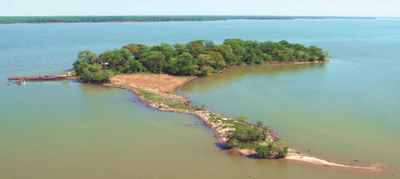
Chopawamsic, River island in Potomac River, Virginia, US

Chopawamsic Island is a forested landmass in the Potomac River located about 30 miles south of Washington, D.C. in Virginia. The island is covered with trees and natural vegetation, with unmanaged shorelines that slope gradually into the water.

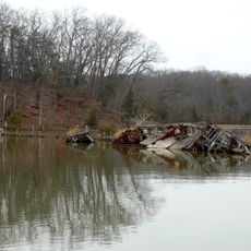
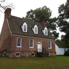
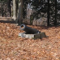
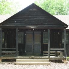
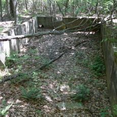
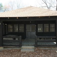
European settlement began on the island in 1649 with figures like Giles Brent establishing a presence there. During the Civil War, the site served as a retreat for soldiers stationed nearby, with visual records of their time there still preserved.

The island's name comes from the Chopawamsic people, a Native American group whose language left its mark on regional place names that survive today.

Reaching the island requires a boat, as there is no road access or bridge connection. Visitors should plan ahead since the site offers minimal facilities and remains in a natural state.

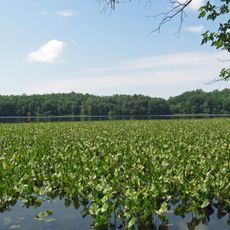
The island serves as a breeding ground for migratory songbirds, great blue herons, ospreys, and bald eagles during warmer seasons. This role as a wildlife refuge makes it an overlooked natural treasure for bird watchers.

The community of curious travelers

AroundUs brings together thousands of curated places, local tips, and hidden gems, enriched daily by 60,000 contributors worldwide.

Start exploring
GPS coordinates
38.50806,-77.29694
Latest update
December 21, 2025 16:05
Around this place
Mallows Bay
United States of America

Mallows Bay

4.6 km
Interstate 95 in Virginia
United States of America

Interstate 95 in Virginia

7.5 km
National Museum of the Marine Corps
United States of America

National Museum of the Marine Corps

5.7 km
Weems–Botts Museum
United States of America

Weems–Botts Museum

7.3 km
Leesylvania State Park
United States of America

Leesylvania State Park

9.8 km
Quantico National Cemetery
United States of America

Quantico National Cemetery

7.1 km
Aquia Creek
United States of America

Aquia Creek

11.4 km
Public Quarry at Government Island
United States of America

Public Quarry at Government Island

10 km
Marine Raider Museum
United States of America

Marine Raider Museum

12.3 km
Aquia Church
United States of America

Aquia Church

10.4 km
Smallwood State Park
United States of America

Smallwood State Park

11.1 km
Featherstone National Wildlife Refuge
United States of America

Featherstone National Wildlife Refuge

10.3 km
Waffle House
United States of America

Waffle House

8.6 km
Breckenridge Reservoir
United States of America

Breckenridge Reservoir

9.5 km
Commanding General's Quarters, Quantico Marine Base
United States of America

Commanding General's Quarters, Quantico Marine Base

2.3 km
Marine Corps Air-Ground Museum
United States of America

Marine Corps Air-Ground Museum

864 m
Freestone Point Confederate Battery
United States of America

Freestone Point Confederate Battery

10.3 km
Christ Church
United States of America

Christ Church

12 km
Henderson House
United States of America

Henderson House

7.2 km
Pleasant Historic District, Chopawamsic RDA Camp 4
United States of America

Pleasant Historic District, Chopawamsic RDA Camp 4

10.5 km
Cabin Branch Pyrite Mine Historic District
United States of America

Cabin Branch Pyrite Mine Historic District

9 km
Chopawamsic Recreational Demonstration Area Cabin Camp 1
United States of America

Chopawamsic Recreational Demonstration Area Cabin Camp 1

11.2 km
Old Town Hall and School
United States of America

Old Town Hall and School

7.1 km
Orenda/SP-26 Historic District, Chopawamsic RDA Camp 3
United States of America

Orenda/SP-26 Historic District, Chopawamsic RDA Camp 3

8.4 km
Crusading for Right
United States of America

Crusading for Right

1.5 km
Mallows Bay – Potomac River National Marine Sanctuary
United States of America

Mallows Bay – Potomac River National Marine Sanctuary

7.2 km
Prince William Forest Park Visitor Center
United States of America

Prince William Forest Park Visitor Center

7.2 km
Prince William Forest Park Historic District
United States of America

Prince William Forest Park Historic District

9.1 km
Show the full map
« Chopawamsic - River island in Potomac River, Virginia, US » is provided by Around Us (aroundus.com). Images and texts are derived from Wikimedia project under a Creative Commons license. You are allowed to copy, distribute, and modify copies of this page, under the conditions set by the license, as long as this note is clearly visible.

Discover hidden gems everywhere you go!

From secret cafés to breathtaking viewpoints, skip the crowded tourist spots and find places that match your style. Our app makes it easy with voice search, smart filtering, route optimization, and insider tips from travelers worldwide. Download now for the complete mobile experience.

Around Us App Screenshot

A unique approach to discovering new places

Le Figaro

All the places worth exploring

France Info

A tailor-made excursion in just a few clicks

20 Minutes

Around Us
Travel Guide & Maps
Download

Send to your phone

QR Code
1

Open the camera app on your mobile.

2

Point at the QR code with your camera. A notification will appear.

3

Tap the notification to open the link.