Enable Location

We need your location to show you interesting places around you

Discover nearby places

Find interesting locations and hidden gems around you

Precise directions

Get accurate directions and distances to places

Your location is never shared with other users. It's only used when you tap the location button.

Quantico National Cemetery

Log in to your account

Start exploring — it's free

Trusted by 63,119 travelers worldwide

Continue with Google
Continue with Apple
or

We will send you a code to connect

By continuing, you accept our Terms and Conditions and our Privacy Policy

Check your inbox

We've sent a pincode in your inbox. Please enter the code below.

Discussion Reviews 1 Photos
8.4k Popularity

Quantico National Cemetery, Military cemetery in Prince William County, United States.

Quantico National Cemetery covers 725 acres of former Marine Corps training grounds with orderly rows of white grave markers set across Virginia's rolling hills. The landscape is laid out in a structured pattern that creates a sense of order and respect throughout the burial grounds.

The land served as a Virginia Navy station in 1775 and later became a Confederate blockade position during the Civil War. In 1983, this military site was transformed into a national cemetery for veterans and service members.

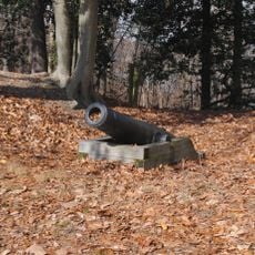
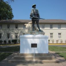
Nine memorials scattered across the grounds honor specific military units and their service. These structures help visitors understand the stories of those buried here and their connections to particular regiments and causes.

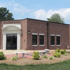
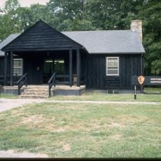
The cemetery is open from sunrise to sunset daily for visitors to walk and pay respects. An electronic gravesite locator in the administration building helps you find specific burial locations without difficulty.

The Avenue of Flags program allows families to donate veterans' flags that are displayed throughout the cemetery during commemorative occasions. This creates a striking display of colors during special events that carries meaning for many visitors.

The community of curious travelers

AroundUs brings together thousands of curated places, local tips, and hidden gems, enriched daily by 60,000 contributors worldwide.

Start exploring
Inception
1983
Phone
GPS coordinates
38.54330,-77.36470
Latest update
December 8, 2025 19:57
Around this place
Mallows Bay
United States of America

Mallows Bay

11.5 km
National Museum of the Marine Corps
United States of America

National Museum of the Marine Corps

1.9 km
Weems–Botts Museum
United States of America

Weems–Botts Museum

4.1 km
Leesylvania State Park
United States of America

Leesylvania State Park

10.8 km
Bel Air
United States of America

Bel Air

10.8 km
Public Quarry at Government Island
United States of America

Public Quarry at Government Island

10.7 km
Rippon Lodge
United States of America

Rippon Lodge

11 km
Marine Raider Museum
United States of America

Marine Raider Museum

8.1 km
Aquia Church
United States of America

Aquia Church

9.4 km
Chopawamsic
United States of America

Chopawamsic

7.1 km
Featherstone National Wildlife Refuge
United States of America

Featherstone National Wildlife Refuge

11.1 km
Waffle House
United States of America

Waffle House

5.5 km
Breckenridge Reservoir
United States of America

Breckenridge Reservoir

2.7 km
Commanding General's Quarters, Quantico Marine Base
United States of America

Commanding General's Quarters, Quantico Marine Base

5.8 km
Marine Corps Air-Ground Museum
United States of America

Marine Corps Air-Ground Museum

6.5 km
Freestone Point Confederate Battery
United States of America

Freestone Point Confederate Battery

11.5 km
C.D. Hylton Senior High School
United States of America

C.D. Hylton Senior High School

11.9 km
Henderson House
United States of America

Henderson House

4.1 km
Pleasant Historic District, Chopawamsic RDA Camp 4
United States of America

Pleasant Historic District, Chopawamsic RDA Camp 4

5.5 km
Cabin Branch Pyrite Mine Historic District
United States of America

Cabin Branch Pyrite Mine Historic District

3.9 km
Chopawamsic Recreational Demonstration Area Cabin Camp 1
United States of America

Chopawamsic Recreational Demonstration Area Cabin Camp 1

6 km
Chopawamsic RDA Camp 2
United States of America

Chopawamsic RDA Camp 2

6.1 km
Old Town Hall and School
United States of America

Old Town Hall and School

4.5 km
Orenda/SP-26 Historic District, Chopawamsic RDA Camp 3
United States of America

Orenda/SP-26 Historic District, Chopawamsic RDA Camp 3

2.4 km
West Beach
United States of America

West Beach

7.7 km
Crusading for Right
United States of America

Crusading for Right

6.4 km
Mallows Bay – Potomac River National Marine Sanctuary
United States of America

Mallows Bay – Potomac River National Marine Sanctuary

12.7 km
Prince William Forest Park Visitor Center
United States of America

Prince William Forest Park Visitor Center

2.4 km
Show the full map
Reviews
Share your experience

No review yet

Discussions
Start a discussion...

No discussion yet

« Quantico National Cemetery - Military cemetery in Prince William County, United States » is provided by Around Us (aroundus.com). Images and texts are derived from Wikimedia project under a Creative Commons license. You are allowed to copy, distribute, and modify copies of this page, under the conditions set by the license, as long as this note is clearly visible.

Discover hidden gems everywhere you go!

From secret cafés to breathtaking viewpoints, skip the crowded tourist spots and find places that match your style. Our app makes it easy with voice search, smart filtering, route optimization, and insider tips from travelers worldwide. Download now for the complete mobile experience.

Around Us App Screenshot

A unique approach to discovering new places

Le Figaro

All the places worth exploring

France Info

A tailor-made excursion in just a few clicks

20 Minutes

Around Us
Travel Guide & Maps
Download

Send to your phone

QR Code
1

Open the camera app on your mobile.

2

Point at the QR code with your camera. A notification will appear.

3

Tap the notification to open the link.