Enable Location

We need your location to show you interesting places around you

Discover nearby places

Find interesting locations and hidden gems around you

Precise directions

Get accurate directions and distances to places

Your location is never shared with other users. It's only used when you tap the location button.

Lightfoot Mill

Log in to your account

Start exploring — it's free

Trusted by 63,591 travelers worldwide

Continue with Google
Continue with Apple
or

We will send you a code to connect

By continuing, you accept our Terms and Conditions and our Privacy Policy

Check your inbox

We've sent a pincode in your inbox. Please enter the code below.

Discussion Reviews 1 Photos
1.6k Popularity

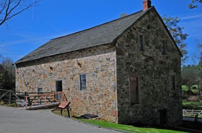
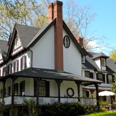
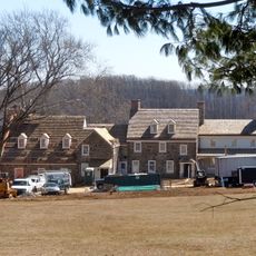
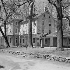
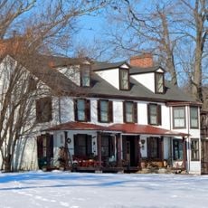
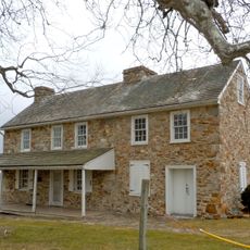
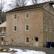
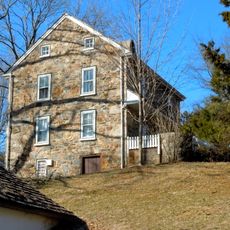
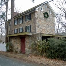
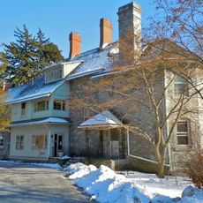
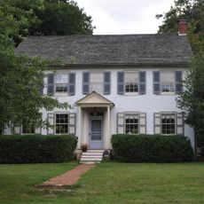
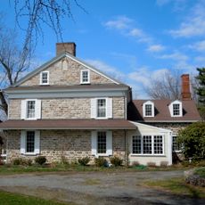
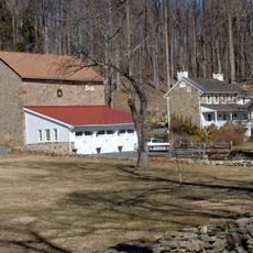
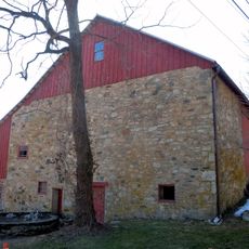
Lightfoot Mill, Colonial grain mill in Chester Springs, Pennsylvania.

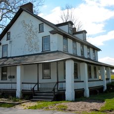
Lightfoot Mill is a colonial grain mill in Chester Springs that retains its 18th century water-powered machinery, including original millstones, wooden gears, and transmission systems still in working order. The building itself contains multiple rooms for different milling stages, with portions rebuilt over centuries but the core structure dating to its founding.

Samuel Lightfoot established this mill in 1747 as one of the region's earliest industrial operations during Pennsylvania's agricultural growth. From the mid-1800s onward, operations shifted from flour production to animal feed milling as local farmers transitioned to dairy operations.

The mill has shaped community life in Chester Springs for generations, serving as a meeting place where neighbors gathered to conduct business and exchange news. Today, visitors still experience this social function when they watch demonstrations and observe how water and machinery worked together to feed the region.

The mill operates demonstrations on select days when water powers the machinery, allowing visitors to observe the milling process in action. It is helpful to check ahead for operating hours and what milling products are available for purchase that day.

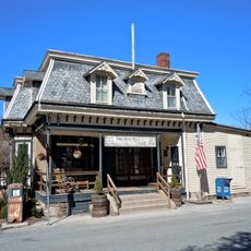
The Collins family ran a machine shop from the mill during the Great Depression and operated the local post office from inside the building, transforming it into a crucial economic hub for the area. This dual operation reveals how one family adapted to economic hardship while serving multiple community needs simultaneously.

The community of curious travelers

AroundUs brings together thousands of curated places, local tips, and hidden gems, enriched daily by 60,000 contributors worldwide.

Start exploring
Location
GPS coordinates
40.08139,-75.64444
Latest update
December 14, 2025 14:27
Around this place
Uwchlan Meetinghouse
United States of America

Uwchlan Meetinghouse

3.3 km
Ker-Feal
United States of America

Ker-Feal

3.3 km
Byers Station Historic District
United States of America

Byers Station Historic District

2.6 km
John Bell Farm
United States of America

John Bell Farm

4.6 km
Strickland-Roberts Homestead
United States of America

Strickland-Roberts Homestead

4.6 km
Chester Springs Historic District
United States of America

Chester Springs Historic District

2.4 km
Benjamin Jacobs House
United States of America

Benjamin Jacobs House

5.1 km
Benjamin Pennypacker House
United States of America

Benjamin Pennypacker House

5.7 km
Lionville Historic District
United States of America

Lionville Historic District

3.3 km
Solitude Farm
United States of America

Solitude Farm

5.1 km
Ivy Cottage
United States of America

Ivy Cottage

6.1 km
Birchrunville General Store
United States of America

Birchrunville General Store

5.5 km
Jacob Wisner House
United States of America

Jacob Wisner House

6 km
Clinger-Moses Mill Complex
United States of America

Clinger-Moses Mill Complex

2.6 km
George Hartman House
United States of America

George Hartman House

5.1 km
Deery Family Homestead
United States of America

Deery Family Homestead

4.7 km
Middle Pickering Rural Historic District
United States of America

Middle Pickering Rural Historic District

5.9 km
Sleepy Hollow Hall
United States of America

Sleepy Hollow Hall

6.1 km
Robert Rooke House
United States of America

Robert Rooke House

4.7 km
Whitford Lodge
United States of America

Whitford Lodge

6.1 km
Charles Thomas House
United States of America

Charles Thomas House

5.6 km
Nicholas East House
United States of America

Nicholas East House

3.7 km
Wheelen House
United States of America

Wheelen House

3.8 km
West Vincent Highlands Historic District
United States of America

West Vincent Highlands Historic District

5.6 km
Hewson Cox House
United States of America

Hewson Cox House

5 km
Fagley House
United States of America

Fagley House

4 km
Birchrunville Historic District
United States of America

Birchrunville Historic District

5.7 km
Rice-Pennebecker Farm
United States of America

Rice-Pennebecker Farm

4.4 km
Show the full map
Reviews
Share your experience

No review yet

Discussions
Start a discussion...

No discussion yet

« Lightfoot Mill - Colonial grain mill in Chester Springs, Pennsylvania » is provided by Around Us (aroundus.com). Images and texts are derived from Wikimedia project under a Creative Commons license. You are allowed to copy, distribute, and modify copies of this page, under the conditions set by the license, as long as this note is clearly visible.

Discover hidden gems everywhere you go!

From secret cafés to breathtaking viewpoints, skip the crowded tourist spots and find places that match your style. Our app makes it easy with voice search, smart filtering, route optimization, and insider tips from travelers worldwide. Download now for the complete mobile experience.

Around Us App Screenshot

A unique approach to discovering new places

Le Figaro

All the places worth exploring

France Info

A tailor-made excursion in just a few clicks

20 Minutes

Around Us
Travel Guide & Maps
Download

Send to your phone

QR Code
1

Open the camera app on your mobile.

2

Point at the QR code with your camera. A notification will appear.

3

Tap the notification to open the link.