Chest opened
+${chestReward.xp} XP
Explorer
NOUVEAU ×${chestReward.collectible.quantity}
tapez pour fermer
Chest locked

Open chests in the app

Around Us is built for your phone — chests unlock when you walk, explore and capture nearby places.

Enable Location

We need your location to show you interesting places around you

Discover nearby places

Find interesting locations and hidden gems around you

Precise directions

Get accurate directions and distances to places

Your location is never shared with other users. It's only used when you tap the location button.

Log in to your account

Start exploring — it's free

Trusted by 72,890 travelers worldwide

Continue with Google
Continue with Apple
or

We will send you a code to connect

By continuing, you accept our Terms and Conditions and our Privacy Policy

Check your inbox

We've sent a pincode in your inbox. Please enter the code below.

Maumee State Forest
Discussion Reviews Photo
1.9k Popularity

Maumee State Forest, State forest in northwestern Ohio, United States.

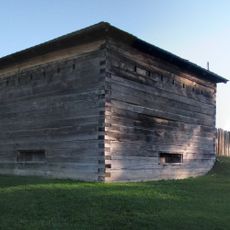
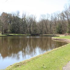
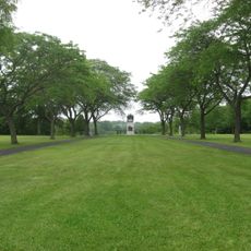
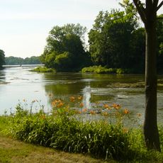
Maumee State Forest is a protected woodland area in northwestern Ohio that spreads across several counties with mixed forest types and wetland habitats. The landscape includes open meadows, mature timber stands, and riparian zones along waterways.

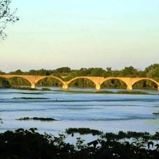
The forest takes its name from the Maumee River, which was central to early settlement and trade in the region. Protection as a state forest came later as conservation efforts grew to preserve local habitats.

The windbreak arboretum within the forest was developed as a living classroom where visitors can see different tree species planted to protect farmland from wind damage. This hands-on space shows practical forestry methods that have been used in the region for generations.

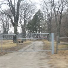
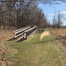
The forest has marked paths for hiking, biking, and horseback riding throughout its grounds. Good footwear is helpful, and conditions vary with the seasons and recent weather.

The forest contains a research site where scientists study tree genetics and test different seedlings for reforestation work. This research helps identify the best varieties for replanting efforts across the region.

The community of curious travelers

AroundUs brings together thousands of curated places, local tips, and hidden gems, enriched daily by 60,000 contributors worldwide.

Start exploring
Location
GPS coordinates
41.46866,-83.89939
Latest update
December 14, 2025 11:02
Around this place
Fort Meigs
United States of America

Fort Meigs

22.7 km
Oak Openings Preserve Metropark
United States of America

Oak Openings Preserve Metropark

10.3 km
Fallen Timbers Battlefield
United States of America

Fallen Timbers Battlefield

18.8 km
Mary Jane Thurston State Park
United States of America

Mary Jane Thurston State Park

6.7 km
Farnsworth Metropark
United States of America

Farnsworth Metropark

14.1 km
Battle of Fallen Timbers Monument
United States of America

Battle of Fallen Timbers Monument

18.8 km
Interurban Bridge
United States of America

Interurban Bridge

14.4 km
Henry County Sheriff's Residence and Jail
United States of America

Henry County Sheriff's Residence and Jail

20.6 km
Wood County Courthouse and Jail
United States of America

Wood County Courthouse and Jail

23.3 km
Dodge Site
United States of America

Dodge Site

14.3 km
Henry County Courthouse
United States of America

Henry County Courthouse

20.7 km
Cornerstone Church
United States of America

Cornerstone Church

23.7 km
Fulton County Courthouse
United States of America

Fulton County Courthouse

21 km
U.S. Post Office
United States of America

U.S. Post Office

23 km
Fort Meigs Historic Site
United States of America

Fort Meigs Historic Site

22.6 km
George S. Clement House
United States of America

George S. Clement House

22.2 km
Jones-Read-Touvelle House
United States of America

Jones-Read-Touvelle House

21.7 km
BG City Pool and Water Park
United States of America

BG City Pool and Water Park

22.3 km
Trinity Church
United States of America

Trinity Church

23.4 km
Fallen Timbers 14 + XD
United States of America

Fallen Timbers 14 + XD

18.3 km
Maumee Indoor Theatre
United States of America

Maumee Indoor Theatre

23 km
Prout Chapel
United States of America

Prout Chapel

23.9 km
Wintergarden Park
United States of America

Wintergarden Park

22.2 km
Wood County District Public Library
United States of America

Wood County District Public Library

23.2 km
BGSU Observatory
United States of America

BGSU Observatory

23.8 km
17th Infantry Regiment
United States of America

17th Infantry Regiment

22.5 km
House of Four Pillars
United States of America

House of Four Pillars

23.4 km
Amos Spafford
United States of America

Amos Spafford

22.5 km
Show the full map
Reviews
Share your experience

No review yet

Discussions
Start a discussion...

No discussion yet

« Maumee State Forest - State forest in northwestern Ohio, United States » is provided by Around Us (aroundus.com). Images and texts are derived from Wikimedia project under a Creative Commons license. You are allowed to copy, distribute, and modify copies of this page, under the conditions set by the license, as long as this note is clearly visible.

Discover hidden gems everywhere you go!

From secret cafés to breathtaking viewpoints, skip the crowded tourist spots and find places that match your style. Our app makes it easy with voice search, smart filtering, route optimization, and insider tips from travelers worldwide. Download now for the complete mobile experience.

Around Us App Screenshot

A unique approach to discovering new places

Le Figaro

All the places worth exploring

France Info

A tailor-made excursion in just a few clicks

20 Minutes

Around Us
Travel Guide & Maps
Download

Send to your phone

QR Code
1

Open the camera app on your mobile.

2

Point at the QR code with your camera. A notification will appear.

3

Tap the notification to open the link.