Enable Location

We need your location to show you interesting places around you

Discover nearby places

Find interesting locations and hidden gems around you

Precise directions

Get accurate directions and distances to places

Your location is never shared with other users. It's only used when you tap the location button.

Farnsworth Metropark

Log in to your account

Start exploring — it's free

Trusted by 65,095 travelers worldwide

Continue with Google
Continue with Apple
or

We will send you a code to connect

By continuing, you accept our Terms and Conditions and our Privacy Policy

Check your inbox

We've sent a pincode in your inbox. Please enter the code below.

Farnsworth Metropark
Discussion Reviews 1 Photos
3.6k Popularity

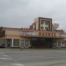
Farnsworth Metropark, Protected area along Maumee River in Waterville, Ohio, United States.

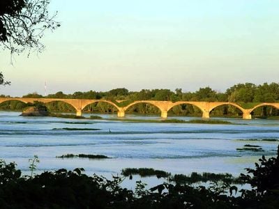
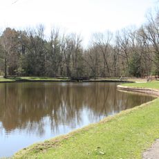
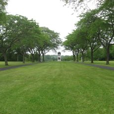
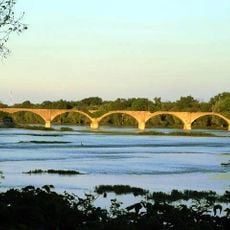
Farnsworth Metropark is a protected area on the western bank of the Maumee River near Waterville, Ohio. It covers forested trails, limestone outcrops along the water, and open views toward Missionary, Butler, and Indian islands.

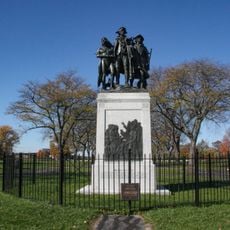
Roche de Bout, the limestone formation in the park, served as a gathering point for Miami, Shawnee, and Lenape peoples before the 1794 Battle of Fallen Timbers. After that conflict, land use across the region shifted dramatically.

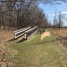
The ruins of the Interurban Bridge in the park show how early electric rail lines once connected towns across this region. Walking past the remaining structure gives a concrete sense of how local travel looked before roads took over.

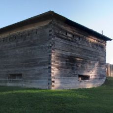
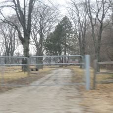
The park is open every day and offers hiking, fishing, kayaking, and picnicking along the river. Camping is available on site, so visitors who want to stay longer can do so without leaving the grounds.

The Bowling Green Fault, the only known fault line in the Great Lakes region, passes directly through the park. It becomes visible in the riverbed when water levels in the Maumee River drop low enough.

The community of curious travelers

AroundUs brings together thousands of curated places, local tips, and hidden gems, enriched daily by 60,000 contributors worldwide.

Start exploring
Location
GPS coordinates
41.48750,-83.73170
Latest update
March 3, 2026 14:02
Around this place
Fort Meigs
United States of America

Fort Meigs

9.9 km
Fort Miami
United States of America

Fort Miami

12.9 km
Oak Openings Preserve Metropark
United States of America

Oak Openings Preserve Metropark

12.5 km
Stranahan Theater
United States of America

Stranahan Theater

13.5 km
Fallen Timbers Battlefield
United States of America

Fallen Timbers Battlefield

6.9 km
Islamic Center of Greater Toledo
United States of America

Islamic Center of Greater Toledo

10.5 km
Battle of Fallen Timbers Monument
United States of America

Battle of Fallen Timbers Monument

6.9 km
Interurban Bridge
United States of America

Interurban Bridge

307 m
Wood County Courthouse and Jail
United States of America

Wood County Courthouse and Jail

14.2 km
Dodge Site
United States of America

Dodge Site

501 m
Hull-Wolcott House
United States of America

Hull-Wolcott House

12.2 km
United States of America

Lucas County Recreation Center

13.2 km
Cornerstone Church
United States of America

Cornerstone Church

12.4 km
U.S. Post Office
United States of America

U.S. Post Office

14 km
Fort Meigs Historic Site
United States of America

Fort Meigs Historic Site

9.8 km
Trinity Church
United States of America

Trinity Church

14.2 km
Fallen Timbers 14 + XD
United States of America

Fallen Timbers 14 + XD

6.8 km
Maumee Indoor Theatre
United States of America

Maumee Indoor Theatre

10.7 km
Wintergarden Park
United States of America

Wintergarden Park

14.5 km
Prout Chapel
United States of America

Prout Chapel

14.5 km
Wood County District Public Library
United States of America

Wood County District Public Library

14.1 km
BGSU Observatory
United States of America

BGSU Observatory

14.2 km
17th Infantry Regiment
United States of America

17th Infantry Regiment

9.6 km
Amos Spafford
United States of America

Amos Spafford

9.6 km
John J. Yeager House
United States of America

John J. Yeager House

11.1 km
Administration Building
United States of America

Administration Building

14.5 km
Hayes Hall
United States of America

Hayes Hall

14.4 km
House of Four Pillars
United States of America

House of Four Pillars

10.8 km
Show the full map
Reviews
Share your experience

No review yet

Discussions
Start a discussion...

No discussion yet

« Farnsworth Metropark - Protected area along Maumee River in Waterville, Ohio, United States » is provided by Around Us (aroundus.com). Images and texts are derived from Wikimedia project under a Creative Commons license. You are allowed to copy, distribute, and modify copies of this page, under the conditions set by the license, as long as this note is clearly visible.

Discover hidden gems everywhere you go!

From secret cafés to breathtaking viewpoints, skip the crowded tourist spots and find places that match your style. Our app makes it easy with voice search, smart filtering, route optimization, and insider tips from travelers worldwide. Download now for the complete mobile experience.

Around Us App Screenshot

A unique approach to discovering new places

Le Figaro

All the places worth exploring

France Info

A tailor-made excursion in just a few clicks

20 Minutes

Around Us
Travel Guide & Maps
Download

Send to your phone

QR Code
1

Open the camera app on your mobile.

2

Point at the QR code with your camera. A notification will appear.

3

Tap the notification to open the link.