Max Patch

Log in to your account

AroundUs is a community-driven map of interesting places, built by curious explorers like you. It grows with every review, story, and photo you share.
Connect to save your favorite spots, contribute locations, and create personalized routes.
Continue with Google
Continue with Apple
Continue with X
Continue with Facebook
Continue with email
By continuing, you accept our Terms and Conditions and our Privacy Policy
Create an account
Add to collection
Map
Suggest a change
Share

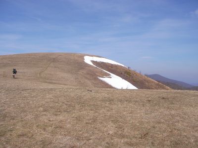
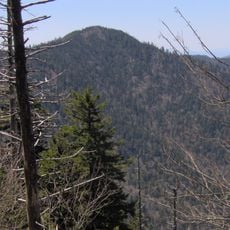
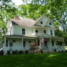
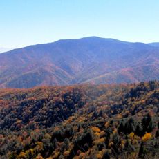
Max Patch, Mountain summit in Pisgah National Forest, North Carolina, United States

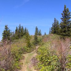
Max Patch is a mountain summit in Pisgah National Forest with a grassy peak covered in wildflowers. Several trails from here connect to the Appalachian Trail system, offering loop options between 1.5 and 2 miles (2.4 and 3.2 km) round trip.

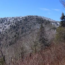
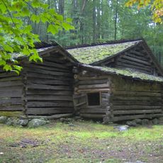
The mountain served as grazing land for livestock during early settlement times, which created its open grass-covered peak instead of forest. This historical grazing shaped the landscape and leaves the summit open today.

The summit sits along the Appalachian Trail, where volunteers regularly maintain and protect this section. Visitors notice the kept paths and the care that keeps this hiking route alive.

Access is via gravel forest service roads with marked parking areas at the base. The trails are well-marked and easy to walk, with most visitors reaching the open summit without difficulty.

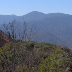
From the summit, visitors see 360 degrees around them and look out over landscapes in North Carolina and Tennessee at the same time. This all-around view from a single point is rare for mountain hikes in the region.

Location: North Carolina

GPS coordinates: 35.79705,-82.95681

Latest update: December 7, 2025 10:04

Photos
Around this place
Ghost Town in the Sky
United States of America

Ghost Town in the Sky

32.6 km
Mount Guyot
United States of America

Mount Guyot

29 km
Old Black
United States of America

Old Black

28.5 km
United States of America

Mount Chapman

30.9 km
Tyson McCarter Place
United States of America

Tyson McCarter Place

31.5 km
Maddron Bald Trail
United States of America

Maddron Bald Trail

28.2 km
Swaggerty Blockhouse
United States of America

Swaggerty Blockhouse

26.2 km
United States of America

Lower Mount Cammerer Trail

23 km
Jeff White House
United States of America

Jeff White House

28.1 km
Frank Smathers House
United States of America

Frank Smathers House

32.4 km
Shook-Welch-Smathers House
United States of America

Shook-Welch-Smathers House

29.7 km
Madison County Courthouse
United States of America

Madison County Courthouse

24.6 km
Davis Family House
United States of America

Davis Family House

19.5 km
Colonial Theater
United States of America

Colonial Theater

31.3 km
Marshall Main Street Historic District
United States of America

Marshall Main Street Historic District

24.7 km
James H. White House
United States of America

James H. White House

24.7 km
United States of America

Mount Zion United Methodist Church

21.9 km
Shackford Hall
United States of America

Shackford Hall

30.4 km
Sunnybank
United States of America

Sunnybank

15.6 km
Alden and Thomasene Howell House
United States of America

Alden and Thomasene Howell House

33.7 km
Waterfall on West Prong Hickey Fork
United States of America

Waterfall on West Prong Hickey Fork

30.9 km
Clyde H. Ray Sr. House
United States of America

Clyde H. Ray Sr. House

33.6 km
Engadine
United States of America

Engadine

33.7 km
Mount Cammerer Fire Lookout
United States of America

Mount Cammerer Fire Lookout

18.9 km
Mount Sterling Tower
United States of America

Mount Sterling Tower

18.3 km
Mount Sterling
United States of America

Mount Sterling

18.3 km
Cataloochee Historic District
United States of America

Cataloochee Historic District

24.3 km
Lake Junaluska
United States of America

Lake Junaluska

30.3 km
Show the full map
Reviews

Visited this place? Tap the stars to rate it and share your experience / photos with the community! Try now! You can cancel it anytime.

« Max Patch - Mountain summit in Pisgah National Forest, North Carolina, United States » is provided by Around Us (aroundus.com). Images and texts are derived from Wikimedia project under a Creative Commons license. You are allowed to copy, distribute, and modify copies of this page, under the conditions set by the license, as long as this note is clearly visible.

Discover hidden gems everywhere you go!

From secret cafés to breathtaking viewpoints, skip the crowded tourist spots and find places that match your style. Our app makes it easy with voice search, smart filtering, route optimization, and insider tips from travelers worldwide. Download now for the complete mobile experience.

Around Us App Screenshot

A unique approach to discovering new places

Le Figaro

All the places worth exploring

France Info

A tailor-made excursion in just a few clicks

20 Minutes