Mount Guyot

Log in to your account

AroundUs is a community-driven map of interesting places, built by curious explorers like you. It grows with every review, story, and photo you share.
Connect to save your favorite spots, contribute locations, and create personalized routes.
By continuing, you accept our Terms and Conditions and our Privacy Policy
Add to collection
Map
Suggest a change
Share

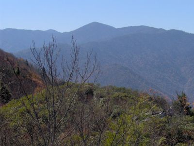
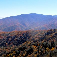
Mount Guyot, Mountain summit in Great Smoky Mountains National Park, United States

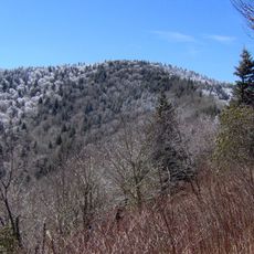
Mount Guyot is a summit in Great Smoky Mountains National Park sitting on the Tennessee-North Carolina border and rises to about 2,018 meters (6,625 feet). It features dense forests of conifers spreading across its twin peaks, creating a heavily wooded landscape.

The peak was named in 1858 after Swiss geographer Arnold Guyot, who studied the regional geography. This naming spurred later expeditions that provided accurate measurements of the mountain's elevation.

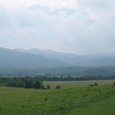
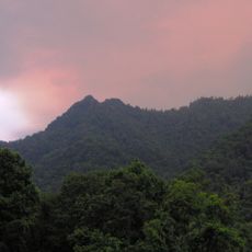
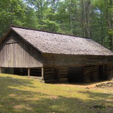
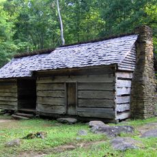
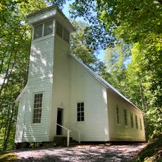
Its remote setting has kept the mountain largely undisturbed, and the old-growth forests here show visitors what the original Appalachian landscape looked like before human development changed the region.

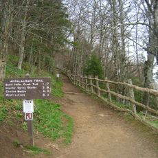
Hikers can reach the summit via several established trails that vary in difficulty and length. The routes are challenging and require good physical condition, so plan accordingly for a full day of hiking.

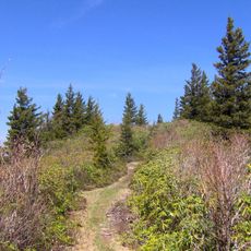
It ranks as the fourth-highest peak in the eastern United States but receives fewer visitors because it has no direct road or parking area at the summit. This isolation keeps it quieter than other major peaks in the region.

Location: Haywood County

Location: Sevier County

Elevation above the sea: 2,018 m

GPS coordinates: 35.70531,-83.25748

Latest update: December 8, 2025 13:41

Photos
Around this place
Great Smoky Mountains National Park
United States of America

Great Smoky Mountains National Park

18.4 km
Mount Le Conte
United States of America

Mount Le Conte

17.2 km
Alum Cave Trail
United States of America

Alum Cave Trail

18.6 km
Chimney Tops
United States of America

Chimney Tops

21.6 km
Oconaluftee Valley
United States of America

Oconaluftee Valley

21.6 km
Mingo Falls
United States of America

Mingo Falls

19.4 km
Oconaluftee Visitor Center
United States of America

Oconaluftee Visitor Center

21.8 km
Old Black
United States of America

Old Black

1.1 km
The Boulevard Trail
United States of America

The Boulevard Trail

16.3 km
Mount Chapman
United States of America

Mount Chapman

2.4 km
Tyson McCarter Place
United States of America

Tyson McCarter Place

7.3 km
Maddron Bald Trail
United States of America

Maddron Bald Trail

7.2 km
John Messer Barn
United States of America

John Messer Barn

12.9 km
Lower Mount Cammerer Trail
United States of America

Lower Mount Cammerer Trail

7 km
Mingus Mill
United States of America

Mingus Mill

21.2 km
Smokemont Bridge
United States of America

Smokemont Bridge

17.6 km
Rockefeller Memorial
United States of America

Rockefeller Memorial

18.4 km
Oconaluftee Ranger Station
United States of America

Oconaluftee Ranger Station

21.8 km
Mount Cammerer Fire Lookout
United States of America

Mount Cammerer Fire Lookout

10.8 km
Mount Sterling Tower
United States of America

Mount Sterling Tower

12.2 km
Roaring Fork Historic District
United States of America

Roaring Fork Historic District

19.2 km
Mount Sterling
United States of America

Mount Sterling

12.2 km
Oconaluftee Baptist Church
United States of America

Oconaluftee Baptist Church

17.5 km
Cataloochee Historic District
United States of America

Cataloochee Historic District

15.8 km
Oconaluftee Archeological District
United States of America

Oconaluftee Archeological District

21.6 km
Alfred Reagan Tub Mill
United States of America

Alfred Reagan Tub Mill

19.2 km
Ephraim Bales Cabin
United States of America

Ephraim Bales Cabin

19.2 km
Alfred Reagan House
United States of America

Alfred Reagan House

19.3 km
Show the full map
Reviews

Visited this place? Tap the stars to rate it and share your experience / photos with the community! Try now! You can cancel it anytime.

« Mount Guyot - Mountain summit in Great Smoky Mountains National Park, United States » is provided by Around Us (aroundus.com). Images and texts are derived from Wikimedia project under a Creative Commons license. You are allowed to copy, distribute, and modify copies of this page, under the conditions set by the license, as long as this note is clearly visible.

Discover hidden gems everywhere you go!

From secret cafés to breathtaking viewpoints, skip the crowded tourist spots and find places that match your style. Our app makes it easy with voice search, smart filtering, route optimization, and insider tips from travelers worldwide. Download now for the complete mobile experience.

Around Us App Screenshot

A unique approach to discovering new places

Le Figaro

All the places worth exploring

France Info

A tailor-made excursion in just a few clicks

20 Minutes