Enable Location

We need your location to show you interesting places around you

Discover nearby places

Find interesting locations and hidden gems around you

Precise directions

Get accurate directions and distances to places

Your location is never shared with other users. It's only used when you tap the location button.

Chimney Tops

Log in to your account

Start exploring — it's free

Trusted by 61,778 travelers worldwide

Continue with Google
Continue with Apple
or

We will send you a code to connect

By continuing, you accept our Terms and Conditions and our Privacy Policy

Check your inbox

We've sent a pincode in your inbox. Please enter the code below.

Chimney Tops

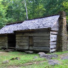
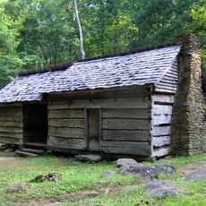
Chimney Tops, Mountain summit in Great Smoky Mountains National Park, Tennessee, US.

Description

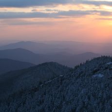
Chimney Tops consists of two narrow rock peaks rising to 4,784 feet in the Appalachian range, creating a striking sight above the surrounding forest. The stone formations have been shaped by weathering over countless millennia and sit within a landscape of dense vegetation and steep slopes.

History

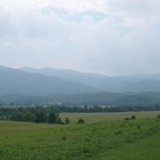
Cherokee peoples inhabited these mountains long before European settlers arrived in the 18th century, making this area a significant part of their ancestral lands. The mountain held spiritual and practical importance within their territories before territorial changes transformed the region's ownership and use.

Culture

The twin peaks carry a Cherokee name that reflects their distinctive shape and the importance of this place to the original inhabitants. Visitors can sense how this location held deep meaning in the region's early history by simply observing the landscape around them.

Practical

The hike is steep and demanding, so wear sturdy shoes and bring plenty of water for the journey through the forest. Plan extra time because the trail is narrow and requires careful footing, especially on wet rock surfaces.

Did you know?

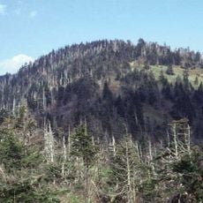
A major wildfire in 2016 severely damaged large portions of this area, triggering extensive restoration and rebuilding efforts that continue today. Hikers can still observe signs of this event in the recovering forest as nature gradually reclaims the burned zones.

Location
GPS coordinates
35.62949,-83.47778
Latest update
December 7, 2025 19:31

AroundUs brings together thousands of curated places, local tips, and hidden gems, enriched daily by 60,000 contributors worldwide. Discover all places nearby (Tennessee).

Around this place
Great Smoky Mountains
United States of America

Great Smoky Mountains

7.7 km
Great Smoky Mountains National Park
United States of America

Great Smoky Mountains National Park

5.2 km
Kuwohi
United States of America

Kuwohi

7.6 km
Mount Le Conte
United States of America

Mount Le Conte

4.6 km
Alum Cave Trail
United States of America

Alum Cave Trail

3 km
Gatlinburg Space Needle
United States of America

Gatlinburg Space Needle

9.8 km
Museum of Salt and Pepper Shakers
United States of America

Museum of Salt and Pepper Shakers

9.9 km
Andrews Bald
United States of America

Andrews Bald

10.2 km
Mount Collins
United States of America

Mount Collins

4.8 km
The Boulevard Trail
United States of America

The Boulevard Trail

5.5 km
John Ownby Cabin
United States of America

John Ownby Cabin

9.2 km
Bullhead Trail
United States of America

Bullhead Trail

9.4 km
Mayna Treanor Avent Studio
United States of America

Mayna Treanor Avent Studio

9.8 km
John Messer Barn
United States of America

John Messer Barn

9.6 km
Sugarland Mountain Trail
United States of America

Sugarland Mountain Trail

4.3 km
Alex Cole Cabin
United States of America

Alex Cole Cabin

5.8 km
Anakeesta
United States of America

Anakeesta

9.2 km
Clingmans Dome Observation Tower
United States of America

Clingmans Dome Observation Tower

7.6 km
Headquarters Bridge
United States of America

Headquarters Bridge

8.3 km
Rockefeller Memorial
United States of America

Rockefeller Memorial

5.2 km
Headquarters Building
United States of America

Headquarters Building

8.4 km
Roaring Fork Historic District
United States of America

Roaring Fork Historic District

7.6 km
Clingmans Dome Information Center and Store
United States of America

Clingmans Dome Information Center and Store

8.2 km
Sugarlands Visitor Center
United States of America

Sugarlands Visitor Center

8.2 km
David Crockett Theatre
United States of America

David Crockett Theatre

9.8 km
Alfred Reagan Tub Mill
United States of America

Alfred Reagan Tub Mill

8.1 km
Ephraim Bales Cabin
United States of America

Ephraim Bales Cabin

7.6 km
Alfred Reagan House
United States of America

Alfred Reagan House

8.2 km
Show the full map
« Chimney Tops - Mountain summit in Great Smoky Mountains National Park, Tennessee, US » is provided by Around Us (aroundus.com). Images and texts are derived from Wikimedia project under a Creative Commons license. You are allowed to copy, distribute, and modify copies of this page, under the conditions set by the license, as long as this note is clearly visible.

Discover hidden gems everywhere you go!

From secret cafés to breathtaking viewpoints, skip the crowded tourist spots and find places that match your style. Our app makes it easy with voice search, smart filtering, route optimization, and insider tips from travelers worldwide. Download now for the complete mobile experience.

Around Us App Screenshot

A unique approach to discovering new places

Le Figaro

All the places worth exploring

France Info

A tailor-made excursion in just a few clicks

20 Minutes

Around Us
Travel Guide & Maps
Download

Send to your phone

QR Code
1

Open the camera app on your mobile.

2

Point at the QR code with your camera. A notification will appear.

3

Tap the notification to open the link.