Enable Location

We need your location to show you interesting places around you

Discover nearby places

Find interesting locations and hidden gems around you

Precise directions

Get accurate directions and distances to places

Your location is never shared with other users. It's only used when you tap the location button.

Alum Cave Trail

Log in to your account

Start exploring — it's free

Trusted by 61,780 travelers worldwide

Continue with Google
Continue with Apple
or

We will send you a code to connect

By continuing, you accept our Terms and Conditions and our Privacy Policy

Check your inbox

We've sent a pincode in your inbox. Please enter the code below.

Alum Cave Trail

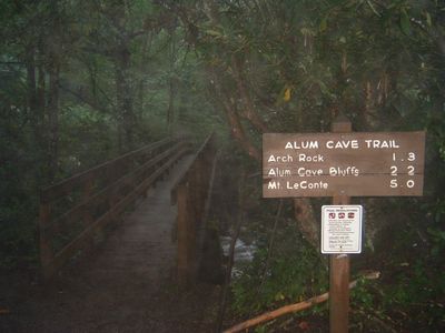
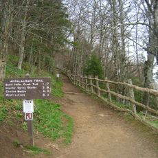
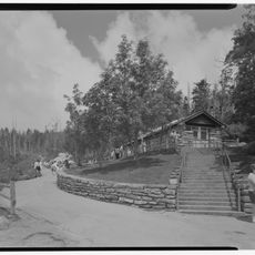
Alum Cave Trail, Hiking trail in Great Smoky Mountains National Park, Tennessee, United States.

Description

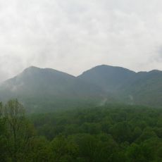
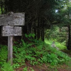
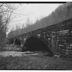
Alum Cave Trail is a hiking path in Great Smoky Mountains National Park, Tennessee, that climbs through old forest to a rock shelter formed from black slate. Along the way, hikers pass Arch Rock, a natural tunnel, and sandstone cliffs that rise beside the ascending route.

History

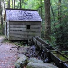
Between 1838 and the mid-1840s, workers mined alum and Epsom salts here, with operations briefly resuming during the Civil War. The cave itself is actually an overhanging bluff that formed through erosion over thousands of years.

Culture

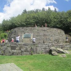
Gracie's Pulpit, a vista point along the route, honors Gracie McNichol who hiked here on her 92nd birthday. Visitors often pause at this spot to take in the long-range views and rest before continuing upward.

Practical

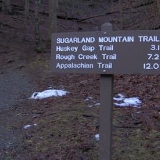
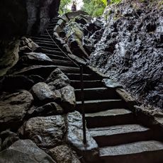
Two parking areas at the trailhead offer access from Newfound Gap Road, with early arrival recommended on weekends and during peak season. The path climbs steadily, with some steel cables along steeper sections to help hikers ascend.

Did you know?

From Inspiration Point roughly halfway along, hikers see the Eye of the Needle, a natural opening in Little Duck Hawk Ridge across the valley. This narrow gap in the rock stands out against the sky and is a popular photograph subject for visitors.

Location
GPS coordinates
35.63850,-83.44620
Latest update
December 6, 2025 11:41

AroundUs brings together thousands of curated places, local tips, and hidden gems, enriched daily by 60,000 contributors worldwide. Discover all places nearby (Sevier County).

Around this place
Great Smoky Mountains
United States of America

Great Smoky Mountains

9.7 km
Great Smoky Mountains National Park
United States of America

Great Smoky Mountains National Park

3.6 km
Kuwohi
United States of America

Kuwohi

9.7 km
Mount Le Conte
United States of America

Mount Le Conte

1.9 km
Chimney Tops
United States of America

Chimney Tops

3 km
Gatlinburg Space Needle
United States of America

Gatlinburg Space Needle

10.4 km
Noah Ogle Place
United States of America

Noah Ogle Place

6.3 km
Arrowmont School of Arts and Crafts
United States of America

Arrowmont School of Arts and Crafts

10.1 km
Museum of Salt and Pepper Shakers
United States of America

Museum of Salt and Pepper Shakers

10 km
Mount Collins
United States of America

Mount Collins

6.3 km
The Boulevard Trail
United States of America

The Boulevard Trail

2.6 km
John Ownby Cabin
United States of America

John Ownby Cabin

10.8 km
Bullhead Trail
United States of America

Bullhead Trail

9.5 km
John Messer Barn
United States of America

John Messer Barn

6.9 km
Sugarland Mountain Trail
United States of America

Sugarland Mountain Trail

5.9 km
Alex Cole Cabin
United States of America

Alex Cole Cabin

7.6 km
Anakeesta
United States of America

Anakeesta

9.5 km
Clingmans Dome Observation Tower
United States of America

Clingmans Dome Observation Tower

9.6 km
Headquarters Bridge
United States of America

Headquarters Bridge

9.7 km
Rockefeller Memorial
United States of America

Rockefeller Memorial

3.6 km
Headquarters Building
United States of America

Headquarters Building

9.8 km
Arch Rock
United States of America

Arch Rock

716 m
Roaring Fork Historic District
United States of America

Roaring Fork Historic District

6.9 km
Clingmans Dome Information Center and Store
United States of America

Clingmans Dome Information Center and Store

10.1 km
Sugarlands Visitor Center
United States of America

Sugarlands Visitor Center

9.7 km
David Crockett Theatre
United States of America

David Crockett Theatre

10.3 km
Alfred Reagan Tub Mill
United States of America

Alfred Reagan Tub Mill

7.4 km
Ephraim Bales Cabin
United States of America

Ephraim Bales Cabin

6.9 km
Show the full map
« Alum Cave Trail - Hiking trail in Great Smoky Mountains National Park, Tennessee, United States » is provided by Around Us (aroundus.com). Images and texts are derived from Wikimedia project under a Creative Commons license. You are allowed to copy, distribute, and modify copies of this page, under the conditions set by the license, as long as this note is clearly visible.

Discover hidden gems everywhere you go!

From secret cafés to breathtaking viewpoints, skip the crowded tourist spots and find places that match your style. Our app makes it easy with voice search, smart filtering, route optimization, and insider tips from travelers worldwide. Download now for the complete mobile experience.

Around Us App Screenshot

A unique approach to discovering new places

Le Figaro

All the places worth exploring

France Info

A tailor-made excursion in just a few clicks

20 Minutes

Around Us
Travel Guide & Maps
Download

Send to your phone

QR Code
1

Open the camera app on your mobile.

2

Point at the QR code with your camera. A notification will appear.

3

Tap the notification to open the link.