Enable Location

We need your location to show you interesting places around you

Discover nearby places

Find interesting locations and hidden gems around you

Precise directions

Get accurate directions and distances to places

Your location is never shared with other users. It's only used when you tap the location button.

Max V. Shaul State Park

Log in to your account

Start exploring — it's free

Trusted by 62,285 travelers worldwide

Continue with Google
Continue with Apple
or

We will send you a code to connect

By continuing, you accept our Terms and Conditions and our Privacy Policy

Check your inbox

We've sent a pincode in your inbox. Please enter the code below.

Max V. Shaul State Park

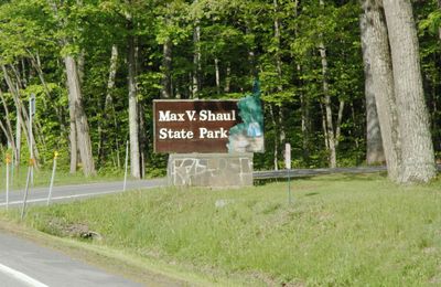
Max V. Shaul State Park, State park in Schoharie Valley, United States.

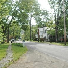
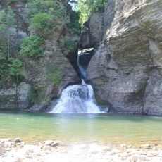
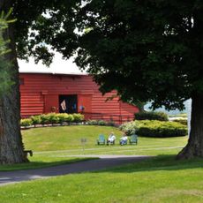
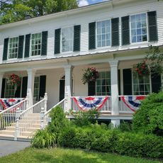
Max V. Shaul State Park is a 200-acre park in the Schoharie Valley located at the base of Toepath Mountain. The grounds feature forested areas, open grassland, and multiple streams running through the property.

The park was created by the New York State Parks System to provide recreational opportunities for the local region. The land was chosen and developed to serve visitors from the Schoharie Valley and surrounding communities.

The park hosts regular educational programs about local ecosystems, connecting visitors with the natural environment through guided experiences and interpretive sessions.

The park has camping areas, restrooms, showers, sports courts, and picnic spots with tables and grills throughout. Visitors should wear comfortable shoes and be prepared for changing weather, as the terrain is hilly and conditions vary by season.

The park offers several fishing spots along its streams and ponds where anglers can catch different fish species in natural waters. The quiet setting and remote location make it a hidden find for people seeking a peaceful fishing experience away from crowds.

The community of curious travelers

AroundUs brings together thousands of curated places, local tips, and hidden gems, enriched daily by 60,000 contributors worldwide.

Start exploring
Location
GPS coordinates
42.54810,-74.41110
Latest update
December 12, 2025 14:22
Around this place
Old Blenheim Bridge
United States of America

Old Blenheim Bridge

8.8 km
Old Stone Fort
United States of America

Old Stone Fort

16.9 km
Lansing Manor House
United States of America

Lansing Manor House

11.7 km
George Westinghouse, Jr., Birthplace and Boyhood Home
United States of America

George Westinghouse, Jr., Birthplace and Boyhood Home

19 km
Gallupville Methodist Church
United States of America

Gallupville Methodist Church

19.3 km
Dr. Christopher S. Best House and Office
United States of America

Dr. Christopher S. Best House and Office

8.4 km
St. Paul's Lutheran Church Historic District
United States of America

St. Paul's Lutheran Church Historic District

15.3 km
Cobleskill Historic District
United States of America

Cobleskill Historic District

15.7 km
Parker 13-Sided Barn
United States of America

Parker 13-Sided Barn

17.6 km
St. Mark's Evangelical Lutheran Church
United States of America

St. Mark's Evangelical Lutheran Church

8.4 km
Schoharie County Courthouse Complex
United States of America

Schoharie County Courthouse Complex

15.2 km
Abraham Sternberg House
United States of America

Abraham Sternberg House

19.2 km
Old Lutheran Parsonage
United States of America

Old Lutheran Parsonage

15.2 km
Becker Stone House
United States of America

Becker Stone House

19 km
Lasell Hall
United States of America

Lasell Hall

15.1 km
Bramanville Mill
United States of America

Bramanville Mill

15.6 km
Livingstonville Community Church
United States of America

Livingstonville Community Church

13.4 km
Bellinger-Dutton House
United States of America

Bellinger-Dutton House

8.7 km
West Fulton Methodist Church
United States of America

West Fulton Methodist Church

4.5 km
Schoharie Valley Railroad Complex
United States of America

Schoharie Valley Railroad Complex

15.9 km
Richmondville United Methodist Church
United States of America

Richmondville United Methodist Church

15.8 km
Breakabeen Historic District
United States of America

Breakabeen Historic District

3.4 km
North Blenheim Historic District
United States of America

North Blenheim Historic District

9.3 km
Daniel Webster Jenkins House
United States of America

Daniel Webster Jenkins House

19 km
Mine Kill State Park
United States of America

Mine Kill State Park

13.2 km
New York Power Authority Blenheim-Gilboa Visitors Center
United States of America

New York Power Authority Blenheim-Gilboa Visitors Center

11.9 km
Lansing Manor House
United States of America

Lansing Manor House

11.8 km
Secret Caverns
United States of America

Secret Caverns

18 km
Show the full map
« Max V. Shaul State Park - State park in Schoharie Valley, United States » is provided by Around Us (aroundus.com). Images and texts are derived from Wikimedia project under a Creative Commons license. You are allowed to copy, distribute, and modify copies of this page, under the conditions set by the license, as long as this note is clearly visible.

Discover hidden gems everywhere you go!

From secret cafés to breathtaking viewpoints, skip the crowded tourist spots and find places that match your style. Our app makes it easy with voice search, smart filtering, route optimization, and insider tips from travelers worldwide. Download now for the complete mobile experience.

Around Us App Screenshot

A unique approach to discovering new places

Le Figaro

All the places worth exploring

France Info

A tailor-made excursion in just a few clicks

20 Minutes

Around Us
Travel Guide & Maps
Download

Send to your phone

QR Code
1

Open the camera app on your mobile.

2

Point at the QR code with your camera. A notification will appear.

3

Tap the notification to open the link.