Chest opened
+${chestReward.xp} XP
Explorer
NOUVEAU ×${chestReward.collectible.quantity}
tapez pour fermer
Chest locked

Open chests in the app

Around Us is built for your phone — chests unlock when you walk, explore and capture nearby places.

Enable Location

We need your location to show you interesting places around you

Discover nearby places

Find interesting locations and hidden gems around you

Precise directions

Get accurate directions and distances to places

Your location is never shared with other users. It's only used when you tap the location button.

Log in to your account

Start exploring — it's free

Trusted by 72,893 travelers worldwide

Continue with Google
Continue with Apple
or

We will send you a code to connect

By continuing, you accept our Terms and Conditions and our Privacy Policy

Check your inbox

We've sent a pincode in your inbox. Please enter the code below.

Malaga Island
Discussion Reviews Photo
15.1k Popularity

Malaga Island, Coastal island in Sagadahoc County, United States.

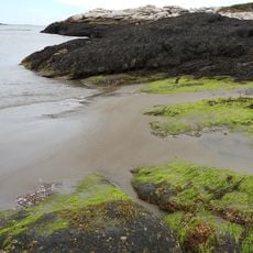
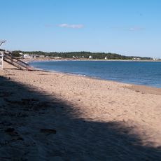
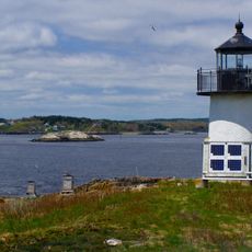
Malaga Island is a 42-acre piece of land at the mouth of the New Meadows River in eastern Casco Bay, located off the coast of Maine. Today the uninhabited site is managed by the Maine Coast Heritage Trust for public awareness and preservation.

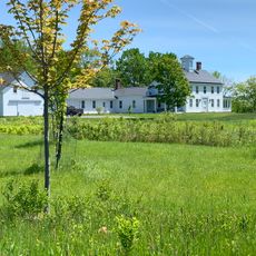
Settlement on the island began in the late 1700s through a family line descended from Benjamin Darling. In 1912, state authorities forcibly removed all 45 residents and sent many to institutional care facilities.

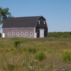
The island once supported a tight-knit community that sustained itself through fishing and farming over generations. Today, visitors can sense the quiet history of those who made their lives here by the water.

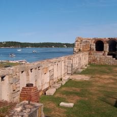
Access to the island requires advance planning and arrangement with local boat services, as there are no regular ferries or scheduled transportation. Visitors should contact the managing organization ahead of time to discuss options for exploring the site.

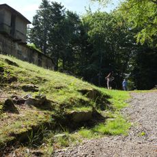
After residents were forced to leave, graves from the island cemetery were dug up and moved to another location to prevent anyone from returning. This harsh act reflects the severity of what happened to this community.

The community of curious travelers

AroundUs brings together thousands of curated places, local tips, and hidden gems, enriched daily by 60,000 contributors worldwide.

Start exploring
Location
GPS coordinates
43.78175,-69.87505
Latest update
December 7, 2025 19:31
Around this place
Popham Colony
United States of America

Popham Colony

7.7 km
Fort Popham
United States of America

Fort Popham

7.9 km
Popham Beach
United States of America

Popham Beach

8.2 km
Bailey Island Bridge
United States of America

Bailey Island Bridge

9.8 km
Fort Baldwin
United States of America

Fort Baldwin

8.1 km
Popham Beach State Park
United States of America

Popham Beach State Park

7.8 km
Pennellville Historic District
United States of America

Pennellville Historic District

11.3 km
Bailey Island Library Hall
United States of America

Bailey Island Library Hall

11.1 km
Pond Island Light
United States of America

Pond Island Light

9.6 km
Squirrel Point Light
United States of America

Squirrel Point Light

7 km
Perkins Island Light
United States of America

Perkins Island Light

7.2 km
Pond Island National Wildlife Refuge
United States of America

Pond Island National Wildlife Refuge

9.6 km
Elijah Kellogg Church
United States of America

Elijah Kellogg Church

9.2 km
East Harpswell Free Will Baptist Church
United States of America

East Harpswell Free Will Baptist Church

7 km
Union Church
United States of America

Union Church

8.5 km
Joseph and Susan Manley Summer Cottage
United States of America

Joseph and Susan Manley Summer Cottage

7.2 km
Elijah Kellogg House
United States of America

Elijah Kellogg House

9.5 km
Ropes End
United States of America

Ropes End

7.2 km
Deacon Andrew Dunning House
United States of America

Deacon Andrew Dunning House

7.6 km
Heal Family House
United States of America

Heal Family House

11 km
James Pennell Mansion
United States of America

James Pennell Mansion

10.9 km
Tarr-Eaton House
United States of America

Tarr-Eaton House

9.3 km
Charles H. Ingraham Cottage
United States of America

Charles H. Ingraham Cottage

7.9 km
Stone Schoolhouse
United States of America

Stone Schoolhouse

8.8 km
Wallace-Haskell Homestead
United States of America

Wallace-Haskell Homestead

3.6 km
Mill Cove School
United States of America

Mill Cove School

11.2 km
Percy District School House
United States of America

Percy District School House

6.1 km
Hunnewell Beach
United States of America

Hunnewell Beach

8.4 km
Show the full map
Reviews
Share your experience

No review yet

Discussions
Start a discussion...

No discussion yet

« Malaga Island - Coastal island in Sagadahoc County, United States » is provided by Around Us (aroundus.com). Images and texts are derived from Wikimedia project under a Creative Commons license. You are allowed to copy, distribute, and modify copies of this page, under the conditions set by the license, as long as this note is clearly visible.

Discover hidden gems everywhere you go!

From secret cafés to breathtaking viewpoints, skip the crowded tourist spots and find places that match your style. Our app makes it easy with voice search, smart filtering, route optimization, and insider tips from travelers worldwide. Download now for the complete mobile experience.

Around Us App Screenshot

A unique approach to discovering new places

Le Figaro

All the places worth exploring

France Info

A tailor-made excursion in just a few clicks

20 Minutes

Around Us
Travel Guide & Maps
Download

Send to your phone

QR Code
1

Open the camera app on your mobile.

2

Point at the QR code with your camera. A notification will appear.

3

Tap the notification to open the link.