Enable Location

We need your location to show you interesting places around you

Discover nearby places

Find interesting locations and hidden gems around you

Precise directions

Get accurate directions and distances to places

Your location is never shared with other users. It's only used when you tap the location button.

Mayo Lake

Log in to your account

Start exploring — it's free

Trusted by 63,131 travelers worldwide

Continue with Google
Continue with Apple
or

We will send you a code to connect

By continuing, you accept our Terms and Conditions and our Privacy Policy

Check your inbox

We've sent a pincode in your inbox. Please enter the code below.

Mayo Lake
Discussion Reviews 1 Photos
2.9k Popularity

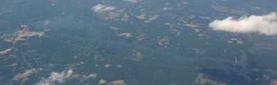
Mayo Lake, reservoir in Person County, North Carolina, United States of America

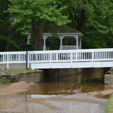
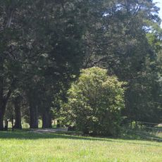
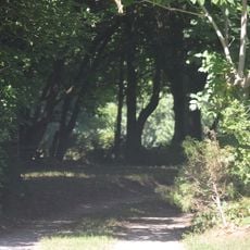
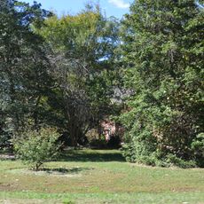
Mayo Lake is a large reservoir in Person County with a natural shoreline surrounded by trees and open spaces. The water stretches across the landscape with gentle slopes along its edges and small inlets that invite quiet exploration.

The lake was created in 1983 when a dam was built across Mayo Creek, with construction beginning in 1978. Carolina Power & Light developed this project to provide both water supply and recreational opportunities for the region.

The name Mayo Lake comes from Mayo Creek, which feeds the reservoir. Today it serves as a gathering place for local families and nature lovers who come to fish, picnic, and walk along the shore.

The lake is accessible via Neal's Store Road, about 9 miles north of Roxboro, with several parking areas and boat launch spots available. Picnic tables and benches are scattered throughout the grounds for comfortable day visits.

The water level changes noticeably depending on rainfall and water management, sometimes appearing lower during dry periods. Yet the lake always maintains enough water to support recreation and attract various birds, fish, and wildlife to its shores.

The community of curious travelers

AroundUs brings together thousands of curated places, local tips, and hidden gems, enriched daily by 60,000 contributors worldwide.

Start exploring
Location
GPS coordinates
36.52528,-78.86722
Latest update
February 9, 2026 08:23
Around this place
Berry Hill Plantation
United States of America

Berry Hill Plantation

20.5 km
Staunton River State Park
United States of America

Staunton River State Park

25 km
South Boston Historic District
United States of America

South Boston Historic District

19.6 km
Brandon Plantation
United States of America

Brandon Plantation

23.5 km
Waverly Plantation
United States of America

Waverly Plantation

19 km
Person County Courthouse
United States of America

Person County Courthouse

17.9 km
E. L. Evans House
United States of America

E. L. Evans House

20.2 km
Glennmary
United States of America

Glennmary

18 km
Buffalo Springs Historical Archeological District
United States of America

Buffalo Springs Historical Archeological District

22.9 km
Tarover
United States of America

Tarover

21.4 km
Burleigh
United States of America

Burleigh

23 km
James A. and Laura Thompson Long House
United States of America

James A. and Laura Thompson Long House

18.1 km
Seaton
United States of America

Seaton

24.9 km
Merritt-Winstead House
United States of America

Merritt-Winstead House

6.6 km
Garland-Buford House
United States of America

Garland-Buford House

26.3 km
Roxboro Male Academy and Methodist Parsonage
United States of America

Roxboro Male Academy and Methodist Parsonage

17.6 km
Holloway-Walker Dollarhite House
United States of America

Holloway-Walker Dollarhite House

5.7 km
Holloway-Jones-Day House
United States of America

Holloway-Jones-Day House

5.8 km
Glenwood
United States of America

Glenwood

18.4 km
House on Wagstaff Farm
United States of America

House on Wagstaff Farm

20.3 km
Reedy Creek Site
United States of America

Reedy Creek Site

18.9 km
Bloomsburg
United States of America

Bloomsburg

18.3 km
Buckshoal Farm
United States of America

Buckshoal Farm

15.6 km
Cedar Grove
United States of America

Cedar Grove

14.6 km
Roxboro Commercial Historic District
United States of America

Roxboro Commercial Historic District

18 km
Brandon-on-the-Dan
United States of America

Brandon-on-the-Dan

25.3 km
Staunton River State Park Historic District
United States of America

Staunton River State Park Historic District

26.3 km
Palace Theatre
United States of America

Palace Theatre

18 km
Show the full map
Reviews
Share your experience

No review yet

Discussions
Start a discussion...

No discussion yet

« Mayo Lake - reservoir in Person County, North Carolina, United States of America » is provided by Around Us (aroundus.com). Images and texts are derived from Wikimedia project under a Creative Commons license. You are allowed to copy, distribute, and modify copies of this page, under the conditions set by the license, as long as this note is clearly visible.

Discover hidden gems everywhere you go!

From secret cafés to breathtaking viewpoints, skip the crowded tourist spots and find places that match your style. Our app makes it easy with voice search, smart filtering, route optimization, and insider tips from travelers worldwide. Download now for the complete mobile experience.

Around Us App Screenshot

A unique approach to discovering new places

Le Figaro

All the places worth exploring

France Info

A tailor-made excursion in just a few clicks

20 Minutes

Around Us
Travel Guide & Maps
Download

Send to your phone

QR Code
1

Open the camera app on your mobile.

2

Point at the QR code with your camera. A notification will appear.

3

Tap the notification to open the link.