Meshomasic State Forest

Log in to your account

AroundUs is a community-driven map of interesting places, built by curious explorers like you. It grows with every review, story, and photo you share.
Connect to save your favorite spots, contribute locations, and create personalized routes.
Continue with Google
Continue with Apple
Continue with X
Continue with Facebook
Continue with email
By continuing, you accept our Terms and Conditions and our Privacy Policy
Create an account
Add to collection
Map
Suggest a change
Share

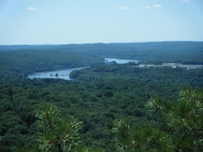
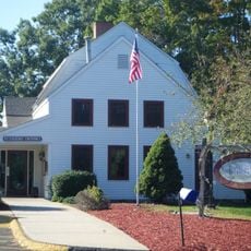
Meshomasic State Forest, State forest in Connecticut, United States.

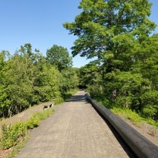
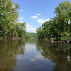
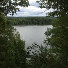
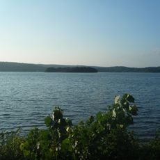
Meshomasic State Forest is a large protected woodland spanning across several Connecticut towns, covered primarily in second-growth forest with numerous glacial boulders scattered throughout. Natural water sources flow through the landscape, supporting both the forest ecosystem and downstream reservoirs.

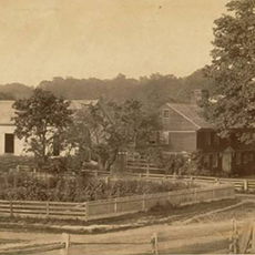
The forest was established in 1903 as Connecticut's first state forest and only the second in the entire United States. During the 1930s, two civilian work camps built the road network that remains the main route through the woodland today.

The name comes from the Algonkian language, connecting to the region's indigenous roots. Walking through the forest today, visitors encounter trails and landscapes shaped by centuries of human presence in this land.

The forest can be explored on gravel roads and marked hiking trails that are open year-round. Visitors should wear sturdy footwear and be prepared for wet or uneven ground conditions, especially after rainfall.

The forest contains Connecticut's largest population of timber rattlesnakes, a rare species found throughout the region. Observant visitors might notice signs of these snakes while exploring, though direct encounters remain uncommon.

Location: Connecticut

Elevation above the sea: 194 m

GPS coordinates: 41.63000,-72.55000

Latest update: December 11, 2025 18:01

Photos
Around this place
Dinosaur State Park and Arboretum
United States of America

Dinosaur State Park and Arboretum

9.2 km
Portland Brownstone Quarries
United States of America

Portland Brownstone Quarries

9.9 km
South Glastonbury Historic District
United States of America

South Glastonbury Historic District

6.1 km
Middle Haddam Historic District
United States of America

Middle Haddam Historic District

8.6 km
Marlborough Tavern
United States of America

Marlborough Tavern

7.5 km
Rapallo Viaduct
United States of America

Rapallo Viaduct

9.2 km
John Hollister House
United States of America

John Hollister House

6.4 km
Dart Island State Park
United States of America

Dart Island State Park

8.6 km
River Highlands State Park
United States of America

River Highlands State Park

6.9 km
Academy Hall
United States of America

Academy Hall

8.4 km
J. B. Williams Co. Historic District
United States of America

J. B. Williams Co. Historic District

8.9 km
Rocky Hill Congregational Church
United States of America

Rocky Hill Congregational Church

8.4 km
Williams and Stancliff Octagon Houses
United States of America

Williams and Stancliff Octagon Houses

9.8 km
Welles-Shipman-Ward House
United States of America

Welles-Shipman-Ward House

6.1 km
Town Farms Inn
United States of America

Town Farms Inn

10 km
Belltown Historic District
United States of America

Belltown Historic District

7.4 km
Middle Haddam School
United States of America

Middle Haddam School

8.6 km
Captain Enoch Lord House
United States of America

Captain Enoch Lord House

6.9 km
John Robbins House
United States of America

John Robbins House

9.6 km
Glastonbury – Rocky Hill Ferry Historic District
United States of America

Glastonbury – Rocky Hill Ferry Historic District

7 km
Glastonbury Historic District
United States of America

Glastonbury Historic District

9.5 km
Daniel and Mary Lee House
United States of America

Daniel and Mary Lee House

6.2 km
Indian Hill Avenue Historic District
United States of America

Indian Hill Avenue Historic District

7 km
Rocky Hill Center Historic District
United States of America

Rocky Hill Center Historic District

8.1 km
Marlborough Congregational Church
United States of America

Marlborough Congregational Church

7.9 km
Middletown Upper Houses Historic District
United States of America

Middletown Upper Houses Historic District

8.9 km
Kimberly Mansion
United States of America

Kimberly Mansion

8.1 km
Pocotopaug Lake
United States of America

Pocotopaug Lake

5.6 km
Show the full map
Reviews

Visited this place? Tap the stars to rate it and share your experience / photos with the community! Try now! You can cancel it anytime.

« Meshomasic State Forest - State forest in Connecticut, United States » is provided by Around Us (aroundus.com). Images and texts are derived from Wikimedia project under a Creative Commons license. You are allowed to copy, distribute, and modify copies of this page, under the conditions set by the license, as long as this note is clearly visible.

Discover hidden gems everywhere you go!

From secret cafés to breathtaking viewpoints, skip the crowded tourist spots and find places that match your style. Our app makes it easy with voice search, smart filtering, route optimization, and insider tips from travelers worldwide. Download now for the complete mobile experience.

Around Us App Screenshot

A unique approach to discovering new places

Le Figaro

All the places worth exploring

France Info

A tailor-made excursion in just a few clicks

20 Minutes