Enable Location

We need your location to show you interesting places around you

Discover nearby places

Find interesting locations and hidden gems around you

Precise directions

Get accurate directions and distances to places

Your location is never shared with other users. It's only used when you tap the location button.

Monocacy Aqueduct

Log in to your account

Start exploring — it's free

Trusted by 65,810 travelers worldwide

Continue with Google
Continue with Apple
or

We will send you a code to connect

By continuing, you accept our Terms and Conditions and our Privacy Policy

Check your inbox

We've sent a pincode in your inbox. Please enter the code below.

Discussion Reviews 1 Photos
4.8k Popularity

Monocacy Aqueduct, Navigable aqueduct in Frederick County, United States

Monocacy Aqueduct is a seven-arch stone structure in Frederick County, Maryland, that carries the towpath and canal channel of the Chesapeake and Ohio Canal over the Monocacy River. The arches are built from granite blocks, and the structure sits low above the river, making the water visible from the walkway on top.

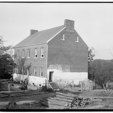
The aqueduct was finished in 1833 as one of the largest stone crossings along the Chesapeake and Ohio Canal. During the Civil War, canal workers talked military commanders out of destroying it, which kept the structure standing.

The name Monocacy comes from a Lenape word thought to mean "stream with many bends," reflecting the river's winding path below the structure. Visitors walking across the aqueduct today can look down and see the river curving through the landscape just as the name describes.

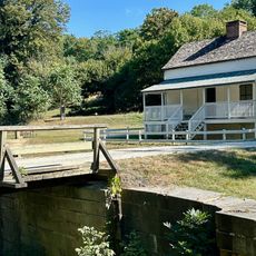
The aqueduct is part of the Chesapeake and Ohio Canal National Historical Park, with parking available nearby and a short trail leading to the structure. The path is unpaved and can be uneven, so sturdy footwear makes the walk more comfortable.

The Monocacy Aqueduct is the longest surviving aqueduct along the entire Chesapeake and Ohio Canal, even though the canal once had eleven of them. At around 330 feet (about 100 meters) long, it stands out among all the canal's stone crossings.

The community of curious travelers

AroundUs brings together thousands of curated places, local tips, and hidden gems, enriched daily by 60,000 contributors worldwide.

Start exploring
Location
Inception
1833
GPS coordinates
39.22360,-77.45190
Latest update
March 3, 2026 08:13
Around this place
Sugar Loaf Mountain
United States of America

Sugar Loaf Mountain

6.7 km
Ball's Bluff Battlefield and National Cemetery
United States of America

Ball's Bluff Battlefield and National Cemetery

12.2 km
United States of America

Gordon Strong Automobile Objective

6.7 km
Carrollton Manor
United States of America

Carrollton Manor

11.3 km
Rockland
United States of America

Rockland

9.8 km
Prospect Hall
United States of America

Prospect Hall

10.2 km
Buckeystown Historic District
United States of America

Buckeystown Historic District

12.1 km
Friends Advice
United States of America

Friends Advice

10.3 km
Point of Rocks Bridge
United States of America

Point of Rocks Bridge

9.7 km
Catoctin Creek Bridge
United States of America

Catoctin Creek Bridge

12.1 km
Poolesville Historic District
United States of America

Poolesville Historic District

9.1 km
St. Paul's Episcopal Church
United States of America

St. Paul's Episcopal Church

9.7 km
Buckingham House and Industrial School Complex
United States of America

Buckingham House and Industrial School Complex

10.4 km
Annington
United States of America

Annington

7.5 km
Chiswell's Inheritance
United States of America

Chiswell's Inheritance

8.2 km
Taylorstown Historic District
United States of America

Taylorstown Historic District

11.1 km
Darnall Place
United States of America

Darnall Place

13.1 km
Valhalla
United States of America

Valhalla

11.3 km
Clapham's Ferry
United States of America

Clapham's Ferry

1.1 km
Johnson-Wolfe Farm
United States of America

Johnson-Wolfe Farm

9.1 km
Old Chiswell Place
United States of America

Old Chiswell Place

9.8 km
Hanover Farm House
United States of America

Hanover Farm House

6.6 km
Susanna Farm
United States of America

Susanna Farm

13.1 km
Drury-Austin House
United States of America

Drury-Austin House

10 km
Nathan Dickerson Poole House
United States of America

Nathan Dickerson Poole House

12.5 km
Nolands Ferry I Archeological Site
United States of America

Nolands Ferry I Archeological Site

4 km
Lock Number 29
United States of America

Lock Number 29

13 km
White's Ferry Bridge
United States of America

White's Ferry Bridge

9.5 km
Show the full map
Reviews
Share your experience

No review yet

Discussions
Start a discussion...

No discussion yet

« Monocacy Aqueduct - Navigable aqueduct in Frederick County, United States » is provided by Around Us (aroundus.com). Images and texts are derived from Wikimedia project under a Creative Commons license. You are allowed to copy, distribute, and modify copies of this page, under the conditions set by the license, as long as this note is clearly visible.

Discover hidden gems everywhere you go!

From secret cafés to breathtaking viewpoints, skip the crowded tourist spots and find places that match your style. Our app makes it easy with voice search, smart filtering, route optimization, and insider tips from travelers worldwide. Download now for the complete mobile experience.

Around Us App Screenshot

A unique approach to discovering new places

Le Figaro

All the places worth exploring

France Info

A tailor-made excursion in just a few clicks

20 Minutes

Around Us
Travel Guide & Maps
Download

Send to your phone

QR Code
1

Open the camera app on your mobile.

2

Point at the QR code with your camera. A notification will appear.

3

Tap the notification to open the link.