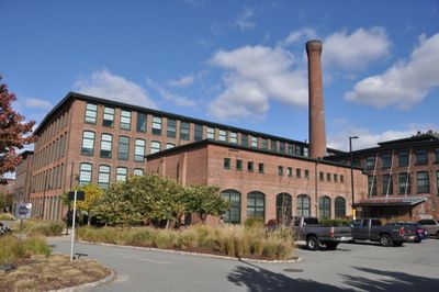
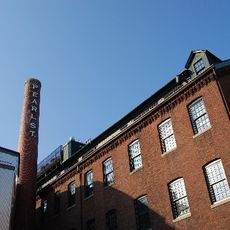
National and Providence Worsted Mills
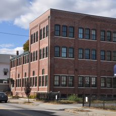
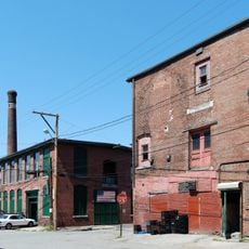
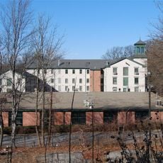
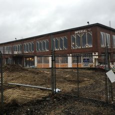
The National and Providence Worsted Mills is a complex of thirteen brick buildings built between 1881 and 1890 covering about ten acres in Providence. The buildings range from one to four stories and feature heavy timber frames, flat or gently sloped roofs, and large windows typical of industrial wool production.
Charles Fletcher, an Englishman who learned wool production in Bradford, founded the National Worsted Mill in Providence in 1875. In 1893 he merged it with Providence Worsted Mill, creating one of the country's largest wool processors with about 750 workers.
The mills reflect a time when wool production was central to Providence's economy and workers from the neighborhood came here daily to operate the machinery. The brick buildings and large windows still show the craftsmanship that shaped the city.
The mills are located west of downtown Providence near the Woonasquatucket River in the Olneyville neighborhood and are visible from outside. Visitors can view the buildings from various points in the area and explore the robust structures that preserve the site's industrial character.
The complex has deep ties to the Rising Sun Mill, a paper factory from the 1760s that supplied The Gazette newspaper, showing the site's long industrial history. The Rising Sun name is still visible on a dam built in 1905.
The community of curious travelers
AroundUs brings together thousands of curated places, local tips, and hidden gems, enriched daily by 60,000 contributors worldwide.