Chest opened
+${chestReward.xp} XP
Explorer
NOUVEAU ×${chestReward.collectible.quantity}
tapez pour fermer
Chest locked

Open chests in the app

Around Us is built for your phone — chests unlock when you walk, explore and capture nearby places.

Enable Location

We need your location to show you interesting places around you

Discover nearby places

Find interesting locations and hidden gems around you

Precise directions

Get accurate directions and distances to places

Your location is never shared with other users. It's only used when you tap the location button.

Log in to your account

Start exploring — it's free

Trusted by 73,024 travelers worldwide

Continue with Google
Continue with Apple
or

We will send you a code to connect

By continuing, you accept our Terms and Conditions and our Privacy Policy

Check your inbox

We've sent a pincode in your inbox. Please enter the code below.

Ohio's 12th congressional district
Discussion Reviews Photo
36k Popularity

Ohio's 12th congressional district, Congressional district in central Ohio, United States.

Ohio's 12th congressional district is a region in central Ohio that includes nine complete counties and portions of three others. It stretches from Delaware County eastward into the rural areas beyond Columbus.

The district was created in 1823 and took on its current shape following the 2010 census. Since then, the area has generally supported conservative representation, with only a few exceptions over the decades.

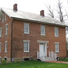
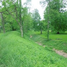
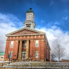
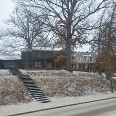
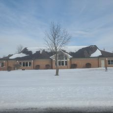
The district blends suburban neighborhoods near Columbus with farming communities scattered across open land. Residents balance concerns of town living with the realities of rural areas around them.

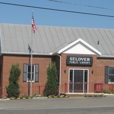
Local residents and visitors can find offices throughout the area to address concerns related to government services and representation. The best time to visit these offices is during weekday business hours.

After the 2010 census, the district's boundaries shifted significantly, transforming it from a predominantly urban area into a blend of suburban and rural communities. This change altered the area's demographic makeup considerably.

The community of curious travelers

AroundUs brings together thousands of curated places, local tips, and hidden gems, enriched daily by 60,000 contributors worldwide.

Start exploring
Location
GPS coordinates
40.23944,-82.61361
Latest update
December 17, 2025 11:16
Around this place
Alligator Effigy Mound
United States of America

Alligator Effigy Mound

21.2 km
Bryn Du Mansion
United States of America

Bryn Du Mansion

20 km
Spruce Run Earthworks
United States of America

Spruce Run Earthworks

22.4 km
Midland Theatre
United States of America

Midland Theatre

27 km
Raleigh Mound
United States of America

Raleigh Mound

26.7 km
St. Luke's Episcopal Church
United States of America

St. Luke's Episcopal Church

20.7 km
Chambers Road Covered Bridge
United States of America

Chambers Road Covered Bridge

20.5 km
Avery-Hunter House
United States of America

Avery-Hunter House

20.8 km
Bethel Baptist Church
United States of America

Bethel Baptist Church

27.2 km
Chesterville Community Church
United States of America

Chesterville Community Church

27.3 km
Christ Church at the Quarry
United States of America

Christ Church at the Quarry

26.4 km
Chester Town Hall
United States of America

Chester Town Hall

27.4 km
George and Christina Ealy House
United States of America

George and Christina Ealy House

24.8 km
Newark Earthworks
United States of America

Newark Earthworks

26.9 km
National Heisey Glass Museum
United States of America

National Heisey Glass Museum

26.7 km
Home Building Association Bank
United States of America

Home Building Association Bank

27 km
Knox County Courthouse
United States of America

Knox County Courthouse

20.5 km
East High Street Historic District
United States of America

East High Street Historic District

20.6 km
Selover Public Library
United States of America

Selover Public Library

27.5 km
East Gambier Street Historic District
United States of America

East Gambier Street Historic District

20.2 km
North Main-North Gay Streets Historic District
United States of America

North Main-North Gay Streets Historic District

20.7 km
Premiere Theatre 7
United States of America

Premiere Theatre 7

23.3 km
Vine Theatre
United States of America

Vine Theatre

20.3 km
Neal Theatre
United States of America

Neal Theatre

27.7 km
Kenyon College Palme house
United States of America

Kenyon College Palme house

23.7 km
Mt Vernon & Knox County, Public Library Of
United States of America

Mt Vernon & Knox County, Public Library Of

20.5 km
Fredericktown Branch
United States of America

Fredericktown Branch

27.1 km
Falling Rock Camp Bridge
United States of America

Falling Rock Camp Bridge

27.4 km
Show the full map
Reviews
Share your experience

No review yet

Discussions
Start a discussion...

No discussion yet

« Ohio's 12th congressional district - Congressional district in central Ohio, United States » is provided by Around Us (aroundus.com). Images and texts are derived from Wikimedia project under a Creative Commons license. You are allowed to copy, distribute, and modify copies of this page, under the conditions set by the license, as long as this note is clearly visible.

Discover hidden gems everywhere you go!

From secret cafés to breathtaking viewpoints, skip the crowded tourist spots and find places that match your style. Our app makes it easy with voice search, smart filtering, route optimization, and insider tips from travelers worldwide. Download now for the complete mobile experience.

Around Us App Screenshot

A unique approach to discovering new places

Le Figaro

All the places worth exploring

France Info

A tailor-made excursion in just a few clicks

20 Minutes

Around Us
Travel Guide & Maps
Download

Send to your phone

QR Code
1

Open the camera app on your mobile.

2

Point at the QR code with your camera. A notification will appear.

3

Tap the notification to open the link.