Chest opened
+${chestReward.xp} XP
Explorer
NOUVEAU ×${chestReward.collectible.quantity}
tapez pour fermer
Chest locked

Open chests in the app

Around Us is built for your phone — chests unlock when you walk, explore and capture nearby places.

Enable Location

We need your location to show you interesting places around you

Discover nearby places

Find interesting locations and hidden gems around you

Precise directions

Get accurate directions and distances to places

Your location is never shared with other users. It's only used when you tap the location button.

Log in to your account

Start exploring — it's free

Trusted by 72,879 travelers worldwide

Continue with Google
Continue with Apple
or

We will send you a code to connect

By continuing, you accept our Terms and Conditions and our Privacy Policy

Check your inbox

We've sent a pincode in your inbox. Please enter the code below.

Old Harbor Housing Project
Discussion Reviews Photo
16.8k Popularity

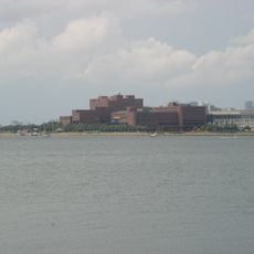
Old Harbor Housing Project, Public housing complex in South Boston, United States

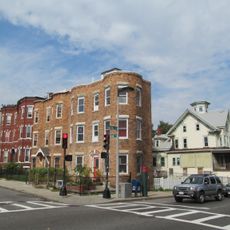
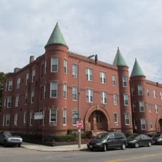
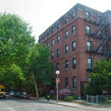
Old Harbor Housing Project is a public housing complex in South Boston containing 1,016 residential units spread across 22 three-story buildings and 152 row houses on a 27-acre site. The development was designed to provide affordable housing for working families and represents a significant residential community within the neighborhood.

Built during the Great Depression as a Public Works Administration project, this housing development opened in 1938 as New England's first public housing initiative. The project represented a pivotal shift in housing policy and established a model for affordable housing developments across the region.

The complex is named after Mary Ellen McCormack, mother of U.S. House Speaker John McCormack, a choice that reflects the community's ties to local political figures. The buildings embody their purpose through straightforward, functional architecture that residents and visitors can immediately recognize.

The complex sits near the Red Line rapid transit and multiple bus routes, offering convenient transportation options for those living or visiting the area. The infrastructure was designed to provide easy access to jobs and services throughout the city.

The Boston Housing Authority partnered with WinnCompanies in 2017 to undertake a substantial redevelopment that transforms the site into a mixed-income community. This initiative aims to create new opportunities and housing options for residents across different income levels.

The community of curious travelers

AroundUs brings together thousands of curated places, local tips, and hidden gems, enriched daily by 60,000 contributors worldwide.

Start exploring
GPS coordinates
42.32700,-71.05500
Latest update
December 7, 2025 19:26
Around this place
Cathedral of the Holy Cross
United States of America

Cathedral of the Holy Cross

1.9 km
James Blake House
United States of America

James Blake House

928 m
National Emerging Infectious Diseases Laboratories
United States of America

National Emerging Infectious Diseases Laboratories

1.5 km
United States of America

Strand Theatre

1.5 km
Shirley-Eustis House
United States of America

Shirley-Eustis House

1.5 km
Monan Park
United States of America

Monan Park

1.6 km
Dorchester North Burying Ground
United States of America

Dorchester North Burying Ground

1.3 km
William Monroe Trotter House
United States of America

William Monroe Trotter House

1.7 km
Cathedral of St. George Historic District
United States of America

Cathedral of St. George Historic District

1.3 km
Statue of Edward Everett
United States of America

Statue of Edward Everett

913 m
Captain Lemuel Clap House
United States of America

Captain Lemuel Clap House

788 m
Clapp Houses
United States of America

Clapp Houses

795 m
William Clapp House
United States of America

William Clapp House

788 m
Harrison Loring House
United States of America

Harrison Loring House

2 km
Upham's Corner Market
United States of America

Upham's Corner Market

1.4 km
Mount Pleasant Historic District
United States of America

Mount Pleasant Historic District

1.9 km
Pilgrim Congregational Church
United States of America

Pilgrim Congregational Church

1.6 km
Moreland Street Historic District
United States of America

Moreland Street Historic District

2.1 km
United States of America

Old Harbor Reservation Parkways

802 m
South End District
United States of America

South End District

2.1 km
Frances and Isabella Apartments
United States of America

Frances and Isabella Apartments

1.7 km
South Boston Boat Clubs Historic District
United States of America

South Boston Boat Clubs Historic District

842 m
Columbia Road–Bellevue Street Historic District
United States of America

Columbia Road–Bellevue Street Historic District

1.9 km
Governor Shirley Square Historic District
United States of America

Governor Shirley Square Historic District

1.7 km
Greenville Street Historic District
United States of America

Greenville Street Historic District

2.1 km
Joshua Bates School
United States of America

Joshua Bates School

1.8 km
Lawrence Model Lodging Houses
United States of America

Lawrence Model Lodging Houses

1.8 km
Church of the Immaculate Conception
United States of America

Church of the Immaculate Conception

1.9 km
Show the full map
Reviews
Share your experience

No review yet

Discussions
Start a discussion...

No discussion yet

« Old Harbor Housing Project - Public housing complex in South Boston, United States » is provided by Around Us (aroundus.com). Images and texts are derived from Wikimedia project under a Creative Commons license. You are allowed to copy, distribute, and modify copies of this page, under the conditions set by the license, as long as this note is clearly visible.

Discover hidden gems everywhere you go!

From secret cafés to breathtaking viewpoints, skip the crowded tourist spots and find places that match your style. Our app makes it easy with voice search, smart filtering, route optimization, and insider tips from travelers worldwide. Download now for the complete mobile experience.

Around Us App Screenshot

A unique approach to discovering new places

Le Figaro

All the places worth exploring

France Info

A tailor-made excursion in just a few clicks

20 Minutes

Around Us
Travel Guide & Maps
Download

Send to your phone

QR Code
1

Open the camera app on your mobile.

2

Point at the QR code with your camera. A notification will appear.

3

Tap the notification to open the link.