Enable Location

We need your location to show you interesting places around you

Discover nearby places

Find interesting locations and hidden gems around you

Precise directions

Get accurate directions and distances to places

Your location is never shared with other users. It's only used when you tap the location button.

Log in to your account

Start exploring — it's free

Trusted by 61,497 travelers worldwide

Continue with Google
Continue with Apple
or

We will send you a code to connect

By continuing, you accept our Terms and Conditions and our Privacy Policy

Check your inbox

We've sent a pincode in your inbox. Please enter the code below.

Pedlar Hills Natural Area Preserve

Pedlar Hills Natural Area Preserve, Natural Area Preserve in Montgomery County, Virginia, United States.

Description

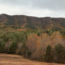
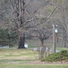
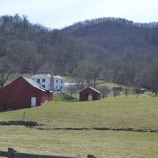
Pedlar Hills Natural Area Preserve is a protected site in Virginia that spans 1,177 acres and rises above the South Fork of the Roanoke River. The land features a mosaic of scrubby woodland with stunted hardwoods and cedars alongside open grassland, all shaped by its distinctive dolomite barren substrate.

History

The preserve was established in the late 1980s as part of Virginia's Natural Area Preserves System, created to protect significant natural sites. This designation was part of a broader effort to safeguard the state's ecologically sensitive regions.

Culture

The preserve harbors uncommon plants adapted to the demanding dolomite barren environment. Visitors can observe these specialized species thriving in their natural setting, where harsh conditions have shaped their growth.

Practical

Access requires advance coordination with a state land steward, as the site has no public facilities or marked trails. Visitors should prepare for unmarked terrain and bring appropriate supplies.

Did you know?

The site contains a specialized dolomite barren habitat with rare plants including Addison's leatherflower and tall gay-feather. This ecological niche attracts researchers interested in studying this fragile environment.

Location
GPS coordinates
37.21950,-80.24000
Latest update
December 14, 2025 13:03

AroundUs brings together thousands of curated places, local tips, and hidden gems, enriched daily by 60,000 contributors worldwide. Discover all places nearby (Virginia).

Around this place
Dixie Caverns
United States of America

Dixie Caverns

6.8 km
United States of America

Poor Mountain

8.2 km
Wilson Creek Bridge
United States of America

Wilson Creek Bridge

13 km
Brush Mountain Wilderness
United States of America

Brush Mountain Wilderness

12.9 km
Yellow Sulphur Springs
United States of America

Yellow Sulphur Springs

14.7 km
Brush Mountain East Wilderness
United States of America

Brush Mountain East Wilderness

14 km
Bowstring Truss Bridge
United States of America

Bowstring Truss Bridge

2.6 km
Twelve O'clock Knob
United States of America

Twelve O'clock Knob

14.2 km
Walnut Grove Farm
United States of America

Walnut Grove Farm

5.7 km
William Barnett House
United States of America

William Barnett House

8.8 km
Currie House
United States of America

Currie House

13.7 km
Pompey Callaway House
United States of America

Pompey Callaway House

951 m
Alleghany Springs Springhouse
United States of America

Alleghany Springs Springhouse

10.3 km
Barnett House
United States of America

Barnett House

1.1 km
Big Spring Baptist Church
United States of America

Big Spring Baptist Church

1.4 km
Earhart House
United States of America

Earhart House

11.5 km
Johnsville Meetinghouse
United States of America

Johnsville Meetinghouse

10.7 km
Virginian Railway Underpass
United States of America

Virginian Railway Underpass

11.2 km
Lafayette Historic District (Lafayette, Virginia)
United States of America

Lafayette Historic District (Lafayette, Virginia)

3.1 km
Blankenship Farm
United States of America

Blankenship Farm

11.7 km
Nealy Gordon Farm
United States of America

Nealy Gordon Farm

6.2 km
Rife House
United States of America

Rife House

4.7 km
Crockett Springs Cottage
United States of America

Crockett Springs Cottage

14.1 km
Shawsville Historic District
United States of America

Shawsville Historic District

5.8 km
George Earhart House
United States of America

George Earhart House

10.9 km
Anderson-Doosing Farm
United States of America

Anderson-Doosing Farm

13 km
Piedmont Camp Meeting Grounds Historic District
United States of America

Piedmont Camp Meeting Grounds Historic District

13 km
Amiss-Palmer House
United States of America

Amiss-Palmer House

14.9 km
Show the full map
« Pedlar Hills Natural Area Preserve - Natural Area Preserve in Montgomery County, Virginia, United States » is provided by Around Us (aroundus.com). Images and texts are derived from Wikimedia project under a Creative Commons license. You are allowed to copy, distribute, and modify copies of this page, under the conditions set by the license, as long as this note is clearly visible.

Discover hidden gems everywhere you go!

From secret cafés to breathtaking viewpoints, skip the crowded tourist spots and find places that match your style. Our app makes it easy with voice search, smart filtering, route optimization, and insider tips from travelers worldwide. Download now for the complete mobile experience.

Around Us App Screenshot

A unique approach to discovering new places

Le Figaro

All the places worth exploring

France Info

A tailor-made excursion in just a few clicks

20 Minutes

Around Us
Travel Guide & Maps
Download

Send to your phone

QR Code
1

Open the camera app on your mobile.

2

Point at the QR code with your camera. A notification will appear.

3

Tap the notification to open the link.