Enable Location

We need your location to show you interesting places around you

Discover nearby places

Find interesting locations and hidden gems around you

Precise directions

Get accurate directions and distances to places

Your location is never shared with other users. It's only used when you tap the location button.

Pignut Mountain

Log in to your account

Start exploring — it's free

Trusted by 61,982 travelers worldwide

Continue with Google
Continue with Apple
or

We will send you a code to connect

By continuing, you accept our Terms and Conditions and our Privacy Policy

Check your inbox

We've sent a pincode in your inbox. Please enter the code below.

Pignut Mountain

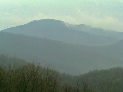
Pignut Mountain, Mountain summit in Rappahannock County, Virginia, United States.

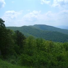
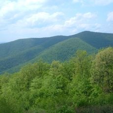
Pignut Mountain is a summit located within Shenandoah National Park in the northern Blue Ridge Mountains, reaching about 2,535 feet in elevation. The peak sits separated from the main ridge system by a deep gap that was carved through centuries of water and weather erosion.

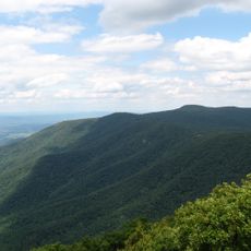
The peak formed millions of years ago as part of the ancient Appalachian range through folding and crystalline rock formation. Erosion along geological fault lines eventually cut the distinctive gap that now separates it from the adjacent ridge.

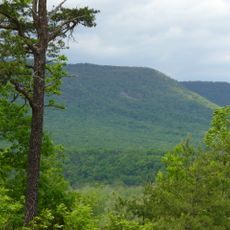
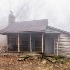
The mountain territory remains undeveloped, representing the natural heritage of Virginia's portion of the Appalachian Mountain range.

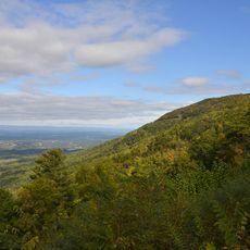
Access to the summit is primarily off-trail and requires navigation through dense forest and underbrush, so sturdy hiking boots are recommended. Overlooks at Thornton Hollow and Rattlesnake Point offer easier vantage points to view the peak without the more challenging bushwhacking route.

The mountain stands separated from the main Blue Ridge chain by an eroded gap, creating a distinct geographical feature in the landscape.

The community of curious travelers

AroundUs brings together thousands of curated places, local tips, and hidden gems, enriched daily by 60,000 contributors worldwide.

Start exploring
Location
GPS coordinates
38.71790,-78.26417
Latest update
December 14, 2025 14:40
Around this place
Thornton Gap
United States of America

Thornton Gap

8 km
Shenandoah River Raymond R. "Andy" Guest Jr. State Park
United States of America

Shenandoah River Raymond R. "Andy" Guest Jr. State Park

15.7 km
Stony Man Mountain
United States of America

Stony Man Mountain

16.3 km
Corbin Cabin
United States of America

Corbin Cabin

14.7 km
Marys Rock Tunnel
United States of America

Marys Rock Tunnel

8.3 km
Milford Battlefield
United States of America

Milford Battlefield

11.9 km
Neighbor Mountain
United States of America

Neighbor Mountain

8.7 km
Stover House
United States of America

Stover House

16.8 km
Mount Salem Baptist Meetinghouse
United States of America

Mount Salem Baptist Meetinghouse

13.6 km
Meadow Grove Farm
United States of America

Meadow Grove Farm

16.5 km
Sunnyside
United States of America

Sunnyside

9.3 km
Calvert Mill/Washington Mill
United States of America

Calvert Mill/Washington Mill

9.7 km
George L. Carder House
United States of America

George L. Carder House

17.2 km
Sperryville Historic District
United States of America

Sperryville Historic District

7.5 km
Abram and Sallie Printz Farm
United States of America

Abram and Sallie Printz Farm

16.3 km
Washington Historic District (Washington, Virginia)
United States of America

Washington Historic District (Washington, Virginia)

9.1 km
Page County Bridge No. 1990
United States of America

Page County Bridge No. 1990

12.3 km
Laurel Mills Historic District
United States of America

Laurel Mills Historic District

17 km
Elkwallow Wayside
United States of America

Elkwallow Wayside

4.5 km
Knob Mountain
United States of America

Knob Mountain

7.5 km
Redwell-Isabella Furnace Historic District
United States of America

Redwell-Isabella Furnace Historic District

17.3 km
Gooney Run Overlook
United States of America

Gooney Run Overlook

14.7 km
Massanutten Lodge‎
United States of America

Massanutten Lodge‎

17.3 km
Wildwood Cabin
United States of America

Wildwood Cabin

17.2 km
Byrd's Nest
United States of America

Byrd's Nest

17 km
Boulder Cabin
United States of America

Boulder Cabin

17 km
Dogwood Cabin
United States of America

Dogwood Cabin

17.2 km
Vollmer Cabin
United States of America

Vollmer Cabin

17 km
Show the full map
« Pignut Mountain - Mountain summit in Rappahannock County, Virginia, United States » is provided by Around Us (aroundus.com). Images and texts are derived from Wikimedia project under a Creative Commons license. You are allowed to copy, distribute, and modify copies of this page, under the conditions set by the license, as long as this note is clearly visible.

Discover hidden gems everywhere you go!

From secret cafés to breathtaking viewpoints, skip the crowded tourist spots and find places that match your style. Our app makes it easy with voice search, smart filtering, route optimization, and insider tips from travelers worldwide. Download now for the complete mobile experience.

Around Us App Screenshot

A unique approach to discovering new places

Le Figaro

All the places worth exploring

France Info

A tailor-made excursion in just a few clicks

20 Minutes

Around Us
Travel Guide & Maps
Download

Send to your phone

QR Code
1

Open the camera app on your mobile.

2

Point at the QR code with your camera. A notification will appear.

3

Tap the notification to open the link.