Enable Location

We need your location to show you interesting places around you

Discover nearby places

Find interesting locations and hidden gems around you

Precise directions

Get accurate directions and distances to places

Your location is never shared with other users. It's only used when you tap the location button.

Thornton Gap

Log in to your account

Start exploring — it's free

Trusted by 61,982 travelers worldwide

Continue with Google
Continue with Apple
or

We will send you a code to connect

By continuing, you accept our Terms and Conditions and our Privacy Policy

Check your inbox

We've sent a pincode in your inbox. Please enter the code below.

Thornton Gap

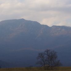
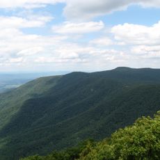
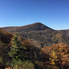
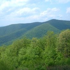
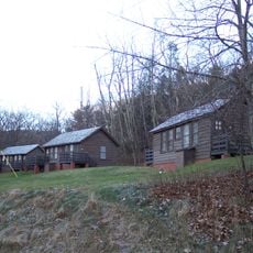
Thornton Gap, Wind gap in Shenandoah National Park, Virginia.

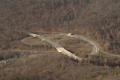
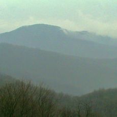
Thornton Gap is a natural passage through the Blue Ridge Mountains located between Page County and Rappahannock County at an elevation of approximately 2,460 feet. The formation creates a low point in the ridge that allows roads and hiking trails to cross through the mountains.

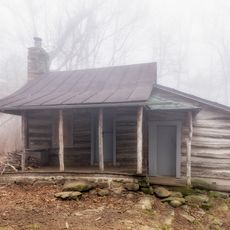
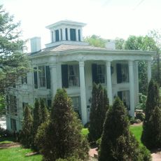
The gap took its name from Francis Thornton, who built a manor near Nethers in the 1740s and owned the adjacent valley. Organized transportation through the passage began in 1806 when a toll company established a road through the mountains.

The Thornton Gap Turnpike Company established a toll road in 1806, marking the beginning of organized transportation through the mountainous region.

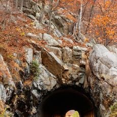
U.S. Route 211 runs through the gap and connects it to Skyline Drive and hiking trails within Shenandoah National Park. Visitors can easily switch between driving and hiking activities at this location.

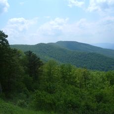
The Appalachian Trail crosses through the gap, creating an intersection between long-distance hiking routes and vehicle traffic. This crossing allows hikers to connect their journey on the famous long-distance trail with nearby road access.

The community of curious travelers

AroundUs brings together thousands of curated places, local tips, and hidden gems, enriched daily by 60,000 contributors worldwide.

Start exploring
Location
GPS coordinates
38.66110,-78.32000
Latest update
December 12, 2025 07:55
« Thornton Gap - Wind gap in Shenandoah National Park, Virginia » is provided by Around Us (aroundus.com). Images and texts are derived from Wikimedia project under a Creative Commons license. You are allowed to copy, distribute, and modify copies of this page, under the conditions set by the license, as long as this note is clearly visible.

Discover hidden gems everywhere you go!

From secret cafés to breathtaking viewpoints, skip the crowded tourist spots and find places that match your style. Our app makes it easy with voice search, smart filtering, route optimization, and insider tips from travelers worldwide. Download now for the complete mobile experience.

Around Us App Screenshot

A unique approach to discovering new places

Le Figaro

All the places worth exploring

France Info

A tailor-made excursion in just a few clicks

20 Minutes

Around Us
Travel Guide & Maps
Download

Send to your phone

QR Code
1

Open the camera app on your mobile.

2

Point at the QR code with your camera. A notification will appear.

3

Tap the notification to open the link.