Enable Location

We need your location to show you interesting places around you

Discover nearby places

Find interesting locations and hidden gems around you

Precise directions

Get accurate directions and distances to places

Your location is never shared with other users. It's only used when you tap the location button.

Log in to your account

Start exploring — it's free

Trusted by 68,089 travelers worldwide

Continue with Google
Continue with Apple
or

We will send you a code to connect

By continuing, you accept our Terms and Conditions and our Privacy Policy

Check your inbox

We've sent a pincode in your inbox. Please enter the code below.

Port Ivory, Staten Island
Discussion Reviews Photo
4.2k Popularity

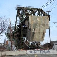
Port Ivory, Staten Island, Industrial waterfront district in Staten Island, United States

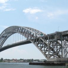
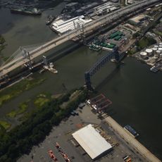
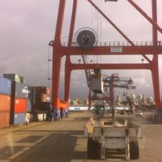
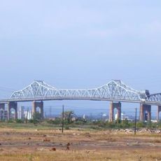
Port Ivory sits in the northwestern corner of Staten Island between Newark Bay and Arthur Kill, featuring extensive maritime infrastructure and rail connections. The district combines shipping facilities with restored freight rail access and broad transportation links throughout the region.

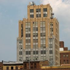
The area took its name from a soap factory that operated from 1907 until 1991 before production moved overseas. This lengthy industrial presence shaped the economic and physical development of the entire district.

The area takes its name from a soap factory that operated here for decades and shaped the local identity. Today visitors can still see traces of this industrial past woven into the parks and natural spaces throughout the neighborhood.

The district is well accessible via the Staten Island Expressway and has rail connections for freight transport. Visitors should note that infrastructure here is primarily oriented toward commerce and transportation operations.

The district contains scattered vintage vehicles and large protected natural areas with salt marshes and pine forests. This blend of industrial remnants and nature shows how the once purely commercial space has been transformed.

The community of curious travelers

AroundUs brings together thousands of curated places, local tips, and hidden gems, enriched daily by 60,000 contributors worldwide.

Start exploring
GPS coordinates
40.64000,-74.17900
Latest update
December 11, 2025 11:06
Around this place
Bayonne Bridge
United States of America

Bayonne Bridge

3.1 km
Goethals Bridge
United States of America

Goethals Bridge

1.6 km
Arthur Kill Vertical Lift Bridge
United States of America

Arthur Kill Vertical Lift Bridge

1.4 km
CRRNJ Newark Bay Bridge
United States of America

CRRNJ Newark Bay Bridge

2.9 km
Red Hook Container Terminal
United States of America

Red Hook Container Terminal

810 m
United States of America

New Springville, Staten Island

5.3 km
United States of America

William T. Davis Wildlife Refuge

5 km
Willowbrook Park
United States of America

Willowbrook Park

4.5 km
Old Goethals Bridge
United States of America

Old Goethals Bridge

1.6 km
Boxwood Hall
United States of America

Boxwood Hall

3.7 km
Hersch Tower
United States of America

Hersch Tower

4.2 km
Church of Our Lady of Pity
United States of America

Church of Our Lady of Pity

3.8 km
Church of the Holy Family
United States of America

Church of the Holy Family

4.1 km
United States of America

Old Place, Staten Island

1.5 km
Elizabeth Public Library
United States of America

Elizabeth Public Library

3.9 km
Bayonne Community Museum
United States of America

Bayonne Community Museum

4.7 km
United States of America

Reformed Church on Staten Island

3.9 km
Hale-Whitney Mansion
United States of America

Hale-Whitney Mansion

4.4 km
Mid-Town Historic District
United States of America

Mid-Town Historic District

4.3 km
Union County Courthouse
United States of America

Union County Courthouse

4 km
Temple Emanu-El
United States of America

Temple Emanu-El

3.9 km
South Front Street Bridge
United States of America

South Front Street Bridge

1.1 km
St. John's Parsonage
United States of America

St. John's Parsonage

3.6 km
Belcher–Ogden Mansion; Benjamin Price House; and Price–Brittan House Historic District
United States of America

Belcher–Ogden Mansion; Benjamin Price House; and Price–Brittan House Historic District

3.6 km
Peter Houseman House
United States of America

Peter Houseman House

4.5 km
Scott-Edwards House
United States of America

Scott-Edwards House

4.8 km
Charles N. Fowler House
United States of America

Charles N. Fowler House

5.1 km
Mariners Harbor Houses
United States of America

Mariners Harbor Houses

1.5 km
Show the full map
Reviews
Share your experience

No review yet

Discussions
Start a discussion...

No discussion yet

« Port Ivory, Staten Island - Industrial waterfront district in Staten Island, United States » is provided by Around Us (aroundus.com). Images and texts are derived from Wikimedia project under a Creative Commons license. You are allowed to copy, distribute, and modify copies of this page, under the conditions set by the license, as long as this note is clearly visible.

Discover hidden gems everywhere you go!

From secret cafés to breathtaking viewpoints, skip the crowded tourist spots and find places that match your style. Our app makes it easy with voice search, smart filtering, route optimization, and insider tips from travelers worldwide. Download now for the complete mobile experience.

Around Us App Screenshot

A unique approach to discovering new places

Le Figaro

All the places worth exploring

France Info

A tailor-made excursion in just a few clicks

20 Minutes

Around Us
Travel Guide & Maps
Download

Send to your phone

QR Code
1

Open the camera app on your mobile.

2

Point at the QR code with your camera. A notification will appear.

3

Tap the notification to open the link.