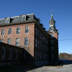
Purgatory Chasm State Reservation, State park and nature reserve in Sutton, Massachusetts.
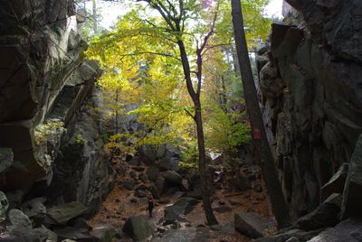
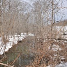
Purgatory Chasm State Reservation is a state park and nature reserve in Sutton, Worcester County, featuring a roughly quarter-mile granite chasm with steep walls and natural caves throughout. The split reaches depths near 70 feet (21 meters) in places and cuts through forested terrain with trails along the upper rim and through the bottom.
The Massachusetts Department of Conservation acquired this land from Whitin Machine Works in 1919 and established it as a protected natural area. Geological research shows the chasm formed during the final stage of the Ice Age when meltwater carved through the bedrock.
Rock climbers obtain permits to train on the granite walls while visitors hike to formations bearing names such as The Corn Crib, The Coffin, and Lovers' Leap. These popular destinations within the chasm offer natural viewpoints and spots to pause between the towering rock walls.
The reservation charges parking fees from May through October, with different rates for Massachusetts residents and out-of-state visitors. Trails through the chasm require sturdy footwear and some balance, as the floor is uneven and involves climbing over rocks.
Rangers report that visitors occasionally spot porcupines in the caves along the rock walls, which retreat between the crevices. The temperature at the chasm floor remains several degrees cooler than outside even in midsummer, providing a refreshing break during hot weather.
Location: Worcester County
Operator: DCR - Division of State Parks and Recreation
GPS coordinates: 42.12830,-71.71440
Latest update: December 5, 2025 22:27
Massachusetts offers a range of locations beyond Boston and Cape Cod that receive fewer visitors. In the western part of the state, stone tower lookouts rise above forested hills, while waterfalls are located within state forests. Historic buildings from the 19th century stand in smaller communities, and gardens featuring native plant species are open to the public. The coastal region includes lighthouses on rocky points and beaches away from main travel routes. A museum houses a walk-through glass globe, geological formations show traces of past ice ages, and Victorian houses document different architectural styles. These places often require specific planning as they lie away from typical tourist routes.
Asa Waters Mansion
7.9 km
Waters Farm
6.3 km
Manchaug Village Historic District
4.7 km
Farnumsville Historic District
5.7 km
Fisherville Historic District
5.7 km
E. N. Jenckes Store
6.3 km
Aaron Taft House
7.5 km
Simon Fairfield Public Library
6.2 km
Whitinsville Historic District
4.6 km
Rockdale Common Housing District
6.2 km
Hayward Mill
5.9 km
Freegrace Marble Farm Historic District
4.8 km
Samuel Taft House
6.4 km
Linwood Historic District
6.5 km
Breezy Picnic Grounds Waterslides
7.3 km
E. Brown House
6.8 km
Old Douglas Center Historic District
8.5 km
Benjamin Adams House
8.5 km
S. A. Hall House
8.2 km
A. Whipple House
4.6 km
Rivulet Mill Complex
7.3 km
N. Williams House
5.3 km
Sutton Center Historic District
4.9 km
First Presbyterian Society Meeting House
8.1 km
West Sutton Historic District
7.4 km
William Hayward House
8.6 km
North Uxbridge School
7.4 km
Waters Farm
6.3 kmReviews
Visited this place? Tap the stars to rate it and share your experience / photos with the community! Try now! You can cancel it anytime.
Discover hidden gems everywhere you go!
From secret cafés to breathtaking viewpoints, skip the crowded tourist spots and find places that match your style. Our app makes it easy with voice search, smart filtering, route optimization, and insider tips from travelers worldwide. Download now for the complete mobile experience.
A unique approach to discovering new places❞
— Le Figaro
All the places worth exploring❞
— France Info
A tailor-made excursion in just a few clicks❞
— 20 Minutes