Rittenhouse Square

Log in to your account

AroundUs is a community-driven map of interesting places, built by curious explorers like you. It grows with every review, story, and photo you share.
Connect to save your favorite spots, contribute locations, and create personalized routes.
Continue with Google
Continue with Apple
Continue with X
Continue with Facebook
Continue with email
By continuing, you accept our Terms and Conditions and our Privacy Policy
Create an account
Add to collection
Map
Suggest a change
Share

Rittenhouse Square, Public park in Center City, Philadelphia, United States.

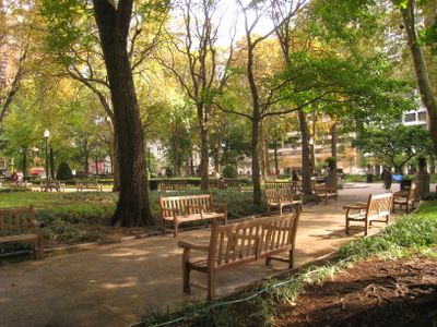
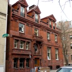
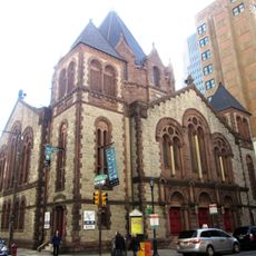
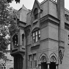
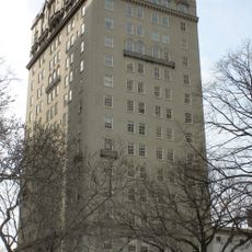
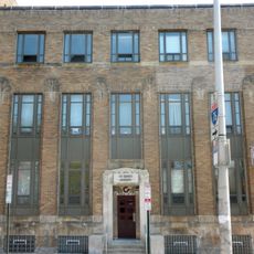
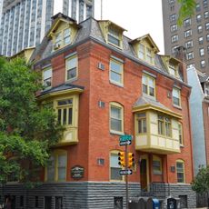
Rittenhouse Square is a public park in the heart of Philadelphia, Pennsylvania, stretching across a full city block and surrounded by a mix of 19th- and 20th-century residential buildings. Diagonal walkways lead to a central oval plaza lined with classical urns, wrought-iron benches, and ornamental lamp posts.

The square was laid out in the late 17th century as one of five public spaces in William Penn's city plan and was originally called Southwest Square. During the 19th century it received its current name in honor of astronomer David Rittenhouse, while the grounds were gradually planted with trees and formal pathways were added.

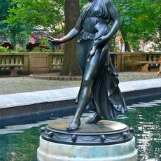
Bronze sculptures by artists such as Antoine-Louis Barye and Paul Manship stand throughout the grounds, freely accessible to anyone walking through. Visitors often touch certain statues, causing their surfaces to develop a different patina over time from the daily contact with passersby.

The grounds are suitable for short walks and rest stops on the many benches scattered under trees or along pathways. Several subway stations and bus lines stop within walking distance, making the park easy to reach from most parts of the city.

The urns and relief figures on the central plaza display Greek motifs that were added in the early 20th century, creating a classical accent in an otherwise informal park setting. Some of the bronze figures show lighter coloring in certain spots due to frequent touching by visitors as they pass by.

Location: Center City

Architects: Thomas Holme

Website: http://friendsofrittenhouse.org

GPS coordinates: 39.94948,-75.17188

Latest update: December 14, 2025 18:49

Photos
Around this place
Tenth Presbyterian Church
United States of America

Tenth Presbyterian Church

324 m
Rosenbach Museum & Library
United States of America

Rosenbach Museum & Library

358 m
Racquet Club of Philadelphia
United States of America

Racquet Club of Philadelphia

339 m
1818 Market Street
United States of America

1818 Market Street

399 m
Church of the Holy Trinity, Philadelphia
United States of America

Church of the Holy Trinity, Philadelphia

171 m
The Warwick
United States of America

The Warwick

173 m
First Presbyterian Church
United States of America

First Presbyterian Church

329 m
Plays and Players Theatre
United States of America

Plays and Players Theatre

304 m
United States of America

Philly Improv Theater

308 m
1700 Market
United States of America

1700 Market

429 m
1616 Walnut Street Building
United States of America

1616 Walnut Street Building

281 m
Horace Jayne House
United States of America

Horace Jayne House

238 m
First Baptist Church
United States of America

First Baptist Church

288 m
Philadelphia Art Alliance
United States of America

Philadelphia Art Alliance

170 m
Thomas Hockley House
United States of America

Thomas Hockley House

343 m
Duck Girl
United States of America

Duck Girl

13 m
1900 Rittenhouse Square Apartments
United States of America

1900 Rittenhouse Square Apartments

179 m
United States of America

The Print Center

322 m
Chateau Crillon Apartment House
United States of America

Chateau Crillon Apartment House

139 m
Philadelphia School of Occupational Therapy
United States of America

Philadelphia School of Occupational Therapy

411 m
Hockley Row
United States of America

Hockley Row

387 m
Sun Oil Building
United States of America

Sun Oil Building

279 m
Solomon House
United States of America

Solomon House

226 m
The Touraine
United States of America

The Touraine

431 m
Physicians and Dentists Building
United States of America

Physicians and Dentists Building

247 m
Mutual Benefit Life Building
United States of America

Mutual Benefit Life Building

81 m
Rafsnyder-Welsh House
United States of America

Rafsnyder-Welsh House

252 m
Walnut-Chancellor Historic District
United States of America

Walnut-Chancellor Historic District

358 m
Show the full map
Reviews

Visited this place? Tap the stars to rate it and share your experience / photos with the community! Try now! You can cancel it anytime.

« Rittenhouse Square - Public park in Center City, Philadelphia, United States » is provided by Around Us (aroundus.com). Images and texts are derived from Wikimedia project under a Creative Commons license. You are allowed to copy, distribute, and modify copies of this page, under the conditions set by the license, as long as this note is clearly visible.

Discover hidden gems everywhere you go!

From secret cafés to breathtaking viewpoints, skip the crowded tourist spots and find places that match your style. Our app makes it easy with voice search, smart filtering, route optimization, and insider tips from travelers worldwide. Download now for the complete mobile experience.

Around Us App Screenshot

A unique approach to discovering new places

Le Figaro

All the places worth exploring

France Info

A tailor-made excursion in just a few clicks

20 Minutes