Robert O. Norris Bridge

Log in to your account

AroundUs is a community-driven map of interesting places, built by curious explorers like you. It grows with every review, story, and photo you share.
Connect to save your favorite spots, contribute locations, and create personalized routes.
Continue with Google
Continue with Apple
Continue with X
Continue with Facebook
Continue with email
By continuing, you accept our Terms and Conditions and our Privacy Policy
Create an account

Robert O. Norris Bridge

Add to collection
Map
Suggest a change
Share

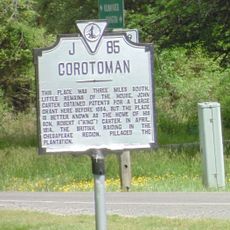
Robert O. Norris Bridge, Road bridge in Virginia, United States

The Robert O. Norris Bridge is a road bridge that crosses the Rappahannock River and connects two counties in Virginia. The structure provides two travel lanes and was built to create a reliable crossing over the river.

The bridge opened in 1957 and replaced a ferry service that had previously connected the two shores. This shift to bridge transport provided faster and more reliable connections between the regions.

The bridge links two communities on opposite shores, making it easier for people to visit and do business across the Rappahannock River. It is woven into daily life for those traveling between the Middle Peninsula and Northern Neck regions.

The bridge is accessible to vehicles and provides a stable crossing over the river for daily traffic. When using it, keep in mind that this is an active traffic route regularly used by commuters and travelers.

During construction of the bridge, there were tragic incidents that claimed the lives of several workers. The structure requires special monitoring because of its fracture-critical design, which demands ongoing attention.

Location: Virginia

GPS coordinates: 37.62431,-76.42317

Latest update: December 9, 2025 18:47

Photos
Around this place
Corotoman
United States of America

Corotoman

3.8 km
Belle Isle State Park
United States of America

Belle Isle State Park

22.8 km
Toddsbury
United States of America

Toddsbury

21.3 km
Stingray Point Light
United States of America

Stingray Point Light

15.2 km
Lower Church
United States of America

Lower Church

8.7 km
USS Aquamarine
United States of America

USS Aquamarine

4.4 km
Lancaster Court House Historic District
United States of America

Lancaster Court House Historic District

16.6 km
Burgh Westra
United States of America

Burgh Westra

22.9 km
Lansdowne
United States of America

Lansdowne

13.6 km
Mary Ball Washington Museum and Library
United States of America

Mary Ball Washington Museum and Library

16.6 km
Great Wicomico River Light
United States of America

Great Wicomico River Light

24.3 km
F.D. Crockett
United States of America

F.D. Crockett

11.7 km
Sibley's and James Store Historic District
United States of America

Sibley's and James Store Historic District

22.9 km
Sandwich
United States of America

Sandwich

13.2 km
Billups House
United States of America

Billups House

23.7 km
Middlesex County Courthouse
United States of America

Middlesex County Courthouse

15.3 km
Urbanna Historic District
United States of America

Urbanna Historic District

13.4 km
Mathews County Courthouse Square
United States of America

Mathews County Courthouse Square

23 km
Wormeley Cottage
United States of America

Wormeley Cottage

13.7 km
Middlesex County Courthouse
United States of America

Middlesex County Courthouse

13.5 km
Springdale
United States of America

Springdale

24 km
Fort Cricket Hill
United States of America

Fort Cricket Hill

18.4 km
Bluff Point Graded School No. 3
United States of America

Bluff Point Graded School No. 3

12.3 km
Kempsville
United States of America

Kempsville

20.3 km
Steuart Blakemore Building
United States of America

Steuart Blakemore Building

16.6 km
Clifton
United States of America

Clifton

11 km
Mathews Downtown Historic District
United States of America

Mathews Downtown Historic District

23 km
Deltaville Maritime Museum
United States of America

Deltaville Maritime Museum

11.9 km
Show the full map
Reviews

Visited this place? Tap the stars to rate it and share your experience / photos with the community! Try now! You can cancel it anytime.

« Robert O. Norris Bridge - Road bridge in Virginia, United States » is provided by Around Us (aroundus.com). Images and texts are derived from Wikimedia project under a Creative Commons license. You are allowed to copy, distribute, and modify copies of this page, under the conditions set by the license, as long as this note is clearly visible.

Discover hidden gems everywhere you go!

From secret cafés to breathtaking viewpoints, skip the crowded tourist spots and find places that match your style. Our app makes it easy with voice search, smart filtering, route optimization, and insider tips from travelers worldwide. Download now for the complete mobile experience.

Around Us App Screenshot

A unique approach to discovering new places

Le Figaro

All the places worth exploring

France Info

A tailor-made excursion in just a few clicks

20 Minutes