Enable Location

We need your location to show you interesting places around you

Discover nearby places

Find interesting locations and hidden gems around you

Precise directions

Get accurate directions and distances to places

Your location is never shared with other users. It's only used when you tap the location button.

Tainter Lake

Log in to your account

Start exploring — it's free

Trusted by 62,559 travelers worldwide

Continue with Google
Continue with Apple
or

We will send you a code to connect

By continuing, you accept our Terms and Conditions and our Privacy Policy

Check your inbox

We've sent a pincode in your inbox. Please enter the code below.

Tainter Lake

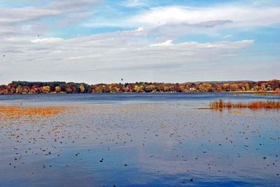
Tainter Lake, body of water

Tainter Lake is a reservoir in Dunn County, Wisconsin, formed by damming the Red Cedar River. The lake is divided into two sections by a narrow channel, with the northern portion being shallower and better suited for fishing, while small docks and cottages dot the shoreline throughout.

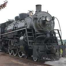
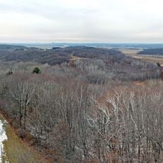
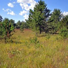
The lake was created in the early 1900s when a dam was built on the Red Cedar River for hydroelectric power generation and flood control. The surrounding land had been heavily logged in the late 1800s, transitioning from dense pine forest to agricultural farms that shaped the region's development.

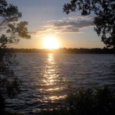
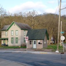
The lake is named after Andrew Tainter, a lumber industry businessman who championed the dam's construction. Weekend homes and a small community have grown along the shores, where local residents value fishing trips and sunset views over the water.

The lake is easy to reach with roads near the shoreline and parking areas available for visitors bringing boats, fishing gear, or picnic supplies. The northern section offers shallow water suitable for beginners, with fish cribs placed throughout to support fish populations.

The dam was originally built with timber in 1910 but later converted to concrete for durability and better flood management. In 2005, the dam received new inflatable spillway gates that maintain consistent water levels year-round, requiring residents to adjust their docks and boats.

The community of curious travelers

AroundUs brings together thousands of curated places, local tips, and hidden gems, enriched daily by 60,000 contributors worldwide.

Start exploring
Location
GPS coordinates
44.93500,-91.88861
Latest update
February 9, 2026 08:22
Around this place
Soo Line 2719
United States of America

Soo Line 2719

32.3 km
Carson Park
United States of America

Carson Park

32.3 km
Lake Menomin
United States of America

Lake Menomin

5.1 km
Hoffman Hills State Recreation Area
United States of America

Hoffman Hills State Recreation Area

8.9 km
Wilson Place Museum
United States of America

Wilson Place Museum

6.7 km
Louis Smith Tainter House
United States of America

Louis Smith Tainter House

7 km
St. Patrick's Church
United States of America

St. Patrick's Church

33 km
State Theatre
United States of America

State Theatre

33.5 km
Community House, First Congregational Church
United States of America

Community House, First Congregational Church

33.5 km
Sacred Heart Church
United States of America

Sacred Heart Church

33.3 km
Brady Anderson and Waldemar Ager House
United States of America

Brady Anderson and Waldemar Ager House

32.4 km
Dunnville Barrens State Natural Area
United States of America

Dunnville Barrens State Natural Area

22.5 km
Colfax Municipal Building
United States of America

Colfax Municipal Building

14.6 km
Oatman Filling Station
United States of America

Oatman Filling Station

31.8 km
James Stephen Hoover and Elizabeth Borland Memorial Chapel
United States of America

James Stephen Hoover and Elizabeth Borland Memorial Chapel

31.8 km
Eau Claire Public Library
United States of America

Eau Claire Public Library

33.7 km
Levi Merrill House
United States of America

Levi Merrill House

31.8 km
Eau Claire Vocational School
United States of America

Eau Claire Vocational School

32.8 km
Children’s Museum of Eau Claire
United States of America

Children’s Museum of Eau Claire

33.3 km
Antique Emporium
United States of America

Antique Emporium

33.8 km
Drummond Business Block
United States of America

Drummond Business Block

33.3 km
Barnes Block
United States of America

Barnes Block

33.5 km
Salsbury Row House
United States of America

Salsbury Row House

33.3 km
Confluence Commercial Historic District
United States of America

Confluence Commercial Historic District

33.5 km
Chippewa Valley Museum
United States of America

Chippewa Valley Museum

32.3 km
Wisconsin Logging Museum
United States of America

Wisconsin Logging Museum

32.4 km
Lutheran Church of the Good Shepherd
United States of America

Lutheran Church of the Good Shepherd

31.3 km
Mabel Tainter Center for the Arts
United States of America

Mabel Tainter Center for the Arts

7.2 km
Show the full map
« Tainter Lake - body of water » is provided by Around Us (aroundus.com). Images and texts are derived from Wikimedia project under a Creative Commons license. You are allowed to copy, distribute, and modify copies of this page, under the conditions set by the license, as long as this note is clearly visible.

Discover hidden gems everywhere you go!

From secret cafés to breathtaking viewpoints, skip the crowded tourist spots and find places that match your style. Our app makes it easy with voice search, smart filtering, route optimization, and insider tips from travelers worldwide. Download now for the complete mobile experience.

Around Us App Screenshot

A unique approach to discovering new places

Le Figaro

All the places worth exploring

France Info

A tailor-made excursion in just a few clicks

20 Minutes

Around Us
Travel Guide & Maps
Download

Send to your phone

QR Code
1

Open the camera app on your mobile.

2

Point at the QR code with your camera. A notification will appear.

3

Tap the notification to open the link.