Chest opened
+${chestReward.xp} XP
Explorer
NOUVEAU ×${chestReward.collectible.quantity}
tapez pour fermer

See the monuments around you in AR Open chests in the app

Around Us is built for your phone — point your camera at the streets and discover the monuments and places around you in augmented reality. Around Us is built for your phone — chests unlock when you walk, explore and capture nearby places.

Enable Location

We need your location to show you interesting places around you

Discover nearby places

Find interesting locations and hidden gems around you

Precise directions

Get accurate directions and distances to places

Your location is never shared with other users. It's only used when you tap the location button.

Log in to your account

Start exploring — it's free

Trusted by 86,477 travelers worldwide

Continue with Google
Continue with Apple
or

We will send you a code to connect

By continuing, you accept our Terms and Conditions and our Privacy Policy

Check your inbox

We've sent a pincode in your inbox. Please enter the code below.

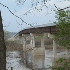
Rocheport Interstate 70 Bridge
Discussion Reviews Photo
1.7k Popularity

Rocheport Interstate 70 Bridge, Road bridge on Interstate 70 near Rocheport, Missouri, US

The Rocheport Interstate 70 Bridge is a road bridge that crosses the Missouri River in Missouri. It consists of two separate structures with three travel lanes and full-width shoulders in each direction.

The original bridge was built in 1960 and underwent rehabilitation in 1994. It was demolished through controlled demolition in September 2023 to make way for a replacement structure.

Monthly community meetings inform residents about construction progress, fostering communication between the Missouri Department of Transportation and local communities.

The bridge connects Cooper and Boone counties and serves as a major route for regional traffic. Traffic flows in both directions on separate roadways designed for efficient vehicle movement.

The reconstruction process was documented through live cameras that allowed the public to monitor building progress in real time. This approach created transparency and public engagement with the infrastructure project as it developed.

The community of curious travelers

AroundUs brings together thousands of curated places, local tips, and hidden gems, enriched daily by 60,000 contributors worldwide.
Start exploring
Location
GPS coordinates
38.95970,-92.54510
Latest update
September 12, 2026 08:28
Around this place
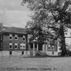
Welch Hall
United States of America

Welch Hall

11.2 mi
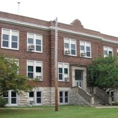
Frederick Douglass High School
United States of America

Frederick Douglass High School

11.4 mi
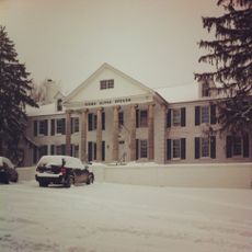
Sigma Alpha Epsilon Fraternity House
United States of America

Sigma Alpha Epsilon Fraternity House

11.2 mi
Rocheport
United States of America

Rocheport

1.6 mi
United States of America

Columbia Agriculture Park

9.7 mi
William B. Hunt House
United States of America

William B. Hunt House

4.7 mi
John N. and Elizabeth Taylor House
United States of America

John N. and Elizabeth Taylor House

10.6 mi
Thomas Nelson House
United States of America

Thomas Nelson House

10.2 mi
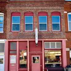
West Broadway Historic District
United States of America

West Broadway Historic District

10.6 mi
Lyric Theater
United States of America

Lyric Theater

10.7 mi
Midway Golf and Games
United States of America

Midway Golf and Games

7 mi
Wilbur T. and Rhoda Stephens Johnson House
United States of America

Wilbur T. and Rhoda Stephens Johnson House

10 mi
St. Matthew's Chapel A.M.E. Church
United States of America

St. Matthew's Chapel A.M.E. Church

10.7 mi
Roeschel-Toennes-Oswald Property
United States of America

Roeschel-Toennes-Oswald Property

11.4 mi
Harris-Chilton-Ruble House
United States of America

Harris-Chilton-Ruble House

11.3 mi
Historic District D
United States of America

Historic District D

10.7 mi
Albert Gallatin Blakey House
United States of America

Albert Gallatin Blakey House

11.2 mi
Juliet Trigg Johnson House
United States of America

Juliet Trigg Johnson House

10.5 mi
Meierhoffer Sand Company Office Building
United States of America

Meierhoffer Sand Company Office Building

11.1 mi
Andrews-Wing House
United States of America

Andrews-Wing House

10.6 mi
William S. and Mary Beckett House
United States of America

William S. and Mary Beckett House

10.8 mi
Sumner Public School
United States of America

Sumner Public School

10.7 mi
New Franklin Commercial Historic District
United States of America

New Franklin Commercial Historic District

11 mi
Josephine Trigg Pigott House
United States of America

Josephine Trigg Pigott House

10.4 mi
Morton-Myer House
United States of America

Morton-Myer House

10 mi
Andrew Gantner House
United States of America

Andrew Gantner House

10.4 mi
United States of America

Historic District C

10.9 mi
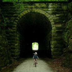
Boonslick Bridge
United States of America

Boonslick Bridge

10.9 mi
Show the full map
Reviews
Share your experience

No review yet

Discussions
Start a discussion...

No discussion yet

« Rocheport Interstate 70 Bridge - Road bridge on Interstate 70 near Rocheport, Missouri, US » is provided by Around Us (aroundus.com). Images and texts are derived from Wikimedia project under a Creative Commons license. You are allowed to copy, distribute, and modify copies of this page, under the conditions set by the license, as long as this note is clearly visible.

Discover hidden gems everywhere you go!

From secret cafés to breathtaking viewpoints, skip the crowded tourist spots and find places that match your style. Our app makes it easy with voice search, smart filtering, route optimization, and insider tips from travelers worldwide. Download now for the complete mobile experience.

Around Us App Screenshot

A unique approach to discovering new places

Le Figaro

All the places worth exploring

France Info

A tailor-made excursion in just a few clicks

20 Minutes

Around Us
Travel Guide & Maps
Download

Send to your phone

QR Code
1

Open the camera app on your mobile.

2

Point at the QR code with your camera. A notification will appear.

3

Tap the notification to open the link.