Enable Location

We need your location to show you interesting places around you

Discover nearby places

Find interesting locations and hidden gems around you

Precise directions

Get accurate directions and distances to places

Your location is never shared with other users. It's only used when you tap the location button.

Rondout–West Strand Historic District

Log in to your account

Start exploring — it's free

Trusted by 61,428 travelers worldwide

Continue with Google
Continue with Apple
or

We will send you a code to connect

By continuing, you accept our Terms and Conditions and our Privacy Policy

Check your inbox

We've sent a pincode in your inbox. Please enter the code below.

Rondout–West Strand Historic District

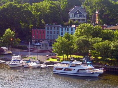
Rondout–West Strand Historic District, Historic waterfront district in Kingston, United States.

Description

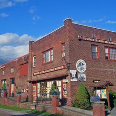
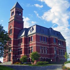
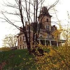
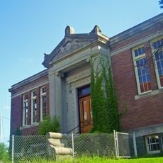
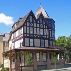
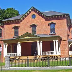
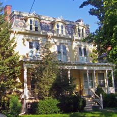
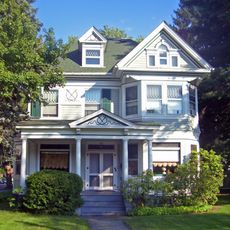
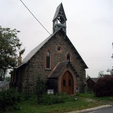
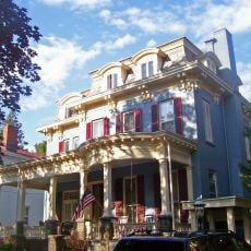
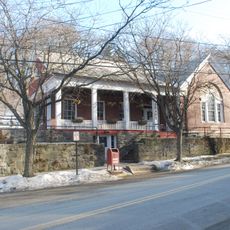
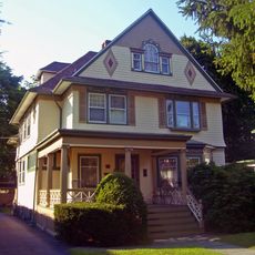
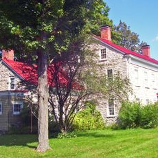
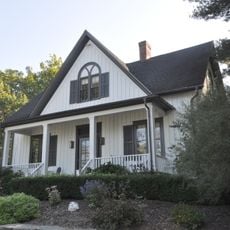
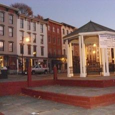
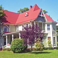
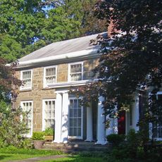
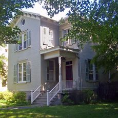
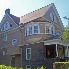
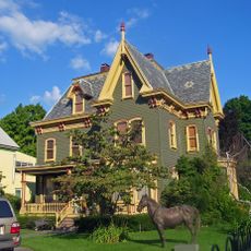
The Rondout-West Strand Historic District is a waterfront area with over 270 residential, commercial, and public buildings from the 1800s spread across 57 acres along a creek. The district keeps its original bluestone sidewalks and stone walls, showing the street pattern from that era.

History

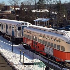
The district took shape after a major canal opened in 1828, turning a small trading spot into a significant port on a major river. Coal, gravel, and other goods moved through its docks for decades, driving growth throughout the 1800s.

Culture

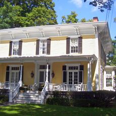
The streets display different architectural styles such as Federal, Greek Revival, and Victorian, each reflecting when the buildings were constructed and what people valued at the time. Walking through the district, you notice how wealthier merchants chose more ornate designs while simpler structures served working families and businesses.

Practical

The area is easy to explore on foot since the original street layout is kept and buildings sit close together. The ground is flat, making it comfortable for a leisurely walk where you can see the different building styles.

Did you know?

The name comes from Dutch and refers to an old fort built for fur trading with Native Americans in the area. This Dutch connection still shapes the history and older place names throughout the region.

Location
GPS coordinates
41.91861,-73.98500
Latest update
December 14, 2025 14:43

AroundUs brings together thousands of curated places, local tips, and hidden gems, enriched daily by 60,000 contributors worldwide. Discover all places nearby (New York).

Around this place
Kingston–Port Ewen Suspension Bridge
United States of America

Kingston–Port Ewen Suspension Bridge

170 m
Ulster Performing Arts Center
United States of America

Ulster Performing Arts Center

2 km
Rondout Light
United States of America

Rondout Light

1.9 km
Hudson River Maritime Museum
United States of America

Hudson River Maritime Museum

315 m
Tobias Van Steenburgh House
United States of America

Tobias Van Steenburgh House

2.7 km
Kingston City Hall
United States of America

Kingston City Hall

1.3 km
Cordts Mansion
United States of America

Cordts Mansion

1.6 km
Kingston City Library
United States of America

Kingston City Library

1.2 km
Kirkland Hotel
United States of America

Kirkland Hotel

3.1 km
James and Mary Forsyth House
United States of America

James and Mary Forsyth House

2.9 km
Boice House
United States of America

Boice House

2.8 km
House at 356 Albany Avenue
United States of America

House at 356 Albany Avenue

2.6 km
Riverside Methodist Church and Parsonage
United States of America

Riverside Methodist Church and Parsonage

2.8 km
United States of America

Ponckhockie Union Chapel

1.2 km
Chichester House
United States of America

Chichester House

2.8 km
Morton Memorial Library
United States of America

Morton Memorial Library

2.8 km
House at 313 Albany Avenue
United States of America

House at 313 Albany Avenue

2.6 km
Jacob Ten Broeck Stone House
United States of America

Jacob Ten Broeck Stone House

2.6 km
Free Church Parsonage
United States of America

Free Church Parsonage

2.7 km
West Strand Historic District
United States of America

West Strand Historic District

148 m
George J. Smith House
United States of America

George J. Smith House

2.6 km
House at 322 Albany Avenue
United States of America

House at 322 Albany Avenue

2.6 km
William Kenyon House
United States of America

William Kenyon House

2.7 km
Frank A. Palen House
United States of America

Frank A. Palen House

2.8 km
House at 184 Albany Avenue
United States of America

House at 184 Albany Avenue

2.5 km
Trolley Museum of New York
United States of America

Trolley Museum of New York

452 m
John T. Loughran Bridge
United States of America

John T. Loughran Bridge

350 m
John Smith House
United States of America

John Smith House

2.7 km
Show the full map
« Rondout–West Strand Historic District - Historic waterfront district in Kingston, United States » is provided by Around Us (aroundus.com). Images and texts are derived from Wikimedia project under a Creative Commons license. You are allowed to copy, distribute, and modify copies of this page, under the conditions set by the license, as long as this note is clearly visible.

Discover hidden gems everywhere you go!

From secret cafés to breathtaking viewpoints, skip the crowded tourist spots and find places that match your style. Our app makes it easy with voice search, smart filtering, route optimization, and insider tips from travelers worldwide. Download now for the complete mobile experience.

Around Us App Screenshot

A unique approach to discovering new places

Le Figaro

All the places worth exploring

France Info

A tailor-made excursion in just a few clicks

20 Minutes

Around Us
Travel Guide & Maps
Download

Send to your phone

QR Code
1

Open the camera app on your mobile.

2

Point at the QR code with your camera. A notification will appear.

3

Tap the notification to open the link.