Chest opened
+${chestReward.xp} XP
Explorer
NOUVEAU ×${chestReward.collectible.quantity}
tapez pour fermer
Chest locked

Open chests in the app

Around Us is built for your phone — chests unlock when you walk, explore and capture nearby places.

Enable Location

We need your location to show you interesting places around you

Discover nearby places

Find interesting locations and hidden gems around you

Precise directions

Get accurate directions and distances to places

Your location is never shared with other users. It's only used when you tap the location button.

Log in to your account

Start exploring — it's free

Trusted by 72,979 travelers worldwide

Continue with Google
Continue with Apple
or

We will send you a code to connect

By continuing, you accept our Terms and Conditions and our Privacy Policy

Check your inbox

We've sent a pincode in your inbox. Please enter the code below.

Sherman Dam
Discussion Reviews Photo
2.3k Popularity

Sherman Dam, Embankment dam in Sherman County, Nebraska.

Sherman Dam is an embankment dam that holds back Oak Creek to create a large reservoir in central Nebraska. The water body covers approximately 2,845 acres and serves recreational purposes with boating and fishing opportunities.

The United States Bureau of Reclamation built Sherman Dam in 1961 to address flood control needs and provide irrigation for farming communities. The construction reflected efforts to manage water resources in the agricultural region.

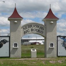
The Sherman Reservoir State Recreation Area serves as a gathering place where people from surrounding towns come to fish and enjoy seasonal activities together. Locals use the shoreline for family outings and community events throughout the year.

Camping facilities with restrooms, boat ramps, and picnic areas are available around the water body for visitor use. Plan time for water and shoreline activities, especially if you intend to bring a boat or fish.

During winter months the reservoir becomes a destination for ice fishing where anglers catch walleye and crappie over submerged structures. This seasonal activity draws specialized fishers who prepare equipment for the cold weather conditions.

The community of curious travelers

AroundUs brings together thousands of curated places, local tips, and hidden gems, enriched daily by 60,000 contributors worldwide.

Start exploring
Location
GPS coordinates
41.30330,-98.88070
Latest update
December 13, 2025 12:23
Around this place
Dowse Sod House
United States of America

Dowse Sod House

39.3 km
Fort Hartsuff State Historical Park
United States of America

Fort Hartsuff State Historical Park

48.3 km
Rad Slavin cis. 112 Z.C.B.J. Hall
United States of America

Rad Slavin cis. 112 Z.C.B.J. Hall

41.1 km
Church of the Visitation of the Blessed Virgin Mary
United States of America

Church of the Visitation of the Blessed Virgin Mary

41 km
St. Michael's Catholic Church Complex
United States of America

St. Michael's Catholic Church Complex

61 km
Sargent Bridge
United States of America

Sargent Bridge

54.6 km
St. Peder's Dansk Evangelical Lutheran Kirke
United States of America

St. Peder's Dansk Evangelical Lutheran Kirke

29.2 km
Dannevirke Danish Lutheran Church and Community Hall
United States of America

Dannevirke Danish Lutheran Church and Community Hall

14.6 km
Garfield County Frontier Fairgrounds
United States of America

Garfield County Frontier Fairgrounds

56.3 km
Andrew M. Hargis House
United States of America

Andrew M. Hargis House

61.6 km
First Presbyterian Church
United States of America

First Presbyterian Church

61 km
Loup City Township Carnegie Library
United States of America

Loup City Township Carnegie Library

7.8 km
Howard County Courthouse
United States of America

Howard County Courthouse

36.8 km
North Loup Bridge
United States of America

North Loup Bridge

25.4 km
Burwell Carnegie Library
United States of America

Burwell Carnegie Library

57.3 km
People's Unitarian Church
United States of America

People's Unitarian Church

33.4 km
Columbia Hall
United States of America

Columbia Hall

34.7 km
George Meisner House
United States of America

George Meisner House

57.6 km
Sherman County Courthouse
United States of America

Sherman County Courthouse

7.8 km
Meisner Bank Building
United States of America

Meisner Bank Building

59.5 km
Greeley County Courthouse
United States of America

Greeley County Courthouse

40 km
H. J. Bartenbach House
United States of America

H. J. Bartenbach House

61.9 km
Valley County Courthouse
United States of America

Valley County Courthouse

33.5 km
Grand Island Carnegie Library
United States of America

Grand Island Carnegie Library

61.9 km
Hamilton-Donald House
United States of America

Hamilton-Donald House

61.7 km
Glade-Donald House
United States of America

Glade-Donald House

61.8 km
Westside Bowling
United States of America

Westside Bowling

59.7 km
La Flor
United States of America

La Flor

61.4 km
Show the full map
Reviews
Share your experience

No review yet

Discussions
Start a discussion...

No discussion yet

« Sherman Dam - Embankment dam in Sherman County, Nebraska » is provided by Around Us (aroundus.com). Images and texts are derived from Wikimedia project under a Creative Commons license. You are allowed to copy, distribute, and modify copies of this page, under the conditions set by the license, as long as this note is clearly visible.

Discover hidden gems everywhere you go!

From secret cafés to breathtaking viewpoints, skip the crowded tourist spots and find places that match your style. Our app makes it easy with voice search, smart filtering, route optimization, and insider tips from travelers worldwide. Download now for the complete mobile experience.

Around Us App Screenshot

A unique approach to discovering new places

Le Figaro

All the places worth exploring

France Info

A tailor-made excursion in just a few clicks

20 Minutes

Around Us
Travel Guide & Maps
Download

Send to your phone

QR Code
1

Open the camera app on your mobile.

2

Point at the QR code with your camera. A notification will appear.

3

Tap the notification to open the link.