Chest opened
+${chestReward.xp} XP
Explorer
NOUVEAU ×${chestReward.collectible.quantity}
tapez pour fermer

See the monuments around you in AR Open chests in the app

Around Us is built for your phone — point your camera at the streets and discover the monuments and places around you in augmented reality. Around Us is built for your phone — chests unlock when you walk, explore and capture nearby places.

Enable Location

We need your location to show you interesting places around you

Discover nearby places

Find interesting locations and hidden gems around you

Precise directions

Get accurate directions and distances to places

Your location is never shared with other users. It's only used when you tap the location button.

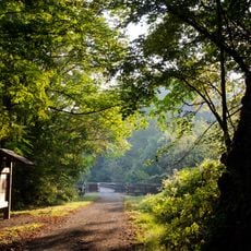
Shot Tower Historical State Park

Log in to your account

Start exploring — it's free

Trusted by 87,150 travelers worldwide

Continue with Google
Continue with Apple
or

We will send you a code to connect

By continuing, you accept our Terms and Conditions and our Privacy Policy

Check your inbox

We've sent a pincode in your inbox. Please enter the code below.

Shot Tower Historical State Park
Discussion Reviews 1 Photos
5.1k Popularity

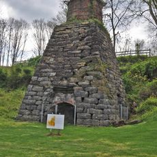
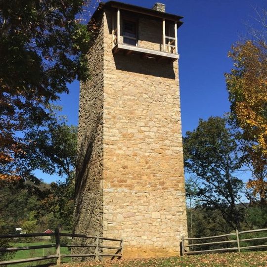
Shot Tower Historical State Park, Industrial historical landmark in Max Meadows, Virginia.

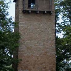
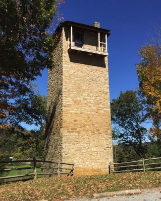
Shot Tower is a 75-foot stone structure in Max Meadows built with a tapered cone shape for making ammunition. The tower was connected to an underground shaft and water basin where the manufacturing process was completed.

Built in 1851, this tower was one of a handful of shot manufacturing facilities operating in America during the 1800s. It operated for decades before ceasing production and eventually becoming a historical landmark.

The tower shows how Americans made ammunition through clever engineering and hard work in the 1800s. Standing here, you can understand why this place mattered to people who built weapons and tools during that era.

The grounds are open daily from sunrise to sunset, allowing you to walk around and view the structure from the outside. Guided tours are sometimes available during warmer months and provide detailed information about how it worked.

What makes this place special is the physics-based production method where molten lead fell from the top and formed perfect spheres in midair. This technique was so effective that it was adopted in other countries and remained the best way to make ammunition for many years.

The community of curious travelers

AroundUs brings together thousands of curated places, local tips, and hidden gems, enriched daily by 60,000 contributors worldwide.

Start exploring
Location
GPS coordinates
36.88440,-80.85310
Latest update
September 12, 2026 08:37
Around this place
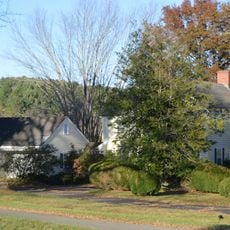
Claytor Lake
United States of America

Claytor Lake

15.1 mi
New River Trail State Park
United States of America

New River Trail State Park

2.3 mi
The Mansion at Fort Chiswell
United States of America

The Mansion at Fort Chiswell

6.2 mi
Foster Falls Historic District
United States of America

Foster Falls Historic District

0.1 mi
Wytheville Historic District
United States of America

Wytheville Historic District

13.4 mi
Graham's Forge Mill
United States of America

Graham's Forge Mill

4.4 mi
Loretto
United States of America

Loretto

13.5 mi
Crockett's Cove Presbyterian Church
United States of America

Crockett's Cove Presbyterian Church

14.1 mi
Wythe County Poorhouse Farm
United States of America

Wythe County Poorhouse Farm

11.8 mi
Carroll County Courthouse
United States of America

Carroll County Courthouse

10.4 mi
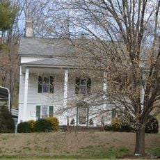
Maj. David Graham House
United States of America

Maj. David Graham House

2.4 mi
Dinwiddie Presbyterian Church and Cemetery
United States of America

Dinwiddie Presbyterian Church and Cemetery

7.6 mi
Reed Creek Mill
United States of America

Reed Creek Mill

12.7 mi
Pulaski Historic Residential District
United States of America

Pulaski Historic Residential District

12.3 mi
Pulaski Historic Commercial District
United States of America

Pulaski Historic Commercial District

15.8 mi
Pulaski County Courthouse
United States of America

Pulaski County Courthouse

12 mi
Dalton Theater
United States of America

Dalton Theater

11.9 mi
Haller-Gibboney Rock House
United States of America

Haller-Gibboney Rock House

13.6 mi
Gordon C. Felts House
United States of America

Gordon C. Felts House

15.7 mi
Galax Commercial Historic District
United States of America

Galax Commercial Historic District

15.6 mi
Newbern Historic District
United States of America

Newbern Historic District

15.8 mi
A. G. Pless, Jr. House
United States of America

A. G. Pless, Jr. House

14.2 mi
Carter Hydraulic Rams
United States of America

Carter Hydraulic Rams

10.5 mi
Fries Boarding Houses
United States of America

Fries Boarding Houses

13.5 mi
Hillsville Historic District
United States of America

Hillsville Historic District

10.4 mi
Pulaski South Historic Residential and Industrial District
United States of America

Pulaski South Historic Residential and Industrial District

11.6 mi
Jackson Ferry Shot Tower
United States of America

Jackson Ferry Shot Tower

1.4 mi
Draper Historic District
United States of America

Draper Historic District

10.2 mi
Show the full map
Reviews
Share your experience

No review yet

Discussions
Start a discussion...

No discussion yet

« Shot Tower Historical State Park - Industrial historical landmark in Max Meadows, Virginia » is provided by Around Us (aroundus.com). Images and texts are derived from Wikimedia project under a Creative Commons license. You are allowed to copy, distribute, and modify copies of this page, under the conditions set by the license, as long as this note is clearly visible.

Discover hidden gems everywhere you go!

From secret cafés to breathtaking viewpoints, skip the crowded tourist spots and find places that match your style. Our app makes it easy with voice search, smart filtering, route optimization, and insider tips from travelers worldwide. Download now for the complete mobile experience.
Around Us App Screenshot

A unique approach to discovering new places

Le Figaro

All the places worth exploring

France Info

A tailor-made excursion in just a few clicks

20 Minutes

Around Us
Travel Guide & Maps
Download

Send to your phone

QR Code
1

Open the camera app on your mobile.

2

Point at the QR code with your camera. A notification will appear.

3

Tap the notification to open the link.