Enable Location

We need your location to show you interesting places around you

Discover nearby places

Find interesting locations and hidden gems around you

Precise directions

Get accurate directions and distances to places

Your location is never shared with other users. It's only used when you tap the location button.

Sinking Springs Farms

Log in to your account

Start exploring — it's free

Trusted by 62,396 travelers worldwide

Continue with Google
Continue with Apple
or

We will send you a code to connect

By continuing, you accept our Terms and Conditions and our Privacy Policy

Check your inbox

We've sent a pincode in your inbox. Please enter the code below.

Sinking Springs Farms, Historic farm district in Manchester Township, Pennsylvania

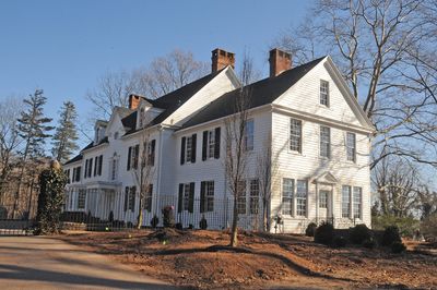
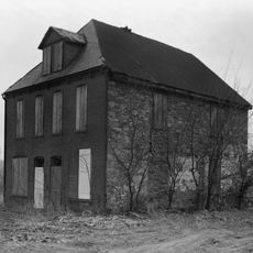
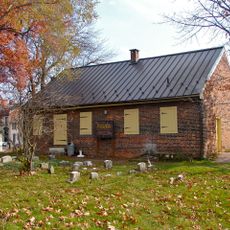
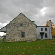
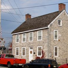
Sinking Springs Farms is a historic agricultural district in Manchester Township containing roughly 32 buildings, 2 sites, and 17 structures spread across 660 acres. The area stretches along several roads and includes a mix of farmhouses and farm buildings from different time periods.

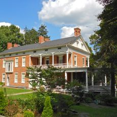
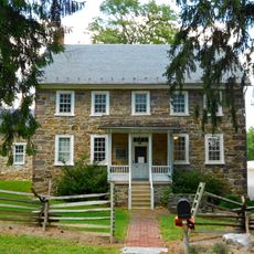
The area has roots reaching back to 1841 when early farms were established, with further growth in the early 1900s. A main house was built in 1900 and later rebuilt in the 1930s, showing how the settlement changed over time.

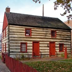
The farm district shows construction styles created by Pennsylvania German settlers, with several multilevel farmhouses built in the early 1900s. These building methods reflect what local families needed to live and work together on the land.

The area is accessible along several roads including Church Road and Sinking Springs Lane, with boundaries extending along other major streets in the region. Visitors should allow plenty of time to explore the sprawling property and view the different buildings scattered across the site.

The property housed a radio broadcast facility with four towers from the 1940s until 1990, adding a technological layer to this otherwise purely agricultural setting. This unusual mix of farming and broadcasting made the site an unexpected meeting point between rural life and media technology.

The community of curious travelers

AroundUs brings together thousands of curated places, local tips, and hidden gems, enriched daily by 60,000 contributors worldwide.

Start exploring
GPS coordinates
40.01028,-76.74250
Latest update
December 14, 2025 18:42
Around this place
York Central Market
United States of America

York Central Market

5.4 km
Cookes House
United States of America

Cookes House

6.2 km
York Meetinghouse
United States of America

York Meetinghouse

5.4 km
York Historic District
United States of America

York Historic District

7.1 km
Barnett Bobb House
United States of America

Barnett Bobb House

5.5 km
Billmeyer House
United States of America

Billmeyer House

5.4 km
Farmers Market
United States of America

Farmers Market

5.7 km
Emig Mansion
United States of America

Emig Mansion

2.4 km
Ashley and Bailey Company Silk Mill
United States of America

Ashley and Bailey Company Silk Mill

6.5 km
Codorus Forge and Furnace Historic District
United States of America

Codorus Forge and Furnace Historic District

8.6 km
Willis House
United States of America

Willis House

4.3 km
United Cigar Manufacturing Company building
United States of America

United Cigar Manufacturing Company building

5.3 km
York Dispatch Newspaper Offices
United States of America

York Dispatch Newspaper Offices

4.3 km
Springdale Historic District
United States of America

Springdale Historic District

7.1 km
Pleasureville Historic District
United States of America

Pleasureville Historic District

3.3 km
Fairmount Historic District
United States of America

Fairmount Historic District

4.8 km
Strickler Family Farmhouse
United States of America

Strickler Family Farmhouse

7.5 km
East York Historic District
United States of America

East York Historic District

6.1 km
Forry House
United States of America

Forry House

5.3 km
Smyser-Bair House
United States of America

Smyser-Bair House

5.6 km
Michael and Magdealena Bixler Farmstead
United States of America

Michael and Magdealena Bixler Farmstead

3.5 km
Bridge between East Manchester and Newberry Townships
United States of America

Bridge between East Manchester and Newberry Townships

8.2 km
The Nook
United States of America

The Nook

7.4 km
William Shelly School and Annex
United States of America

William Shelly School and Annex

4.4 km
Agricultural & Industrial Museum
United States of America

Agricultural & Industrial Museum

5.8 km
York County History Center
United States of America

York County History Center

5.5 km
Strand Theatre
United States of America

Strand Theatre

5.3 km
Capitol Theatre
United States of America

Capitol Theatre

5.3 km
Show the full map
« Sinking Springs Farms - Historic farm district in Manchester Township, Pennsylvania » is provided by Around Us (aroundus.com). Images and texts are derived from Wikimedia project under a Creative Commons license. You are allowed to copy, distribute, and modify copies of this page, under the conditions set by the license, as long as this note is clearly visible.

Discover hidden gems everywhere you go!

From secret cafés to breathtaking viewpoints, skip the crowded tourist spots and find places that match your style. Our app makes it easy with voice search, smart filtering, route optimization, and insider tips from travelers worldwide. Download now for the complete mobile experience.

Around Us App Screenshot

A unique approach to discovering new places

Le Figaro

All the places worth exploring

France Info

A tailor-made excursion in just a few clicks

20 Minutes

Around Us
Travel Guide & Maps
Download

Send to your phone

QR Code
1

Open the camera app on your mobile.

2

Point at the QR code with your camera. A notification will appear.

3

Tap the notification to open the link.