Starved Rock Lock and Dam
Starved Rock Lock and Dam, Navigation lock and dam complex in LaSalle County, United States
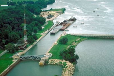
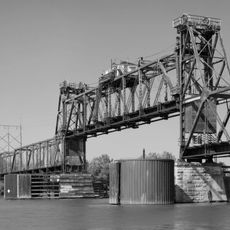
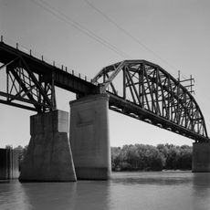
Starved Rock Lock and Dam is a navigation facility and water-control structure on the Illinois River. The complex comprises a concrete gravity dam spanning about 1,310 feet, a controlled spillway section, and a lock chamber measuring 110 by 600 feet that lifts vessels over an 18-foot elevation change.
Built between 1926 and 1933, the structure was part of a federal program to improve navigation on the Illinois River. Its construction enabled commercial shipping to reach inland ports that were previously inaccessible.
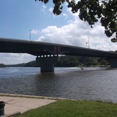
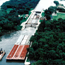
The facility serves as a vital link in the Illinois Waterway, allowing barges and vessels to move between the Great Lakes and Mississippi River corridor. Its operation connects commercial shipping networks across the central United States.
The site is accessible for visitors interested in viewing the lock operation and dam structure from designated viewing areas. The best vantage point is near the lock chamber where you can observe vessels passing through and water levels changing.
The dam generates electricity through a hydroelectric facility integrated into the structure. This dual-purpose design allowed the project to produce power while managing water navigation, making it both functional and productive.
Location: LaSalle County
Inception: 1933
Architects: Walter Mickle Smith
Elevation above the sea: 137 m
GPS coordinates: 41.32250,-88.98560
Latest update: December 12, 2025 14:23
Starved Rock State Park
412 m
Interstate 39
21.9 km
Matthiessen State Park
4.5 km
Grand Village of the Illinois
1.5 km
Hegeler Carus Mansion
8.6 km
Abraham Lincoln Memorial Bridge
7.6 km
Wild Bill Hickok Memorial
18 km
Washington Park Historic District
12.4 km
John Hossack House
12.2 km
Mitchell's Grove Nature Preserve
10.6 km
Julius W. Hegeler I House
8.6 km
Silas Williams House
25.8 km
Shippingsport Bridge
8.9 km
Ottawa Rail Bridge
11.8 km
Jeremiah Strawn House
13 km
Andrew J. O'Conor III House
13.4 km
Ruffin Drew Fletcher House
25.6 km
Clear Creek Meeting House
25.5 km
Fisher-Nash-Griggs House
10.8 km
Ottawa East Side Historic District
13.1 km
Veterans Memorial Bridge
12.3 km
LaSalle City Building
9.2 km
Ottawa Commercial Historic District
12.4 km
LaSalle Downtown Commercial District
9.3 km
Marseilles Lock and Dam Historic District
19.5 km
Ottawa Historical and Scouting Heritage Museum
12.1 km
LaSalle Rail Bridge
8.1 km
Roxy Cinemas
12.3 kmVisited this place? Tap the stars to rate it and share your experience / photos with the community! Try now! You can cancel it anytime.
Discover hidden gems everywhere you go!
From secret cafés to breathtaking viewpoints, skip the crowded tourist spots and find places that match your style. Our app makes it easy with voice search, smart filtering, route optimization, and insider tips from travelers worldwide. Download now for the complete mobile experience.
A unique approach to discovering new places❞
— Le Figaro
All the places worth exploring❞
— France Info
A tailor-made excursion in just a few clicks❞
— 20 Minutes