Starved Rock State Park
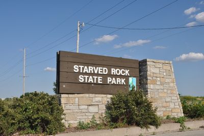
Starved Rock State Park, State park and archaeological site in Deer Park Township, United States.
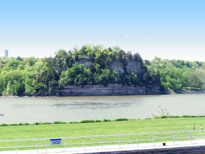
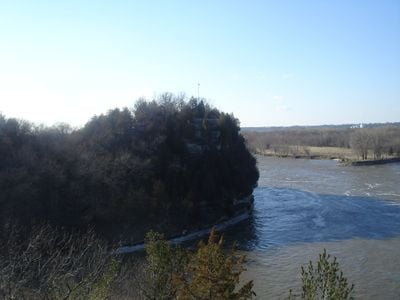
Starved Rock State Park stretches across more than 1,050 hectares along the Illinois River and shelters 18 sandstone canyons with dense forest cover and waterfalls. The canyons have moss-covered walls and narrow paths that wind through rock formations, while the river curves through open landscape below.
The area became a park in 1911 and later received recognition as a National Historic Landmark. Workers from the Civilian Conservation Corps built many of the paths and structures during the 1930s that visitors use today.
Local legend recalls an event when members of the Illinois tribe took refuge atop the highest rock formation during a conflict. Today, visitors walk canyon trails and watch eagles along the river, especially during winter months when the birds return to fish.
More than 20 kilometers of marked trails run through the canyons and along the river, though some sections become slippery when wet. The grounds offer camping areas and several visitor centers with maps and updates on trail conditions throughout the year.
The waterfalls flow mainly in spring when snowmelt and rain fill the canyons with water. In winter, climbers use the frozen walls of some canyons for ice climbing, an activity not possible during the rest of the year.
Location: Deer Park Township
Inception: 1911
Operator: Illinois Department of Natural Resources
Website: https://dnr.illinois.gov/parks/park.starvedrock.html
GPS coordinates: 41.32140,-88.99030
Latest update: December 12, 2025 18:14
Illinois holds a rich collection of historical sites and natural landscapes. Visitors can explore prehistoric ruins like the Cahokia Mounds, where earthen structures reflect the achievements of ancient peoples. The region also features striking rock formations such as Garden of the Gods and natural...
Grand Village of the Illinois
1.9 km
Starved Rock Lock and Dam
412 mHotel Plaza (Ls36) Site
2 mStarved Rock Pool
452 mKaskaskia Canyon
4.2 kmKickapoo Canyon
787 mEagle Cliff Overlook
400 mLovers Leap Overlook
220 mAurora Canyon
656 mBasswood Canyon
1.2 kmBeehive Overlook
653 mCouncil Overhang
4 kmHennepin Canyon
3.2 kmIllinois Canyon
4.7 kmDeer Park Country Club
3.6 kmHennepin Canyon Overlook
3.3 kmLaSalle Canyon
2 kmLonetree Canyon
1.3 kmOttawa Canyon
4 kmParkman's Plain
2.4 kmSac Canyon
710 mSaint Louis Canyon
1.3 kmSandstone Point Overlook
1.3 kmTonty Canyon
1.8 kmWildcat Canyon - east platform
831 mWildcat Canyon - west platform
797 mOwl Canyon Overlook
2.5 kmOwl Canyon
2.4 kmVisited this place? Tap the stars to rate it and share your experience / photos with the community! Try now! You can cancel it anytime.
Discover hidden gems everywhere you go!
From secret cafés to breathtaking viewpoints, skip the crowded tourist spots and find places that match your style. Our app makes it easy with voice search, smart filtering, route optimization, and insider tips from travelers worldwide. Download now for the complete mobile experience.
A unique approach to discovering new places❞
— Le Figaro
All the places worth exploring❞
— France Info
A tailor-made excursion in just a few clicks❞
— 20 Minutes