Enable Location

We need your location to show you interesting places around you

Discover nearby places

Find interesting locations and hidden gems around you

Precise directions

Get accurate directions and distances to places

Your location is never shared with other users. It's only used when you tap the location button.

LaSalle County

Log in to your account

Start exploring — it's free

Trusted by 60,653 travelers worldwide

Continue with Google
Continue with Apple
or

We will send you a code to connect

By continuing, you accept our Terms and Conditions and our Privacy Policy

Check your inbox

We've sent a pincode in your inbox. Please enter the code below.

LaSalle County, Administrative county in Illinois, United States

Description

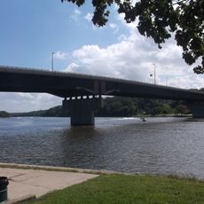
LaSalle County is an administrative division in Illinois situated across portions of the Fox Valley and Illinois River Valley. The city of Ottawa serves as its administrative center and is located in the heart of this region.

History

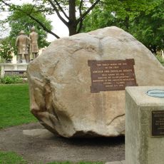
The county was established in 1831 and named after a French explorer who had traveled through Illinois territories. The 1800s brought major political moments that drew national attention to the region.

Culture

The county's name honors a French explorer who traveled through the region and shaped its early story. This heritage remains visible in how locals speak about their land and the stories passed down through generations.

Practical

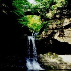
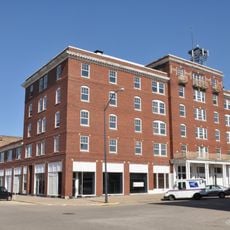
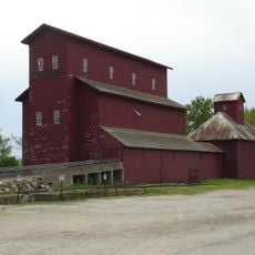
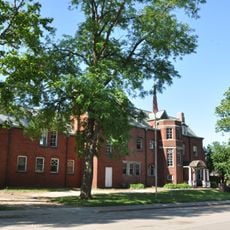
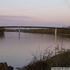
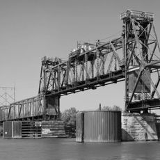
The area offers a mix of rural settings and small urban centers easily explored by car. Visitors will find agricultural landscapes, local businesses, and access to river valleys.

Did you know?

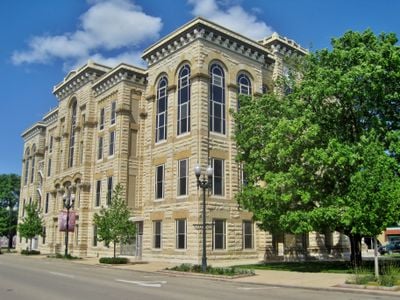
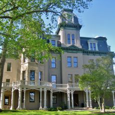
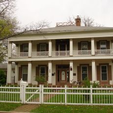
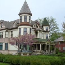
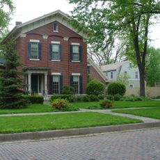
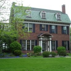
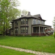
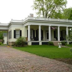
A grand mansion from the mid-1800s displays architectural features from that era and stands as evidence of affluent life before the Civil War. This building is remarkable for its size and the attention to detail in its construction.

Location
Inception
January 15, 1831
Capital city
Ottawa
Elevation above the sea
147 m
Shares border with
Lee County, DeKalb County, Kendall County, Grundy County, Livingston County, Woodford County, Marshall County, Putnam County, Bureau County
GPS coordinates
41.34399,-88.88595
Latest update
December 19, 2025 23:57

AroundUs brings together thousands of curated places, local tips, and hidden gems, enriched daily by 60,000 contributors worldwide. Discover all places nearby (Illinois).

Around this place
Starved Rock State Park
United States of America

Starved Rock State Park

9.1 km
Matthiessen State Park
United States of America

Matthiessen State Park

12.8 km
Grand Village of the Illinois
United States of America

Grand Village of the Illinois

7.3 km
Hegeler Carus Mansion
United States of America

Hegeler Carus Mansion

16.8 km
Abraham Lincoln Memorial Bridge
United States of America

Abraham Lincoln Memorial Bridge

16.1 km
Wild Bill Hickok Memorial
United States of America

Wild Bill Hickok Memorial

21.4 km
Starved Rock Lock and Dam
United States of America

Starved Rock Lock and Dam

8.7 km
United States of America

LaSalle Lake State Fish and Wildlife Area

23.6 km
Washington Park Historic District
United States of America

Washington Park Historic District

3.7 km
John Hossack House
United States of America

John Hossack House

3.8 km
Hotel Kaskaskia
United States of America

Hotel Kaskaskia

17.6 km
United States of America

Mitchell's Grove Nature Preserve

17.4 km
Armour's Warehouse
United States of America

Armour's Warehouse

23.1 km
Marseilles Hydro Plant
United States of America

Marseilles Hydro Plant

14.5 km
Julius W. Hegeler I House
United States of America

Julius W. Hegeler I House

16.8 km
Silas Williams House
United States of America

Silas Williams House

24.9 km
Shippingsport Bridge
United States of America

Shippingsport Bridge

17.5 km
Ottawa Rail Bridge
United States of America

Ottawa Rail Bridge

3.3 km
Jeremiah Strawn House
United States of America

Jeremiah Strawn House

4.4 km
Andrew J. O'Conor III House
United States of America

Andrew J. O'Conor III House

4.8 km
Nisbet Homestead Farm
United States of America

Nisbet Homestead Farm

27.4 km
Hauge Lutheran Church
United States of America

Hauge Lutheran Church

22.8 km
Ruffin Drew Fletcher House
United States of America

Ruffin Drew Fletcher House

24.8 km
United States of America

Hotel Plaza (Ls36) Site

9.1 km
Veterans Memorial Bridge
United States of America

Veterans Memorial Bridge

3.8 km
Fisher-Nash-Griggs House
United States of America

Fisher-Nash-Griggs House

2.3 km
Ottawa East Side Historic District
United States of America

Ottawa East Side Historic District

4.5 km
Ransom Water Tower
United States of America

Ransom Water Tower

28.8 km
Show the full map
« LaSalle County - Administrative county in Illinois, United States » is provided by Around Us (aroundus.com). Images and texts are derived from Wikimedia project under a Creative Commons license. You are allowed to copy, distribute, and modify copies of this page, under the conditions set by the license, as long as this note is clearly visible.

Discover hidden gems everywhere you go!

From secret cafés to breathtaking viewpoints, skip the crowded tourist spots and find places that match your style. Our app makes it easy with voice search, smart filtering, route optimization, and insider tips from travelers worldwide. Download now for the complete mobile experience.

Around Us App Screenshot

A unique approach to discovering new places

Le Figaro

All the places worth exploring

France Info

A tailor-made excursion in just a few clicks

20 Minutes

Around Us
Travel Guide & Maps
Download

Send to your phone

QR Code
1

Open the camera app on your mobile.

2

Point at the QR code with your camera. A notification will appear.

3

Tap the notification to open the link.